– Lat/Long: 38.38° S 71.58° W
 Lonquimay
Weather Forecast, ChileIssued: 1 am Fri 19 Apr Local TimeUpdates in: hr min sUpdate imminent
LonquimayWeather Forecast, Chile
Issued: 1 am Fri 19 Apr Local Time
Updates in:
Update imminent hr min s

Issued: 1 am Fri 19 Apr Local Time
Updates in:
Update imminent hr min s
Days 1–3 Weather SummaryA light covering of new snow mostly falling on Sun night. Temperatures will be below freezing (max 0°C on Fri night, min -6°C on Sun night). Winds decreasing (near gales from the WNW on Fri morning, moderate winds from the NNW by Sun night). | Days 4–6 Weather SummaryA moderate fall of snow, heaviest on Wed afternoon. Temperatures will be below freezing (max -2°C on Tue afternoon, min -8°C on Wed morning). Winds increasing (moderate winds from the WNW on Mon morning, stormy winds from the WNW by Wed afternoon). | |||||||||||||||||
Friday 19 | Saturday 20 | Sunday 21 | Monday 22 | Tuesday 23 | Wednesday 24 | |||||||||||||
AM | PM | night | AM | PM | night | AM | PM | night | AM | PM | night | AM | PM | night | AM | PM | night | |
some clouds | some clouds | some clouds | some clouds | some clouds | some clouds | cloudy | cloudy | light snow | light snow | some clouds | clear | clear | clear | clear | some clouds | heavy snow | snow shwrs | |
km/h | ||||||||||||||||||
Wave Height Map | 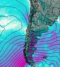 | 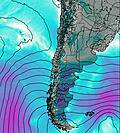 | 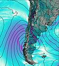 | 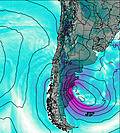 | 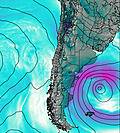 | 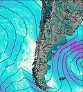 | ||||||||||||
— | — | — | — | — | — | — | — | 5 | 2.0 | — | — | — | — | — | — | 15 | 2.0 | |
— | — | — | — | — | — | — | — | — | — | — | — | — | — | — | — | — | — | |
max°C | -2 | -1 | 0 | -1 | -1 | -1 | -1 | -2 | -4 | -5 | -4 | -4 | -3 | -2 | -2 | -3 | -5 | -5 |
min°C | -3 | -1 | -1 | -1 | -1 | -2 | -2 | -2 | -6 | -6 | -5 | -5 | -4 | -2 | -3 | -8 | -7 | -7 |
-13 | -10 | -10 | -10 | -10 | -10 | -10 | -10 | -15 | -13 | -13 | -14 | -12 | -8 | -11 | -21 | -20 | -19 | |
2450 | 2700 | 2750 | 2750 | 2700 | 2550 | 2550 | 2600 | 2000 | 1850 | 2200 | 2050 | 2400 | 2650 | 2450 | 2000 | 1800 | 1900 | |
Cloud base (m) | 1550 | 2200 | 6350 | 6200 | 5200 | 4050 | 2400 | 950 | 950 | 1650 | 2000 | 3250 | 900 | 950 | ||||
7:16 | — | — | 7:18 | — | — | 7:18 | — | — | 7:20 | — | — | 7:20 | — | — | 7:22 | — | — | |
— | 6:12 | — | — | 6:09 | — | — | 6:08 | — | — | 6:07 | — | — | 6:06 | — | — | 6:05 | — | |
Lonquimay Weather (Days 0-3):
The weather forecast for Lonquimay is: A light covering of new snow mostly falling on Sun night. Temperatures will be below freezing (max 0°C on Fri night, min -6°C on Sun night). Winds decreasing (near gales from the WNW on Fri morning, moderate winds from the NNW by Sun night).
Lonquimay Weather (Days 3-6):
A moderate fall of snow, heaviest on Wed afternoon. Temperatures will be below freezing (max -2°C on Tue afternoon, min -8°C on Wed morning). Winds increasing (moderate winds from the WNW on Mon morning, stormy winds from the WNW by Wed afternoon).
This table gives the weather forecast for Lonquimay at the specific elevation of 2890 m. Our advanced weather models allow us to provide distinct weather forecasts for several elevations of Lonquimay. To see the weather forecasts for the other elevations, use the tab navigation above the table. For a wider overview of the weather, consult the Weather Map of Chile.
| Weather Station | Temp. | Weather | Wind | Gusts | Cloud / Visibility |
|---|---|---|---|---|---|
Temuco | |||||
Maquehue -Ufro | |||||
Temuco Airport | |||||
Los Angeles |
* NOTE: not all weather observatories update at the same frequency which is the reason why some locations may show data from stations that are further away than known closer ones.
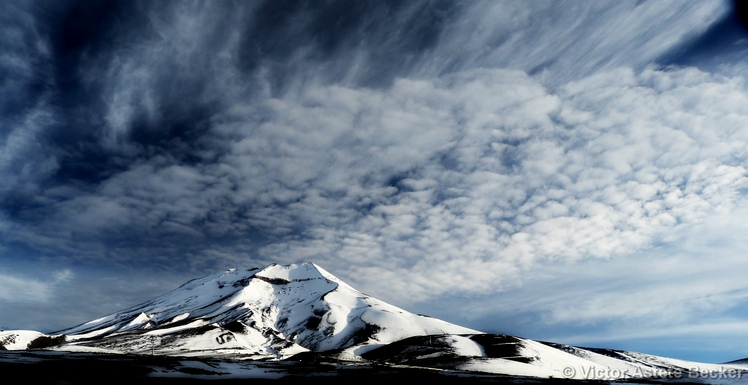
Lonquimay Photos
View all
Central Argentina-Chile photos (430) |
Andes photos (890) |
photos from mountains in Chile (432) |
all photos
 Upload new photo
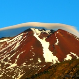
 See 14 more Lonquimay photos
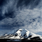
Lenticular Cloud over Lonquimay Volcano
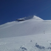
Lonquimay Volcano
Corralco
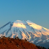
Lonquimay Volcano
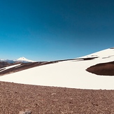
Volcán lonquimay en 3 fotos
 Like us
 Follow us
