– Lat/Long: 52.22° N 117.43° W
 North Twin Peak
Weather Forecast, CanadaIssued: 11 pm Mon 22 Apr Local TimeUpdates in: hr min sUpdate imminent
North Twin PeakWeather Forecast, Canada
Issued: 11 pm Mon 22 Apr Local Time
Updates in:
Update imminent hr min s

Issued: 11 pm Mon 22 Apr Local Time
Updates in:
Update imminent hr min s
Days 1–4 Weather SummaryA light covering of new snow mostly falling on Thu morning. Extremely cold (max -11°C on Tue afternoon, min -14°C on Mon night). Winds increasing (calm on Mon night, fresh winds from the SW by Wed night). | Days 5–7 Weather SummaryA light covering of new snow mostly falling on Thu night. Extremely cold (max -11°C on Sat afternoon, min -16°C on Fri morning). Wind will be generally light. | Days 8–10 Weather SummaryA heavy fall of snow, heaviest during Sun night. Extremely cold (max -11°C on Sun night, min -17°C on Mon night). Wind will be generally light. | Days 11–13 Weather SummaryA light covering of new snow mostly falling on Sat afternoon. Extremely cold (max -11°C on Thu afternoon, min -15°C on Sat night). Wind will be generally light. | |||||||||||||||||||||||||||||||||
Tuesday 23 | Wednesday 24 | Thursday 25 | Friday 26 | Saturday 27 | Sunday 28 | Monday 29 | Tuesday 30 | Wednesday 1 | Thursday 2 | Friday 3 | Sat 4 | |||||||||||||||||||||||||
night | AM | PM | night | AM | PM | night | AM | PM | night | AM | PM | night | AM | PM | night | AM | PM | night | AM | PM | night | AM | PM | night | AM | PM | night | AM | PM | night | AM | PM | night | AM | PM | |
clear | some clouds | some clouds | some clouds | cloudy | light snow | snow shwrs | snow shwrs | snow shwrs | snow shwrs | some clouds | some clouds | snow shwrs | clear | some clouds | some clouds | light snow | light snow | snow shwrs | snow shwrs | light snow | some clouds | some clouds | snow shwrs | some clouds | cloudy | light snow | some clouds | clear | snow shwrs | some clouds | cloudy | some clouds | some clouds | some clouds | mod. snow | |
km/h | ||||||||||||||||||||||||||||||||||||
Wave Height Map |  |  |  | 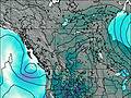 | 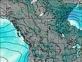 | 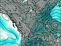 | 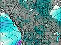 | 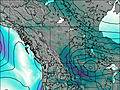 | 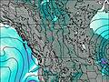 | 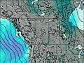 | 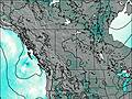 | 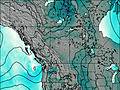 | 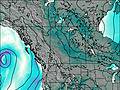 | |||||||||||||||||||||||
— | — | — | — | — | 2.0 | 1.0 | 3 | 1.0 | 1.0 | — | — | 1.0 | — | — | — | 1.0 | 2.0 | 10 | 5 | 4 | — | — | 1.0 | — | — | 1.0 | — | — | 2.0 | — | — | — | — | — | 6 | |
— | — | — | — | — | — | — | — | — | — | — | — | — | — | — | — | — | — | — | — | — | — | — | — | — | — | — | — | — | — | — | — | — | — | — | — | |
max°C | -14 | -12 | -11 | -11 | -11 | -11 | -12 | -13 | -13 | -14 | -15 | -12 | -13 | -13 | -11 | -11 | -12 | -11 | -11 | -15 | -15 | -16 | -16 | -13 | -13 | -13 | -13 | -12 | -12 | -11 | -12 | -13 | -12 | -12 | -13 | -13 |
min°C | -14 | -13 | -12 | -11 | -12 | -11 | -13 | -13 | -13 | -15 | -16 | -13 | -13 | -14 | -12 | -12 | -12 | -11 | -14 | -16 | -16 | -17 | -17 | -14 | -13 | -13 | -13 | -13 | -13 | -11 | -13 | -14 | -13 | -13 | -13 | -14 |
-14 | -20 | -19 | -18 | -21 | -20 | -23 | -23 | -24 | -24 | -22 | -21 | -21 | -20 | -19 | -19 | -19 | -18 | -20 | -21 | -22 | -25 | -24 | -22 | -20 | -20 | -19 | -19 | -18 | -16 | -22 | -22 | -22 | -21 | -22 | -19 | |
1550 | 1600 | 2100 | 2050 | 2050 | 2150 | 1900 | 1850 | 2050 | 1600 | 1500 | 2050 | 1850 | 1750 | 2250 | 2150 | 2050 | 2200 | 1900 | 1600 | 1650 | 1350 | 1500 | 1850 | 1900 | 1900 | 1950 | 2000 | 2000 | 2300 | 1950 | 1800 | 2100 | 1950 | 1950 | 2050 | |
Cloud base (m) | 2850 | 2300 | 6450 | 6100 | 2650 | 2400 | 2300 | 2800 | 2300 | 3150 | 3150 | 2400 | 3100 | 3200 | 2300 | 2400 | 2400 | 2300 | 2550 | 2450 | 2300 | 2900 | 4800 | 5250 | 2700 | 2950 | 2600 | 2800 | 2500 | 2300 | 2550 | 2600 | 2300 | 2600 | ||
— | 6:33 | — | — | 6:31 | — | — | 6:28 | — | — | 6:26 | — | — | 6:24 | — | — | 6:22 | — | — | 6:20 | — | — | 6:18 | — | — | 6:16 | — | — | 6:16 | — | — | 6:13 | — | — | 6:11 | — | |
— | — | — | 9:01 | — | — | 9:04 | — | — | 9:06 | — | — | 9:07 | — | — | 9:08 | — | — | 9:10 | — | — | 9:13 | — | — | 9:14 | — | — | 9:15 | — | — | 9:17 | — | — | 9:19 | — | 9:21 | |
North Twin Peak Weather (Days 0-3):
The weather forecast for North Twin Peak is: A light covering of new snow mostly falling on Thu morning. Extremely cold (max -11°C on Tue afternoon, min -14°C on Mon night). Winds increasing (calm on Mon night, fresh winds from the SW by Wed night).
North Twin Peak Weather (Days 3-6):
A light covering of new snow mostly falling on Thu night. Extremely cold (max -11°C on Sat afternoon, min -16°C on Fri morning). Wind will be generally light.
North Twin Peak Weather (Days 6-9):
A heavy fall of snow, heaviest during Sun night. Extremely cold (max -11°C on Sun night, min -17°C on Mon night). Wind will be generally light.
This table gives the weather forecast for North Twin Peak at the specific elevation of 3731 m. Our advanced weather models allow us to provide distinct weather forecasts for several elevations of North Twin Peak. To see the weather forecasts for the other elevations, use the tab navigation above the table. For a wider overview of the weather, consult the Weather Map of Alberta.
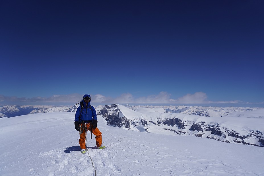
North Twin Peak Photos
View all
Sir Winston Churchill Range photos (7) |
Canadian Rockies photos (82) |
photos from mountains in Canada (417) |
all photos
 Upload new photo
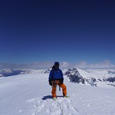
Summit of Mount Columbia
 Like us
 Follow us
