– Lat/Long: 37.09° S 12.28° W
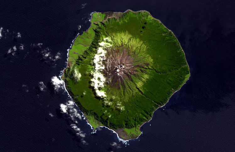
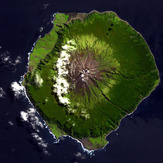
 Queen Mary's Peak
Weather Forecast, Tristan Da CunhaIssued: 11 pm Fri 19 Apr Local TimeUpdates in: hr min sUpdate imminent
Queen Mary's PeakWeather Forecast, Tristan Da Cunha
Issued: 11 pm Fri 19 Apr Local Time
Updates in:
Update imminent hr min s

Issued: 11 pm Fri 19 Apr Local Time
Updates in:
Update imminent hr min s
Days 1–4 Weather SummarySome drizzle, heaviest during Sun night. Freeze-thaw conditions (max 6°C on Sun night, min 0°C on Sun morning). Winds increasing (calm on Sat afternoon, near gales from the W by Mon afternoon). | Days 5–7 Weather SummaryLight rain (total 5mm), mostly falling on Tue morning. Mild temperatures (max 8°C on Thu morning, min 2°C on Tue afternoon). Winds increasing (fresh winds from the W on Tue night, stormy winds from the NW by Thu afternoon). | Days 8–10 Weather SummaryMild with moderate rain (total 14mm) on Thu night, Becoming colder with a light covering of snow, mostly falling on Fri morning. Freeze-thaw conditions (max 8°C on Thu night, min -6°C on Sat morning). Winds decreasing (extremely windy from the NNW on Thu night, moderate winds from the SW by Fri afternoon). | Days 11–13 Weather SummaryLight rain (total 6mm) at first, then becoming colder with a dusting of snow on Tue night. Freeze-thaw conditions (max 5°C on Mon afternoon, min -4°C on Sun night). Winds increasing (fresh winds from the SW on Sun night, extremely windy from the WNW by Mon afternoon). | |||||||||||||||||||||||||||||||||
Saturday 20 | Sunday 21 | Monday 22 | Tuesday 23 | Wednesday 24 | Thursday 25 | Friday 26 | Saturday 27 | Sunday 28 | Monday 29 | Tuesday 30 | Wed 1 | |||||||||||||||||||||||||
night | AM | PM | night | AM | PM | night | AM | PM | night | AM | PM | night | AM | PM | night | AM | PM | night | AM | PM | night | AM | PM | night | AM | PM | night | AM | PM | night | AM | PM | night | AM | PM | |
rain shwrs | clear | clear | cloudy | some clouds | clear | rain shwrs | rain shwrs | clear | rain shwrs | light rain | rain shwrs | rain shwrs | rain shwrs | rain shwrs | rain shwrs | rain shwrs | rain shwrs | heavy rain | light snow | cloudy | some clouds | snow shwrs | some clouds | snow shwrs | snow shwrs | cloudy | some clouds | cloudy | light rain | rain shwrs | some clouds | clear | snow shwrs | clear | clear | |
km/h | ||||||||||||||||||||||||||||||||||||
— | — | — | — | — | — | — | — | — | — | — | — | — | — | — | — | — | — | — | 1.0 | — | — | 1.0 | — | 4 | 1.0 | — | — | — | — | — | — | — | 1.0 | — | — | |
0.2 | — | — | — | — | — | 0.9 | 0.3 | — | 0.9 | 1.0 | 0.1 | 0.1 | 0.1 | 0.1 | 1.6 | 0.3 | 0.7 | 14 | 0.2 | — | — | — | — | — | — | — | — | — | 3 | 2 | — | — | — | — | — | |
max°C | 4 | 2 | 1 | 1 | 2 | 3 | 6 | 6 | 6 | 6 | 5 | 3 | 3 | 5 | 6 | 7 | 8 | 7 | 8 | 3 | 0 | -2 | -5 | -6 | -6 | -6 | -4 | -3 | 1 | 5 | 4 | 1 | 1 | 1 | 1 | 1 |
min°C | 1 | 2 | 1 | 1 | 0 | 2 | 4 | 6 | 6 | 5 | 3 | 2 | 2 | 4 | 6 | 6 | 7 | 7 | 5 | 2 | -1 | -3 | -6 | -6 | -6 | -6 | -5 | -4 | -2 | 4 | 1 | 1 | 1 | 1 | 1 | 1 |
-6 | -2 | 0 | -2 | -6 | -4 | -1 | 1 | 0 | -3 | -5 | -5 | -5 | -2 | 0 | 0 | 0 | 0 | -2 | -4 | -8 | -11 | -16 | -15 | -16 | -17 | -15 | -13 | -11 | -5 | -7 | -7 | -7 | -7 | -6 | -6 | |
3100 | 3250 | 3250 | 2850 | 2150 | 2650 | 3000 | 3350 | 3550 | 3450 | 3050 | 2950 | 2850 | 3100 | 3200 | 3250 | 3300 | 3400 | 3250 | 2700 | 2150 | 1350 | 1300 | 1300 | 1250 | 1200 | 1200 | 1150 | 1400 | 3050 | 3200 | 2550 | 2400 | 2250 | 2250 | 2300 | |
Cloud base (m) | 450 | 300 | 400 | 450 | 2500 | 2100 | 600 | 850 | 150 | 850 | 1000 | 2450 | 2050 | 200 | 550 | 350 | 100 | 400 | 400 | 900 | 700 | 750 | 650 | 550 | 750 | 100 | 450 | 550 | 1700 | 850 | ||||||
— | 7:20 | — | — | 7:20 | — | — | 7:20 | — | — | 7:22 | — | — | 7:22 | — | — | 7:24 | — | — | 7:24 | — | — | 7:26 | — | — | 7:26 | — | — | 7:28 | — | — | 7:28 | — | — | 7:28 | — | |
— | — | 6:14 | — | — | 6:13 | — | — | 6:12 | — | — | 6:10 | — | — | 6:09 | — | — | 6:07 | — | — | 6:07 | — | — | 6:06 | — | — | 6:05 | — | — | 6:04 | — | — | 6:02 | — | — | 6:00 | |
Queen Mary's Peak Weather (Days 0-3):
The weather forecast for Queen Mary's Peak is: Some drizzle, heaviest during Sun night. Freeze-thaw conditions (max 6°C on Sun night, min 0°C on Sun morning). Winds increasing (calm on Sat afternoon, near gales from the W by Mon afternoon).
Queen Mary's Peak Weather (Days 3-6):
Light rain (total 5mm), mostly falling on Tue morning. Mild temperatures (max 8°C on Thu morning, min 2°C on Tue afternoon). Winds increasing (fresh winds from the W on Tue night, stormy winds from the NW by Thu afternoon).
Queen Mary's Peak Weather (Days 6-9):
Mild with moderate rain (total 14mm) on Thu night, Becoming colder with a light covering of snow, mostly falling on Fri morning. Freeze-thaw conditions (max 8°C on Thu night, min -6°C on Sat morning). Winds decreasing (extremely windy from the NNW on Thu night, moderate winds from the SW by Fri afternoon).
This table gives the weather forecast for Queen Mary's Peak at the specific elevation of 2062 m. Our advanced weather models allow us to provide distinct weather forecasts for several elevations of Queen Mary's Peak. To see the weather forecasts for the other elevations, use the tab navigation above the table.
 Like us
 Follow us
