– Lat/Long: 53.07° N 4.07° W
 Snowdon
Weather Forecast, United KingdomIssued: 6 pm Wed 24 Apr Local TimeUpdates in: hr min sUpdate imminent
SnowdonWeather Forecast, United Kingdom
Issued: 6 pm Wed 24 Apr Local Time
Updates in:
Update imminent hr min s

Issued: 6 pm Wed 24 Apr Local Time
Updates in:
Update imminent hr min s
Days 1–4 Weather SummaryMostly dry. Temperatures will be below freezing (max 0°C on Wed afternoon, min -2°C on Thu night). Mainly fresh winds. | Days 5–7 Weather SummaryA dusting of new snow. Freeze-thaw conditions (max 4°C on Tue morning, min 0°C on Sat night). Winds decreasing (strong winds from the NE on Sat night, light winds from the W by Sun night). | Days 8–10 Weather SummaryModerate rain (total 11mm), heaviest on Thu night. Mild temperatures (max 9°C on Fri morning, min 4°C on Tue afternoon). Winds increasing (calm on Thu morning, fresh winds from the E by Fri morning). | Days 11–13 Weather SummaryMostly dry. Mild temperatures (max 9°C on Fri afternoon, min 3°C on Sat night). Winds decreasing (strong winds from the E on Sat morning, calm by Sun night). | |||||||||||||||||||||||||||||||||
Wed 24 | Thursday 25 | Friday 26 | Saturday 27 | Sunday 28 | Monday 29 | Tuesday 30 | Wednesday 1 | Thursday 2 | Friday 3 | Saturday 4 | Sunday 5 | Mon 6 | ||||||||||||||||||||||||
PM | night | AM | PM | night | AM | PM | night | AM | PM | night | AM | PM | night | AM | PM | night | AM | PM | night | AM | PM | night | AM | PM | night | AM | PM | night | AM | PM | night | AM | PM | night | AM | |
clear | some clouds | cloudy | some clouds | some clouds | cloudy | cloudy | some clouds | cloudy | some clouds | some clouds | light snow | some clouds | clear | light rain | rain shwrs | rain shwrs | cloudy | rain shwrs | some clouds | rain shwrs | rain shwrs | light rain | light rain | light rain | mod. rain | light rain | rain shwrs | some clouds | some clouds | clear | clear | some clouds | some clouds | some clouds | clear | |
km/h | ||||||||||||||||||||||||||||||||||||
Wave Height Map |  |  |  |  |  |  |  |  |  |  |  |  |  | |||||||||||||||||||||||
— | — | — | — | — | — | — | — | — | — | — | 2.0 | — | — | — | — | — | — | — | — | — | — | — | — | — | — | — | — | — | — | — | — | — | — | — | — | |
— | — | — | — | — | — | — | — | — | — | — | — | — | — | 0.4 | 0.5 | 0.1 | — | 0.3 | — | 0.3 | 1.9 | 0.2 | 0.1 | 0.6 | 7 | 0.7 | 0.2 | — | — | — | — | — | — | — | — | |
max°C | 0 | -1 | -1 | -1 | -2 | -1 | 0 | -1 | 0 | 1 | 1 | 1 | 1 | 2 | 3 | 3 | 3 | 4 | 4 | 4 | 6 | 6 | 7 | 7 | 7 | 7 | 9 | 9 | 9 | 8 | 7 | 6 | 5 | 5 | 5 | 6 |
min°C | 0 | -1 | -1 | -1 | -2 | -2 | 0 | -1 | -1 | 1 | 0 | 1 | 0 | 1 | 2 | 3 | 2 | 4 | 4 | 4 | 5 | 6 | 6 | 6 | 6 | 6 | 8 | 8 | 7 | 8 | 7 | 3 | 4 | 5 | 4 | 5 |
-4 | -5 | -7 | -6 | -6 | -7 | -4 | -6 | -8 | -5 | -7 | -6 | -6 | -5 | -5 | -4 | -4 | -2 | -1 | 1 | 0 | 3 | 2 | 4 | 3 | 3 | 4 | 4 | 2 | 3 | 2 | 0 | 1 | 3 | 4 | 3 | |
1100 | 900 | 900 | 950 | 750 | 900 | 1100 | 900 | 1000 | 1150 | 1300 | 1250 | 1150 | 1250 | 1400 | 1450 | 1650 | 1650 | 1750 | 1950 | 2000 | 2050 | 2250 | 2250 | 2350 | 2500 | 2550 | 2700 | 2700 | 2500 | 2350 | 2300 | 2100 | 2200 | 2250 | 2450 | |
Cloud base (m) | 500 | 500 | 250 | 700 | 450 | 1400 | 800 | 550 | 700 | 700 | 250 | 250 | 550 | 350 | 250 | 600 | 850 | 550 | 700 | 1900 | 1600 | 1650 | 350 | 400 | 250 | 250 | 300 | 500 | 2150 | 700 | 550 | 500 | 700 | 1700 | 8600 | |
— | — | 5:54 | — | — | 5:52 | — | — | 5:50 | — | — | 5:48 | — | — | 5:46 | — | — | 5:43 | — | — | 5:41 | — | — | 5:39 | — | — | 5:37 | — | — | 5:35 | — | — | 5:33 | — | — | 5:31 | |
8:32 | — | — | 8:34 | — | — | 8:36 | — | — | 8:37 | — | — | 8:39 | — | — | 8:42 | — | — | 8:43 | — | — | 8:45 | — | — | 8:46 | — | — | 8:49 | — | — | 8:50 | — | — | 8:52 | — | — | |
Snowdon Weather (Days 0-3):
The weather forecast for Snowdon is: Mostly dry. Temperatures will be below freezing (max 0°C on Wed afternoon, min -2°C on Thu night). Mainly fresh winds.
Snowdon Weather (Days 3-6):
A dusting of new snow. Freeze-thaw conditions (max 4°C on Tue morning, min 0°C on Sat night). Winds decreasing (strong winds from the NE on Sat night, light winds from the W by Sun night).
Snowdon Weather (Days 6-9):
Moderate rain (total 11mm), heaviest on Thu night. Mild temperatures (max 9°C on Fri morning, min 4°C on Tue afternoon). Winds increasing (calm on Thu morning, fresh winds from the E by Fri morning).
This table gives the weather forecast for Snowdon at the specific elevation of 1085 m. Our advanced weather models allow us to provide distinct weather forecasts for several elevations of Snowdon. To see the weather forecasts for the other elevations, use the tab navigation above the table. For a wider overview of the weather, consult the Weather Map of United Kingdom.
| Weather Station | Temp. | Weather | Wind | Gusts | Cloud / Visibility |
|---|---|---|---|---|---|
Capel Curig NO 3 | |||||
Caernarfon Airport | |||||
* NOTE: not all weather observatories update at the same frequency which is the reason why some locations may show data from stations that are further away than known closer ones.
Snowdon Photos
View all
Snowdonia photos (149) |
Cambrian Mountains photos (325) |
photos from mountains in United Kingdom (1741) |
all photos
 Upload new photo
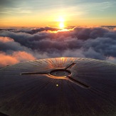
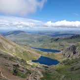
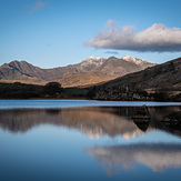
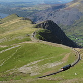
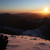 See 51 more Snowdon photos
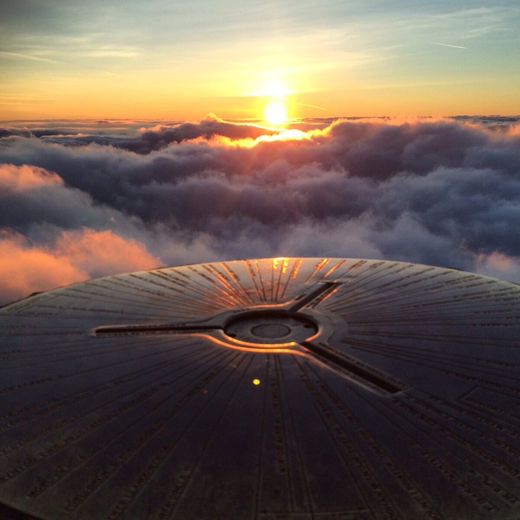
Snowdon trig
The view from the trig point
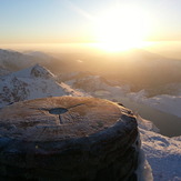
Views for miles
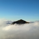
View from Llynau Mymbyr
Stunning sunrise over Snowdon
 Like us
 Follow us
