– Lat/Long: 64.42° N 17.33° W
 Grímsvötn or Grimsvotn
Weather Forecast, IcelandIssued: 11 pm Fri 31 May Local TimeUpdates in: hr min sUpdate imminent
Grímsvötn or GrimsvotnWeather Forecast, Iceland
Issued: 11 pm Fri 31 May Local Time
Updates in:
Update imminent hr min s

Issued: 11 pm Fri 31 May Local Time
Updates in:
Update imminent hr min s
Days 1–4 Weather SummaryA moderate fall of snow, heaviest on Sun afternoon. Freeze-thaw conditions (max 1°C on Sat afternoon, min -9°C on Sun night). Winds decreasing (near gales from the W on Sun morning, light winds from the N by Mon morning). | Days 5–7 Weather SummaryA moderate fall of snow, heaviest on Tue morning. Temperatures will be below freezing (max -5°C on Thu afternoon, min -9°C on Mon night). Winds decreasing (severe gales from the NNW on Tue morning, light winds from the NW by Thu morning). | Days 8–10 Weather SummaryA dusting of new snow. Temperatures will be below freezing (max -4°C on Sat morning, min -10°C on Thu night). Mainly fresh winds. | Days 11–13 Weather SummaryA dusting of new snow. Freeze-thaw conditions (max 2°C on Wed morning, min -5°C on Sun night). Wind will be generally light. | |||||||||||||||||||||||||||||||||
Saturday 1 | Sunday 2 | Monday 3 | Tuesday 4 | Wednesday 5 | Thursday 6 | Friday 7 | Saturday 8 | Sunday 9 | Monday 10 | Tuesday 11 | Wed 12 | |||||||||||||||||||||||||
night | AM | PM | night | AM | PM | night | AM | PM | night | AM | PM | night | AM | PM | night | AM | PM | night | AM | PM | night | AM | PM | night | AM | PM | night | AM | PM | night | AM | PM | night | AM | PM | |
light snow | cloudy | cloudy | some clouds | light snow | light snow | snow shwrs | cloudy | snow shwrs | light snow | light snow | light snow | snow shwrs | some clouds | some clouds | some clouds | some clouds | some clouds | cloudy | cloudy | some clouds | light snow | cloudy | light snow | snow shwrs | some clouds | cloudy | cloudy | some clouds | clear | some clouds | clear | clear | clear | cloudy | light snow | |
km/h | ||||||||||||||||||||||||||||||||||||
Wave Height Map |  |  |  |  |  |  |  | 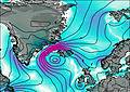 | 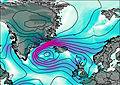 |  | 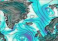 | 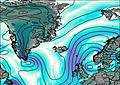 | 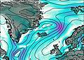 | |||||||||||||||||||||||
1.0 | — | — | — | 2.0 | 3 | 3 | — | 1.0 | 2.0 | 4 | 2.0 | 3 | — | — | — | — | — | — | — | — | 1.0 | — | 1.0 | 2.0 | — | — | — | — | — | — | — | — | — | — | 1.0 | |
— | — | — | — | — | — | — | — | — | — | — | — | — | — | — | — | — | — | — | — | — | — | — | — | — | — | — | — | — | — | — | — | — | — | — | 0.2 | |
max°C | -1 | 0 | 1 | 0 | -5 | -5 | -7 | -7 | -7 | -7 | -7 | -6 | -7 | -7 | -6 | -7 | -6 | -5 | -8 | -6 | -5 | -5 | -4 | -4 | -5 | -4 | -4 | -5 | -3 | -2 | -3 | 0 | 0 | 0 | 2 | 2 |
min°C | -1 | 0 | 0 | -5 | -6 | -6 | -9 | -9 | -9 | -9 | -7 | -6 | -9 | -8 | -6 | -8 | -6 | -6 | -10 | -6 | -5 | -7 | -5 | -4 | -7 | -5 | -4 | -5 | -4 | -2 | -4 | -2 | 0 | -2 | 2 | 2 |
-9 | -7 | -7 | -14 | -17 | -17 | -18 | -14 | -20 | -20 | -20 | -18 | -20 | -19 | -16 | -18 | -13 | -11 | -16 | -10 | -11 | -16 | -13 | -9 | -14 | -13 | -10 | -11 | -9 | -6 | -10 | -7 | -4 | -6 | -2 | -1 | |
1400 | 1600 | 1900 | 1000 | 900 | 1000 | 300 | 350 | 650 | 150 | 500 | 700 | 350 | 350 | 700 | 200 | 600 | 1000 | 0 | 650 | 950 | 850 | 850 | 1100 | 650 | 800 | 1000 | 750 | 900 | 1250 | 650 | 1200 | 1800 | 1200 | 2050 | 2200 | |
Cloud base (m) | 1650 | 1650 | 1650 | 1650 | 1650 | 1650 | 1650 | 1700 | 1650 | 1650 | 1650 | 1650 | 1650 | 1650 | 1650 | 1650 | 1650 | 1650 | 1650 | 1650 | 1650 | 1650 | 1650 | 1650 | 1600 | 1650 | 1650 | 1650 | 1650 | 1650 | 1650 | 1650 | 1650 | 1800 | 1900 | 1650 |
— | 2:57 | — | — | 2:54 | — | — | 2:51 | — | — | 2:48 | — | — | 2:47 | — | — | 2:45 | — | — | 2:43 | — | — | 2:41 | — | — | 2:39 | — | — | 2:36 | — | — | 2:34 | — | — | 2:33 | — | |
— | — | — | 11:19 | — | — | 11:22 | — | — | 11:24 | — | — | 11:28 | — | — | 11:30 | — | — | 11:32 | — | — | 11:35 | — | — | 11:37 | — | — | 11:39 | — | — | 11:42 | — | — | 11:43 | — | 11:45 | |
Grímsvötn or Grimsvotn Weather (Days 0-3):
The weather forecast for Grímsvötn or Grimsvotn is: A moderate fall of snow, heaviest on Sun afternoon. Freeze-thaw conditions (max 1°C on Sat afternoon, min -9°C on Sun night). Winds decreasing (near gales from the W on Sun morning, light winds from the N by Mon morning).
Grímsvötn or Grimsvotn Weather (Days 3-6):
A moderate fall of snow, heaviest on Tue morning. Temperatures will be below freezing (max -5°C on Thu afternoon, min -9°C on Mon night). Winds decreasing (severe gales from the NNW on Tue morning, light winds from the NW by Thu morning).
Grímsvötn or Grimsvotn Weather (Days 6-9):
A dusting of new snow. Temperatures will be below freezing (max -4°C on Sat morning, min -10°C on Thu night). Mainly fresh winds.
This table gives the weather forecast for Grímsvötn or Grimsvotn at the specific elevation of 1725 m. Our advanced weather models allow us to provide distinct weather forecasts for several elevations of Grímsvötn or Grimsvotn. To see the weather forecasts for the other elevations, use the tab navigation above the table. For a wider overview of the weather, consult the Weather Map of Iceland.
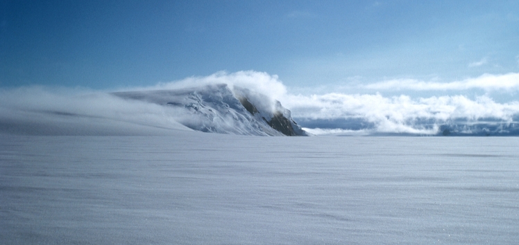
Grímsvötn or Grimsvotn Photos
View all
Iceland photos (4) |
Atlantic Islands photos (72) |
photos from mountains in Iceland (24) |
all photos
 Upload new photo
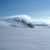
Grímsvötn or Grimsvotn
 Like us
 Follow us
