
– Lat/Long: 43.72° N 110.79° W
 Shadow Peak
Weather Forecast, United StatesIssued: 5 pm Wed 12 Jun Local TimeUpdates in: hr min sUpdate imminent
Shadow PeakWeather Forecast, United States
Issued: 5 pm Wed 12 Jun Local Time
Updates in:
Update imminent hr min s

Issued: 5 pm Wed 12 Jun Local Time
Updates in:
Update imminent hr min s
Days 1–4 Weather SummarySome drizzle, heaviest during Fri night. Very mild (max 13°C on Thu afternoon, min 5°C on Sat morning). Winds decreasing (strong winds from the WSW on Wed afternoon, light winds from the SSW by Thu night). | Days 5–7 Weather SummaryA dusting of new snow. Freeze-thaw conditions (max 10°C on Mon afternoon, min -6°C on Tue morning). Winds decreasing (near gales from the WSW on Sat afternoon, light winds from the SSW by Sun night). | ||||||||||||||||
Wed 12 | Thursday 13 | Friday 14 | Saturday 15 | Sunday 16 | Monday 17 | ||||||||||||
PM | night | AM | PM | night | AM | PM | night | AM | PM | night | AM | PM | night | AM | PM | night | |
clear | clear | clear | clear | risk tstorm | clear | risk tstorm | rain shwrs | rain shwrs | some clouds | some clouds | some clouds | some clouds | some clouds | some clouds | some clouds | light snow | |
km/h | |||||||||||||||||
Wave Height Map |  |  |  |  | 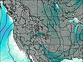 | 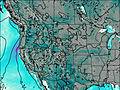 | |||||||||||
— | — | — | — | — | — | — | — | — | — | — | — | — | — | — | — | 2.0 | |
— | — | — | — | 0.3 | — | 0.2 | 0.8 | 0.1 | — | — | — | — | — | — | — | — | |
max°C | 10 | 10 | 11 | 13 | 12 | 11 | 11 | 10 | 6 | 5 | 1 | 1 | 4 | 5 | 7 | 10 | 2 |
min°C | 9 | 8 | 9 | 13 | 11 | 11 | 11 | 9 | 5 | 3 | -2 | -2 | 3 | 4 | 6 | 9 | -5 |
4 | 4 | 6 | 11 | 8 | 8 | 8 | 7 | -1 | -4 | -9 | -8 | -2 | 0 | 2 | 4 | -12 | |
4600 | 4550 | 4500 | 4850 | 4800 | 4650 | 4650 | 4550 | 4150 | 4100 | 3150 | 2950 | 3700 | 3850 | 4050 | 4500 | 2900 | |
Cloud base (m) | 5250 | 9700 | 5350 | 5100 | 4100 | 6250 | 6900 | 6350 | 6750 | 4950 | 2650 | ||||||
— | — | 5:39 | — | — | 5:39 | — | — | 5:39 | — | — | 5:39 | — | — | 5:39 | — | — | |
— | 9:05 | — | — | 9:06 | — | — | 9:06 | — | — | 9:06 | — | — | 9:07 | — | — | 9:07 | |
Shadow Peak Weather (Days 0-3):
The weather forecast for Shadow Peak is: Some drizzle, heaviest during Fri night. Very mild (max 13°C on Thu afternoon, min 5°C on Sat morning). Winds decreasing (strong winds from the WSW on Wed afternoon, light winds from the SSW by Thu night).
Shadow Peak Weather (Days 3-6):
A dusting of new snow. Freeze-thaw conditions (max 10°C on Mon afternoon, min -6°C on Tue morning). Winds decreasing (near gales from the WSW on Sat afternoon, light winds from the SSW by Sun night).
This table gives the weather forecast for Shadow Peak at the specific elevation of 3269 m. Our advanced weather models allow us to provide distinct weather forecasts for several elevations of Shadow Peak. To see the weather forecasts for the other elevations, use the tab navigation above the table. For a wider overview of the weather, consult the Weather Map of Wyoming.
 Like us
 Follow us
