– Lat/Long: 44.08° N 115.05° W
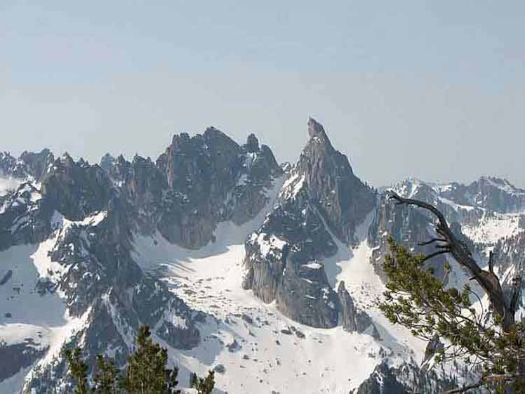
 Warbonnet Peak
Weather Forecast, United StatesIssued: 5 pm Fri 31 May Local TimeUpdates in: hr min sUpdate imminent
Warbonnet PeakWeather Forecast, United States
Issued: 5 pm Fri 31 May Local Time
Updates in:
Update imminent hr min s

Issued: 5 pm Fri 31 May Local Time
Updates in:
Update imminent hr min s
Days 1–4 Weather SummaryMild at first with light rain (total 6mm) on Sun night followed by colder weather and light fall of snow, heaviest on Mon morning. Freeze-thaw conditions (max 5°C on Sat afternoon, min -1°C on Sun morning). Winds increasing (light winds from the SW on Fri night, near gales from the SW by Sun night). | Days 5–7 Weather SummaryA light covering of new snow mostly falling on Mon afternoon. Freeze-thaw conditions (max 12°C on Thu morning, min -5°C on Mon night). Winds decreasing (near gales from the W on Mon afternoon, light winds from the SW by Wed night). | Days 8–10 Weather SummaryLight rain (total 8mm), mostly falling on Sat night. Very mild (max 14°C on Fri afternoon, min 4°C on Sat night). Winds decreasing (fresh winds from the SSW on Fri afternoon, calm by Fri night). | Days 11–13 Weather SummaryModerate rain (total 11mm), heaviest on Mon afternoon. Mild temperatures (max 8°C on Mon night, min 4°C on Sun afternoon). Wind will be generally light. | |||||||||||||||||||||||||||||||||
Fri 31 | Saturday 1 | Sunday 2 | Monday 3 | Tuesday 4 | Wednesday 5 | Thursday 6 | Friday 7 | Saturday 8 | Sunday 9 | Monday 10 | Tuesday 11 | Wed 12 | ||||||||||||||||||||||||
PM | night | AM | PM | night | AM | PM | night | AM | PM | night | AM | PM | night | AM | PM | night | AM | PM | night | AM | PM | night | AM | PM | night | AM | PM | night | AM | PM | night | AM | PM | night | AM | |
clear | clear | some clouds | cloudy | rain shwrs | some clouds | some clouds | mod. snow | heavy snow | mod. snow | clear | clear | some clouds | some clouds | clear | clear | some clouds | some clouds | rain shwrs | light rain | risk tstorm | clear | rain shwrs | rain shwrs | rain shwrs | rain shwrs | light rain | light rain | rain shwrs | rain shwrs | risk tstorm | rain shwrs | rain shwrs | rain shwrs | clear | some clouds | |
km/h | ||||||||||||||||||||||||||||||||||||
Wave Height Map |  |  |  | 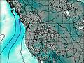 | 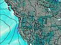 | 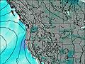 | 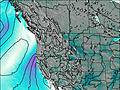 |  |  |  |  | 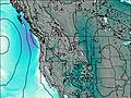 | 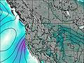 | |||||||||||||||||||||||
— | — | — | — | — | — | — | 7 | 12 | 8 | — | — | — | — | — | — | — | — | — | — | — | — | — | — | — | — | — | — | — | — | — | — | — | — | — | — | |
— | — | — | — | 0.4 | — | — | 6 | — | — | — | — | — | — | — | — | — | — | 0.1 | 3 | 0.1 | — | 0.2 | 1.2 | 1.0 | 2 | 0.4 | 2 | 1.9 | 1.0 | 4 | 0.4 | 1.0 | 0.5 | — | — | |
max°C | 4 | 4 | 4 | 5 | 2 | 1 | 2 | 2 | 1 | -1 | -4 | 0 | 4 | 5 | 6 | 10 | 11 | 12 | 13 | 13 | 13 | 14 | 13 | 6 | 8 | 6 | 5 | 5 | 4 | 6 | 7 | 8 | 6 | 8 | 6 | 6 |
min°C | 3 | 4 | 3 | 5 | 0 | -1 | 1 | 1 | 1 | -3 | -5 | -2 | 3 | 3 | 5 | 9 | 9 | 11 | 13 | 10 | 13 | 13 | 10 | 6 | 8 | 4 | 4 | 4 | 4 | 4 | 7 | 6 | 5 | 8 | 5 | 5 |
0 | 2 | 0 | 0 | -8 | -7 | -6 | -7 | -7 | -13 | -14 | -9 | -2 | -3 | 0 | 6 | 8 | 9 | 11 | 7 | 12 | 10 | 10 | 3 | 4 | 2 | 1 | 3 | 3 | 2 | 4 | 6 | 4 | 5 | 3 | 3 | |
3550 | 3650 | 3600 | 3800 | 3350 | 3000 | 3550 | 3400 | 3300 | 3000 | 2300 | 2850 | 3700 | 4050 | 4150 | 4550 | 4750 | 4800 | 4850 | 4750 | 4800 | 4900 | 4950 | 4150 | 4300 | 3900 | 3800 | 3750 | 3650 | 3700 | 4150 | 4200 | 3950 | 4200 | 4050 | 3900 | |
Cloud base (m) | 9950 | 8850 | 4550 | 2950 | 3100 | 3400 | 2500 | 2500 | 2500 | 8450 | 3200 | 3400 | 5300 | 5550 | 5000 | 8850 | 5050 | 3350 | 2800 | 4800 | 3050 | 2700 | 4700 | 5900 | 4300 | 3600 | 9000 | 8650 | ||||||||
— | — | 5:58 | — | — | 5:58 | — | — | 5:58 | — | — | 5:58 | — | — | 5:58 | — | — | 5:56 | — | — | 5:56 | — | — | 5:56 | — | — | 5:56 | — | — | 5:56 | — | — | 5:56 | — | — | 5:56 | |
— | 9:15 | — | — | 9:15 | — | — | 9:16 | — | — | 9:17 | — | — | 9:19 | — | — | 9:19 | — | — | 9:20 | — | — | 9:21 | — | — | 9:21 | — | — | 9:22 | — | — | 9:22 | — | — | 9:22 | — | |
Warbonnet Peak Weather (Days 0-3):
The weather forecast for Warbonnet Peak is: Mild at first with light rain (total 6mm) on Sun night followed by colder weather and light fall of snow, heaviest on Mon morning. Freeze-thaw conditions (max 5°C on Sat afternoon, min -1°C on Sun morning). Winds increasing (light winds from the SW on Fri night, near gales from the SW by Sun night).
Warbonnet Peak Weather (Days 3-6):
A light covering of new snow mostly falling on Mon afternoon. Freeze-thaw conditions (max 12°C on Thu morning, min -5°C on Mon night). Winds decreasing (near gales from the W on Mon afternoon, light winds from the SW by Wed night).
Warbonnet Peak Weather (Days 6-9):
Light rain (total 8mm), mostly falling on Sat night. Very mild (max 14°C on Fri afternoon, min 4°C on Sat night). Winds decreasing (fresh winds from the SSW on Fri afternoon, calm by Fri night).
This table gives the weather forecast for Warbonnet Peak at the specific elevation of 3124 m. Our advanced weather models allow us to provide distinct weather forecasts for several elevations of Warbonnet Peak. To see the weather forecasts for the other elevations, use the tab navigation above the table. For a wider overview of the weather, consult the Weather Map of Idaho.
Warbonnet Peak Photos
View all
Bitterroot Range photos (5) |
Rocky Mountains (USA) photos (226) |
photos from mountains in United States (2757) |
all photos
 Upload new photo
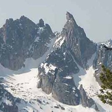
Warbonnet Mountain from Baron Peak
 Like us
 Follow us
