
– Lat/Long: 32.42° S 19.20° E
 Tafelberg
Weather Forecast, South AfricaIssued: 7 pm Sat 01 Jun Local TimeUpdates in: hr min sUpdate imminent
TafelbergWeather Forecast, South Africa
Issued: 7 pm Sat 01 Jun Local Time
Updates in:
Update imminent hr min s

Issued: 7 pm Sat 01 Jun Local Time
Updates in:
Update imminent hr min s
Days 1–4 Weather SummaryA dusting of snow. Milder later with heavy rain (total 41mm) on Tue afternoon. Freeze-thaw conditions (max 5°C on Mon night, min 0°C on Sun night). Winds increasing (calm on Sun night, near gales from the WSW by Mon night). | Days 5–7 Weather SummaryLight rain (total 6mm) at first, then becoming colder with a dusting of snow on Thu morning. Mild temperatures (max 5°C on Tue night, min 1°C on Wed night). Winds decreasing (strong winds from the WNW on Wed night, calm by Fri afternoon). | Days 8–10 Weather SummaryMostly dry. Mild temperatures (max 9°C on Mon afternoon, min 5°C on Fri night). Wind will be generally light. | Days 11–13 Weather SummaryMostly dry. Mild temperatures (max 9°C on Mon night, min 3°C on Tue morning). Winds decreasing (fresh winds from the NW on Mon night, light winds from the SSW by Tue night). | |||||||||||||||||||||||||||||||||
Sunday 2 | Monday 3 | Tuesday 4 | Wednesday 5 | Thursday 6 | Friday 7 | Saturday 8 | Sunday 9 | Monday 10 | Tuesday 11 | Wednesday 12 | Thu 13 | |||||||||||||||||||||||||
night | AM | PM | night | AM | PM | night | AM | PM | night | AM | PM | night | AM | PM | night | AM | PM | night | AM | PM | night | AM | PM | night | AM | PM | night | AM | PM | night | AM | PM | night | AM | PM | |
clear | clear | clear | some clouds | cloudy | light snow | heavy rain | heavy rain | heavy rain | rain shwrs | clear | some clouds | light rain | snow shwrs | rain shwrs | rain shwrs | clear | clear | clear | clear | clear | some clouds | clear | clear | some clouds | some clouds | clear | clear | rain shwrs | clear | clear | clear | some clouds | clear | clear | clear | |
km/h | ||||||||||||||||||||||||||||||||||||
Wave Height Map | 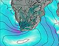 | 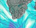 |  | 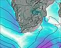 | 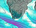 | 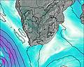 | 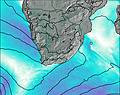 | 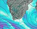 | 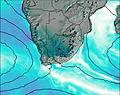 | 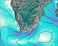 | 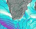 | 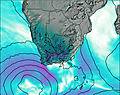 | 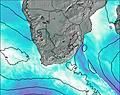 | |||||||||||||||||||||||
— | — | — | — | — | 1.0 | — | — | — | — | — | — | — | 1.0 | — | — | — | — | — | — | — | — | — | — | — | — | — | — | — | — | — | — | — | — | — | — | |
— | — | — | — | — | — | 17 | 11 | 12 | 5 | — | — | 0.5 | — | 0.2 | 0.1 | — | — | — | — | — | — | — | — | — | — | — | — | 0.1 | — | — | — | — | — | — | — | |
max°C | 2 | 1 | 2 | 1 | 0 | 1 | 5 | 5 | 5 | 5 | 3 | 2 | 2 | 1 | 2 | 3 | 3 | 4 | 6 | 6 | 7 | 8 | 7 | 8 | 8 | 8 | 9 | 9 | 3 | 3 | 4 | 5 | 6 | 6 | 6 | 7 |
min°C | 1 | 1 | 2 | 0 | 0 | 0 | 2 | 5 | 5 | 4 | 2 | 2 | 1 | 1 | 1 | 3 | 3 | 4 | 5 | 6 | 6 | 7 | 7 | 7 | 8 | 8 | 8 | 4 | 3 | 3 | 4 | 5 | 6 | 5 | 6 | 6 |
-4 | -4 | -1 | 0 | -7 | -7 | -5 | -1 | 0 | -1 | -4 | -4 | -6 | -5 | -4 | -1 | 2 | 4 | 5 | 5 | 5 | 7 | 7 | 7 | 7 | 5 | 5 | -2 | -2 | -1 | 1 | 1 | 1 | 2 | 3 | 4 | |
2200 | 2200 | 2300 | 1950 | 1900 | 2250 | 2850 | 3100 | 2950 | 2650 | 2400 | 2300 | 2150 | 2150 | 2400 | 2600 | 3200 | 3350 | 3550 | 3600 | 3600 | 3550 | 3500 | 3500 | 3550 | 3550 | 3400 | 3000 | 2600 | 2750 | 2800 | 3400 | 3550 | 3550 | 3700 | 3700 | |
Cloud base (m) | 2400 | 700 | 700 | 700 | 650 | 700 | 700 | 700 | 700 | 2550 | 800 | 800 | 900 | 8600 | 7150 | 9350 | 850 | 1950 | ||||||||||||||||||
— | 7:37 | — | — | 7:37 | — | — | 7:37 | — | — | 7:37 | — | — | 7:39 | — | — | 7:39 | — | — | 7:39 | — | — | 7:39 | — | — | 7:41 | — | — | 7:41 | — | — | 7:41 | — | — | 7:41 | — | |
— | — | 5:45 | — | — | 5:45 | — | — | 5:44 | — | — | 5:44 | — | — | 5:44 | — | — | 5:44 | — | — | 5:44 | — | — | 5:44 | — | — | 5:44 | — | — | 5:44 | — | — | 5:44 | — | — | 5:44 | |
Tafelberg Weather (Days 0-3):
The weather forecast for Tafelberg is: A dusting of snow. Milder later with heavy rain (total 41mm) on Tue afternoon. Freeze-thaw conditions (max 5°C on Mon night, min 0°C on Sun night). Winds increasing (calm on Sun night, near gales from the WSW by Mon night).
Tafelberg Weather (Days 3-6):
Light rain (total 6mm) at first, then becoming colder with a dusting of snow on Thu morning. Mild temperatures (max 5°C on Tue night, min 1°C on Wed night). Winds decreasing (strong winds from the WNW on Wed night, calm by Fri afternoon).
Tafelberg Weather (Days 6-9):
Mostly dry. Mild temperatures (max 9°C on Mon afternoon, min 5°C on Fri night). Wind will be generally light.
This table gives the weather forecast for Tafelberg at the specific elevation of 1969 m. Our advanced weather models allow us to provide distinct weather forecasts for several elevations of Tafelberg. To see the weather forecasts for the other elevations, use the tab navigation above the table. For a wider overview of the weather, consult the Weather Map of South Africa.
 Like us
 Follow us
