– Lat/Long: 48.45° N 121.06° W
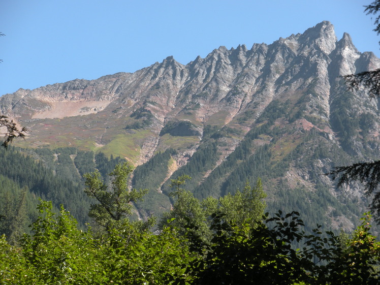
 Mix-up Peak
Weather Forecast, United StatesIssued: 10 am Mon 20 May Local TimeUpdates in: hr min sUpdate imminent
Mix-up PeakWeather Forecast, United States
Issued: 10 am Mon 20 May Local Time
Updates in:
Update imminent hr min s

Issued: 10 am Mon 20 May Local Time
Updates in:
Update imminent hr min s
Days 1–3 Weather SummaryA moderate fall of snow, heaviest on Tue afternoon. Temperatures will be below freezing (max 0°C on Mon afternoon, min -4°C on Wed morning). Wind will be generally light. | Days 4–6 Weather SummaryA moderate fall of snow, heaviest on Fri afternoon. Temperatures will be below freezing (max 0°C on Thu afternoon, min -6°C on Fri night). Wind will be generally light. | Days 7–9 Weather SummaryMostly dry. Freeze-thaw conditions (max 13°C on Tue afternoon, min -1°C on Sun morning). Wind will be generally light. | Days 10–12 Weather SummaryLight rain (total 7mm) at first, then becoming colder with a dusting of snow on Wed night. Freeze-thaw conditions (max 10°C on Wed morning, min -4°C on Thu night). Wind will be generally light. | |||||||||||||||||||||||||||||||||
Monday 20 | Tuesday 21 | Wednesday 22 | Thursday 23 | Friday 24 | Saturday 25 | Sunday 26 | Monday 27 | Tuesday 28 | Wednesday 29 | Thursday 30 | Friday 31 | |||||||||||||||||||||||||
AM | PM | night | AM | PM | night | AM | PM | night | AM | PM | night | AM | PM | night | AM | PM | night | AM | PM | night | AM | PM | night | AM | PM | night | AM | PM | night | AM | PM | night | AM | PM | night | |
some clouds | some clouds | some clouds | cloudy | mod. snow | mod. snow | light snow | cloudy | cloudy | cloudy | some clouds | cloudy | light snow | light snow | light snow | light snow | light snow | cloudy | some clouds | cloudy | clear | clear | some clouds | some clouds | some clouds | some clouds | rain shwrs | rain shwrs | risk tstorm | snow shwrs | snow shwrs | snow shwrs | clear | clear | some clouds | some clouds | |
km/h | ||||||||||||||||||||||||||||||||||||
Wave Height Map |  |  |  | 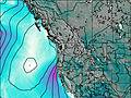 | 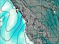 | 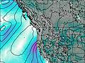 | 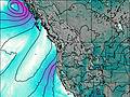 | 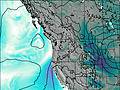 | 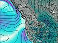 | 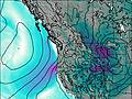 | 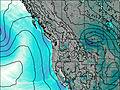 | 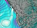 | ||||||||||||||||||||||||
— | — | — | — | 6 | 8 | 5 | — | — | — | — | — | 1.0 | 4 | 4 | 2.0 | 1.0 | — | — | — | — | — | — | — | — | — | — | — | — | 2.0 | 1.0 | 1.0 | — | — | — | — | |
— | — | — | — | — | — | — | — | — | — | — | — | — | — | — | — | — | — | — | — | — | — | — | — | — | — | 0.8 | 0.7 | 4 | 1.7 | — | — | — | — | — | — | |
max°C | -2 | 0 | -1 | -1 | -1 | -2 | -3 | -2 | -2 | -1 | 0 | -1 | -1 | -2 | -3 | -5 | -2 | -1 | 0 | 2 | 2 | 6 | 9 | 8 | 10 | 13 | 11 | 10 | 10 | 5 | -3 | -2 | -2 | 1 | 3 | 2 |
min°C | -3 | -1 | -3 | -1 | -2 | -3 | -4 | -3 | -2 | -1 | 0 | -2 | -1 | -3 | -6 | -5 | -3 | -2 | -1 | 1 | 1 | 4 | 8 | 6 | 7 | 12 | 8 | 9 | 7 | -3 | -3 | -3 | -4 | -2 | 2 | 0 |
-6 | -4 | -8 | -6 | -7 | -7 | -8 | -8 | -6 | -1 | -2 | -6 | -5 | -7 | -10 | -10 | -7 | -5 | -4 | -1 | 0 | 3 | 6 | 4 | 5 | 11 | 6 | 6 | 5 | -8 | -7 | -8 | -8 | -2 | 0 | -2 | |
1950 | 2150 | 1600 | 2000 | 1800 | 1650 | 1600 | 1750 | 1750 | 2050 | 2200 | 2000 | 2000 | 1750 | 1300 | 1450 | 1800 | 1550 | 2250 | 2700 | 2850 | 3150 | 3200 | 3450 | 3600 | 3700 | 3750 | 3550 | 3350 | 2300 | 1700 | 1950 | 1350 | 2300 | 2450 | 2100 | |
Cloud base (m) | 1600 | 1950 | 1850 | 1600 | 1600 | 1600 | 1600 | 1600 | 1650 | 1600 | 1700 | 1700 | 1750 | 1600 | 1600 | 1600 | 1600 | 1600 | 1600 | 1850 | 2600 | 3750 | 3050 | 6000 | 7400 | 3600 | 4050 | 2150 | 1800 | 1650 | 1650 | 1600 | 1600 | 2850 | ||
5:16 | — | — | 5:16 | — | — | 5:13 | — | — | 5:13 | — | — | 5:11 | — | — | 5:11 | — | — | 5:11 | — | — | 5:09 | — | — | 5:09 | — | — | 5:07 | — | — | 5:07 | — | — | 5:07 | — | — | |
— | — | 8:45 | — | — | 8:45 | — | — | 8:46 | — | — | 8:47 | — | — | 8:50 | — | — | 8:51 | — | — | 8:52 | — | — | 8:52 | — | — | 8:53 | — | — | 8:54 | — | — | 8:55 | — | — | 8:57 | |
Mix-up Peak Weather (Days 0-3):
The weather forecast for Mix-up Peak is: A moderate fall of snow, heaviest on Tue afternoon. Temperatures will be below freezing (max 0°C on Mon afternoon, min -4°C on Wed morning). Wind will be generally light.
Mix-up Peak Weather (Days 3-6):
A moderate fall of snow, heaviest on Fri afternoon. Temperatures will be below freezing (max 0°C on Thu afternoon, min -6°C on Fri night). Wind will be generally light.
Mix-up Peak Weather (Days 6-9):
Mostly dry. Freeze-thaw conditions (max 13°C on Tue afternoon, min -1°C on Sun morning). Wind will be generally light.
This table gives the weather forecast for Mix-up Peak at the specific elevation of 2204 m. Our advanced weather models allow us to provide distinct weather forecasts for several elevations of Mix-up Peak. To see the weather forecasts for the other elevations, use the tab navigation above the table. For a wider overview of the weather, consult the Weather Map of Washington.
Mix-up Peak Photos
View all
Cascade Range photos (410) |
Pacific Coast Ranges photos (962) |
photos from mountains in United States (2753) |
all photos
 Upload new photo
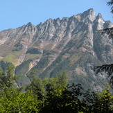
South side of Mix Up Peak
 Like us
 Follow us
