– Lat/Long: 28.10° N 86.65° E
 Cho Oyu or Qowowuyag ( 卓奧有山)
Weather Forecast, NepalIssued: 10 pm Sun 19 May Local TimeUpdates in: hr min sUpdate imminent
Cho Oyu or Qowowuyag ( 卓奧有山)Weather Forecast, Nepal
Issued: 10 pm Sun 19 May Local Time
Updates in:
Update imminent hr min s

Issued: 10 pm Sun 19 May Local Time
Updates in:
Update imminent hr min s
Days 1–4 Weather SummaryA light covering of new snow mostly falling on Mon morning. Extremely cold (max -12°C on Wed afternoon, min -16°C on Sun night). Winds decreasing (fresh winds from the ENE on Sun night, calm by Tue morning). | Days 5–7 Weather SummaryA light covering of new snow mostly falling on Sat afternoon. Temperatures will be well below freezing (max -9°C on Sat afternoon, min -14°C on Wed night). Wind will be generally light. | Days 8–10 Weather SummaryA moderate fall of snow, heaviest on Sun night. Temperatures will be well below freezing (max -8°C on Mon afternoon, min -11°C on Sat night). Wind will be generally light. | Days 11–13 Weather SummaryA dusting of new snow. Temperatures will be well below freezing (max -7°C on Fri afternoon, min -10°C on Wed morning). Wind will be generally light. | |||||||||||||||||||||||||||||||||
Monday 20 | Tuesday 21 | Wednesday 22 | Thursday 23 | Friday 24 | Saturday 25 | Sunday 26 | Monday 27 | Tuesday 28 | Wednesday 29 | Thursday 30 | Fri 31 | |||||||||||||||||||||||||
night | AM | PM | night | AM | PM | night | AM | PM | night | AM | PM | night | AM | PM | night | AM | PM | night | AM | PM | night | AM | PM | night | AM | PM | night | AM | PM | night | AM | PM | night | AM | PM | |
some clouds | snow shwrs | snow shwrs | some clouds | some clouds | snow shwrs | some clouds | snow shwrs | snow shwrs | some clouds | some clouds | snow shwrs | some clouds | some clouds | snow shwrs | some clouds | snow shwrs | snow shwrs | some clouds | snow shwrs | snow shwrs | snow shwrs | light snow | light snow | some clouds | some clouds | snow shwrs | some clouds | some clouds | snow shwrs | some clouds | some clouds | some clouds | some clouds | some clouds | some clouds | |
km/h | ||||||||||||||||||||||||||||||||||||
Wave Height Map |  |  |  |  |  |  |  |  |  |  |  |  |  | |||||||||||||||||||||||
— | 1.0 | 1.0 | — | — | 1.0 | — | 1.0 | 1.0 | — | — | 1.0 | — | — | 2.0 | — | 1.0 | 5 | — | 1.0 | 2.0 | 2.0 | 2.0 | 1.0 | — | — | 2.0 | — | — | 1.0 | — | — | — | — | — | — | |
— | — | — | — | — | — | — | — | — | — | — | — | — | — | — | — | — | — | — | — | — | — | — | — | — | — | — | — | — | — | — | — | — | — | — | — | |
max°C | -16 | -16 | -14 | -14 | -15 | -13 | -13 | -14 | -12 | -13 | -13 | -12 | -11 | -12 | -10 | -11 | -11 | -9 | -9 | -10 | -9 | -9 | -9 | -8 | -8 | -9 | -8 | -9 | -10 | -8 | -9 | -9 | -8 | -8 | -9 | -7 |
min°C | -16 | -16 | -15 | -15 | -15 | -14 | -14 | -14 | -13 | -14 | -13 | -12 | -13 | -12 | -11 | -12 | -11 | -10 | -11 | -10 | -10 | -10 | -10 | -9 | -9 | -9 | -9 | -9 | -10 | -9 | -10 | -10 | -9 | -10 | -9 | -8 |
-28 | -25 | -21 | -21 | -21 | -19 | -19 | -19 | -18 | -14 | -17 | -12 | -17 | -16 | -17 | -16 | -16 | -13 | -16 | -16 | -14 | -15 | -15 | -15 | -15 | -16 | -15 | -15 | -18 | -16 | -18 | -17 | -15 | -15 | -9 | -14 | |
4800 | 5200 | 5350 | 4900 | 5400 | 5450 | 5050 | 5450 | 5600 | 5200 | 5600 | 5650 | 5450 | 5850 | 5850 | 5600 | 5850 | 6000 | 5700 | 5950 | 6050 | 5850 | 6000 | 6100 | 5800 | 6050 | 6100 | 5800 | 6000 | 6100 | 5750 | 6100 | 6200 | 5900 | 6150 | 6300 | |
Cloud base (m) | 5900 | 5950 | 5900 | 5900 | 6050 | 5950 | 5900 | 5950 | 5900 | 5900 | 6100 | 5900 | 5900 | 6050 | 6000 | 5900 | 5950 | 5900 | 5900 | 5950 | 5900 | 5900 | 5900 | 5900 | 5950 | 5950 | 5950 | 5900 | 6000 | 5950 | 5900 | 6300 | 6200 | 5950 | 6100 | 6100 |
— | 5:05 | — | — | 5:05 | — | — | 5:03 | — | — | 5:03 | — | — | 5:03 | — | — | 5:03 | — | — | 5:03 | — | — | 5:03 | — | — | 5:01 | — | — | 5:01 | — | — | 5:01 | — | — | 5:01 | — | |
— | — | 6:44 | — | — | 6:45 | — | — | 6:45 | — | — | 6:45 | — | — | 6:45 | — | — | 6:46 | — | — | 6:46 | — | — | 6:47 | — | — | 6:47 | — | — | 6:49 | — | — | 6:50 | — | — | 6:50 | |
Cho Oyu or Qowowuyag ( 卓奧有山) Weather (Days 0-3):
The weather forecast for Cho Oyu or Qowowuyag ( 卓奧有山) is: A light covering of new snow mostly falling on Mon morning. Extremely cold (max -12°C on Wed afternoon, min -16°C on Sun night). Winds decreasing (fresh winds from the ENE on Sun night, calm by Tue morning).
Cho Oyu or Qowowuyag ( 卓奧有山) Weather (Days 3-6):
A light covering of new snow mostly falling on Sat afternoon. Temperatures will be well below freezing (max -9°C on Sat afternoon, min -14°C on Wed night). Wind will be generally light.
Cho Oyu or Qowowuyag ( 卓奧有山) Weather (Days 6-9):
A moderate fall of snow, heaviest on Sun night. Temperatures will be well below freezing (max -8°C on Mon afternoon, min -11°C on Sat night). Wind will be generally light.
This table gives the weather forecast for Cho Oyu or Qowowuyag ( 卓奧有山) at the specific elevation of 7500 m. Our advanced weather models allow us to provide distinct weather forecasts for several elevations of Cho Oyu or Qowowuyag ( 卓奧有山). To see the weather forecasts for the other elevations, use the tab navigation above the table. For a wider overview of the weather, consult the Weather Map of Nepal.
| Weather Station | Temp. | Weather | Wind | Gusts | Cloud / Visibility |
|---|---|---|---|---|---|
Tingri | |||||
* NOTE: not all weather observatories update at the same frequency which is the reason why some locations may show data from stations that are further away than known closer ones.
Cho Oyu or Qowowuyag ( 卓奧有山) Photos
View all
Central Nepal Himalaya photos (94) |
Greater Himalaya photos (195) |
photos from mountains in Nepal (166) |
all photos
 Upload new photo
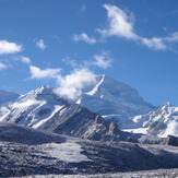
 See 8 more Cho Oyu or Qowowuyag ( 卓奧有山) photos
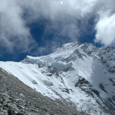
Cho Oyu
From north on Cho Oyu
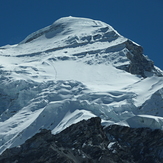
Cho-Yu from Tibet side climb
Cho Oyu
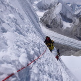
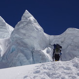
Chegando no Ice Cliff
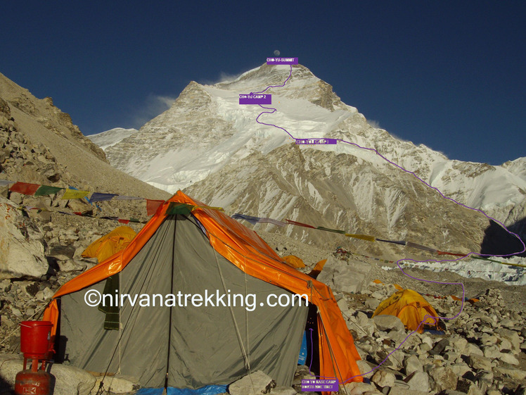
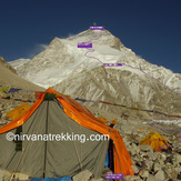
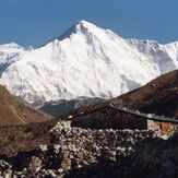
Trace of ascent to Cho Oyu
Cho Oyu or Qowowuyag ( 卓奧有山)
 Like us
 Follow us
