– Lat/Long: 45.01° N 110.84° W
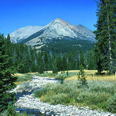
 Electric Peak
Weather Forecast, United StatesIssued: 5 am Mon 29 Apr Local TimeUpdates in: hr min sUpdate imminent
Electric PeakWeather Forecast, United States
Issued: 5 am Mon 29 Apr Local Time
Updates in:
Update imminent hr min s

Issued: 5 am Mon 29 Apr Local Time
Updates in:
Update imminent hr min s
Days 1–3 Weather SummaryA light covering of new snow mostly falling on Wed night. Freeze-thaw conditions (max 2°C on Mon afternoon, min -8°C on Tue night). Winds decreasing (gales from the SW on Mon afternoon, light winds from the WSW by Tue night). | Days 4–6 Weather SummaryA dusting of new snow. Freeze-thaw conditions (max 7°C on Sat afternoon, min -6°C on Thu morning). Wind will be generally light. | Days 7–9 Weather SummaryA light covering of new snow mostly falling on Mon afternoon. Freeze-thaw conditions (max 12°C on Sun afternoon, min -5°C on Tue night). Winds increasing (light winds from the S on Sun night, near gales from the SW by Mon afternoon). | Days 10–12 Weather SummaryA moderate fall of snow, heaviest on Thu night. Freeze-thaw conditions (max 2°C on Wed afternoon, min -4°C on Wed morning). Wind will be generally light. | |||||||||||||||||||||||||||||||||
Monday 29 | Tuesday 30 | Wednesday 1 | Thursday 2 | Friday 3 | Saturday 4 | Sunday 5 | Monday 6 | Tuesday 7 | Wednesday 8 | Thursday 9 | Friday 10 | |||||||||||||||||||||||||
AM | PM | night | AM | PM | night | AM | PM | night | AM | PM | night | AM | PM | night | AM | PM | night | AM | PM | night | AM | PM | night | AM | PM | night | AM | PM | night | AM | PM | night | AM | PM | night | |
some clouds | clear | snow shwrs | cloudy | light snow | snow shwrs | cloudy | cloudy | light snow | cloudy | some clouds | cloudy | light snow | snow shwrs | clear | clear | clear | some clouds | cloudy | some clouds | rain shwrs | light snow | light snow | light snow | light snow | light snow | light snow | some clouds | clear | cloudy | light snow | light snow | mod. snow | light snow | cloudy | some clouds | |
km/h | ||||||||||||||||||||||||||||||||||||
Wave Height Map |  |  |  |  |  |  |  | 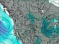 | 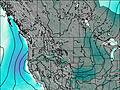 | 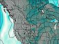 | 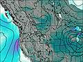 | 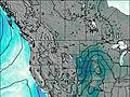 | ||||||||||||||||||||||||
— | — | 2.0 | — | 1.0 | 1.0 | — | — | 4 | — | — | — | 2.0 | 1.0 | — | — | — | — | — | — | — | 1.0 | 2.0 | 1.0 | 1.0 | 2.0 | 2.0 | — | — | — | 3 | 1.0 | 10 | 4 | — | — | |
— | — | — | — | — | — | — | — | — | — | — | — | — | — | — | — | — | — | — | — | 0.5 | — | — | — | — | — | — | — | — | — | — | — | — | — | — | — | |
max°C | 0 | 2 | -3 | -5 | -3 | -5 | -5 | -3 | -5 | -3 | 0 | -2 | -3 | -2 | -3 | 3 | 7 | 5 | 9 | 12 | 9 | 1 | -2 | -3 | -3 | -2 | -2 | -2 | 2 | 0 | 0 | 0 | -1 | -2 | -1 | -2 |
min°C | -1 | 2 | -7 | -7 | -3 | -8 | -7 | -3 | -7 | -6 | -1 | -4 | -4 | -2 | -4 | -1 | 6 | 5 | 7 | 12 | 5 | 0 | -2 | -4 | -4 | -2 | -5 | -4 | 0 | -1 | -2 | 0 | -3 | -3 | -1 | -4 |
-7 | -6 | -14 | -15 | -12 | -12 | -12 | -10 | -13 | -10 | -7 | -7 | -4 | -7 | -4 | -5 | 2 | 1 | 4 | 9 | 2 | -6 | -10 | -12 | -12 | -10 | -12 | -10 | -5 | -4 | -6 | -4 | -3 | -6 | -5 | -7 | |
2350 | 2750 | 1600 | 1700 | 2100 | 1350 | 1650 | 2100 | 1350 | 1750 | 2450 | 1850 | 1950 | 2250 | 1500 | 2400 | 3250 | 3550 | 3700 | 4050 | 3700 | 2600 | 2250 | 1950 | 1950 | 2200 | 2000 | 1950 | 2500 | 2450 | 2250 | 2450 | 2250 | 2050 | 2400 | 1750 | |
Cloud base (m) | 2450 | 2950 | 2750 | 3100 | 2700 | 2600 | 4050 | 2500 | 2350 | 2950 | 2850 | 2300 | 2550 | 2750 | 2350 | 6000 | 5000 | 5100 | 2350 | 2350 | 2350 | 2300 | 2400 | 2300 | 2350 | 2800 | 3300 | 2400 | 2450 | 2300 | 2300 | 2350 | 2400 | |||
6:13 | — | — | 6:13 | — | — | 6:11 | — | — | 6:09 | — | — | 6:07 | — | — | 6:07 | — | — | 6:05 | — | — | 6:03 | — | — | 6:03 | — | — | 6:01 | — | — | 6:00 | — | — | 5:58 | — | — | |
— | 8:27 | — | — | 8:28 | — | — | 8:29 | — | — | 8:30 | — | — | 8:31 | — | — | 8:32 | — | — | 8:34 | — | — | 8:35 | — | — | 8:37 | — | — | 8:37 | — | — | 8:38 | — | — | 8:39 | — | |
Electric Peak Weather (Days 0-3):
The weather forecast for Electric Peak is: A light covering of new snow mostly falling on Wed night. Freeze-thaw conditions (max 2°C on Mon afternoon, min -8°C on Tue night). Winds decreasing (gales from the SW on Mon afternoon, light winds from the WSW by Tue night).
Electric Peak Weather (Days 3-6):
A dusting of new snow. Freeze-thaw conditions (max 7°C on Sat afternoon, min -6°C on Thu morning). Wind will be generally light.
Electric Peak Weather (Days 6-9):
A light covering of new snow mostly falling on Mon afternoon. Freeze-thaw conditions (max 12°C on Sun afternoon, min -5°C on Tue night). Winds increasing (light winds from the S on Sun night, near gales from the SW by Mon afternoon).
This table gives the weather forecast for Electric Peak at the specific elevation of 2500 m. Our advanced weather models allow us to provide distinct weather forecasts for several elevations of Electric Peak. To see the weather forecasts for the other elevations, use the tab navigation above the table. For a wider overview of the weather, consult the Weather Map of Montana.
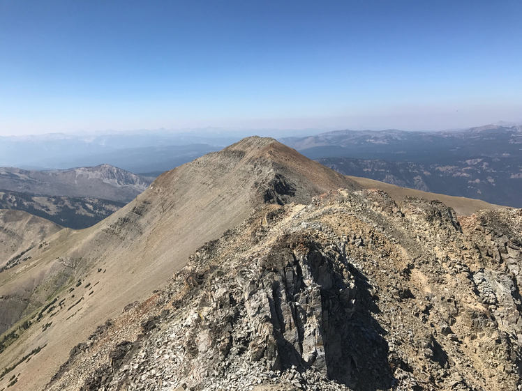
Electric Peak Photos
View all
Teton Range photos (30) |
Rocky Mountains (USA) photos (225) |
photos from mountains in United States (2751) |
all photos
 Upload new photo
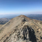
Electric Peak summit
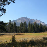
Electric Peak
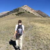
Electric Peak approach
Electric Peak
 Like us
 Follow us
