– Lat/Long: 43.60° N 72.82° W
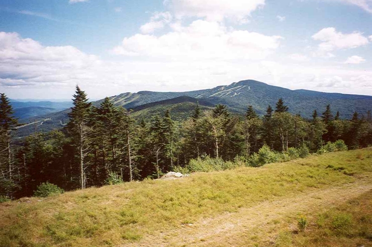
 Killington Peak
Weather Forecast, United StatesIssued: 1 am Wed 16 Apr Local TimeUpdates in: hr min sUpdate imminent
Killington Peak Weather Forecast, United States
Issued: 1 am Wed 16 Apr Local Time
Updates in:
Update imminent hr min s

Issued: 1 am Wed 16 Apr Local Time
Updates in:
Update imminent hr min s
Days 1–3 Weather SummaryA dusting of snow turning to light rain (total 4mm) on Fri night. Freeze-thaw conditions (max 11°C on Fri night, min -8°C on Wed morning). Winds increasing (moderate winds from the WNW on Thu night, severe gales from the WSW by Fri night). | Days 4–6 Weather SummaryHeavy rain (total 30mm), heaviest during Mon morning. Later becoming colder with a dusting of snow on Mon night. Freeze-thaw conditions (max 12°C on Sat morning, min -6°C on Mon night). Winds decreasing (severe gales from the W on Sat afternoon, fresh winds from the SW by Sun night). | |||||||||||||||||
Wednesday 16 | Thursday 17 | Friday 18 | Saturday 19 | Sunday 20 | Monday 21 | |||||||||||||
AM | PM | night | AM | PM | night | AM | PM | night | AM | PM | night | AM | PM | night | AM | PM | night | |
some clouds | light snow | snow shwrs | some clouds | clear | clear | clear | light rain | rain shwrs | light rain | rain shwrs | rain shwrs | some clouds | risk tstorm | heavy rain | rain shwrs | rain shwrs | snow shwrs | |
km/h | ||||||||||||||||||
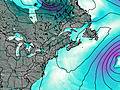 | 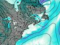 | 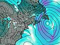 |  |  |  | |||||||||||||
— | 1.0 | 3 | — | — | — | — | — | — | — | — | — | — | — | — | — | — | 3 | |
— | — | — | — | — | — | — | 0.1 | 4 | 1.5 | 0.5 | 0.5 | — | 1.8 | 10 | 15 | 0.6 | — | |
max°C | -6 | -5 | -6 | -6 | -2 | 1 | 4 | 6 | 11 | 12 | 11 | 11 | 12 | 12 | 10 | 8 | 5 | -3 |
min°C | -8 | -6 | -6 | -6 | -2 | -3 | 3 | 5 | 6 | 11 | 11 | 10 | 11 | 12 | 8 | 7 | 1 | -6 |
-20 | -18 | -18 | -16 | -10 | -12 | -2 | -2 | -1 | 7 | 6 | 5 | 7 | 8 | 3 | 2 | -7 | -18 | |
550 | 650 | 300 | 650 | 1100 | 1050 | 2250 | 2800 | 3500 | 3350 | 3800 | 3150 | 3550 | 3450 | 3150 | 2650 | 1400 | 500 | |
Cloud base (m) | 350 | 450 | 400 | 450 | 8300 | 8550 | 1950 | 400 | 500 | 550 | 800 | 550 | 750 | 400 | 400 | 500 | 400 | |
6:07 | — | — | 6:05 | — | — | 6:03 | — | — | 6:01 | — | — | 6:01 | — | — | 5:58 | — | — | |
— | 7:35 | — | — | 7:36 | — | — | 7:37 | — | — | 7:37 | — | — | 7:39 | — | — | 7:40 | — | |
Loading...
Killington Peak Weather (Days 0-3):
The weather forecast for Killington Peak is: A dusting of snow turning to light rain (total 4mm) on Fri night. Freeze-thaw conditions (max 11°C on Fri night, min -8°C on Wed morning). Winds increasing (moderate winds from the WNW on Thu night, severe gales from the WSW by Fri night).
Killington Peak Weather (Days 3-6):
Heavy rain (total 30mm), heaviest during Mon morning. Later becoming colder with a dusting of snow on Mon night. Freeze-thaw conditions (max 12°C on Sat morning, min -6°C on Mon night). Winds decreasing (severe gales from the W on Sat afternoon, fresh winds from the SW by Sun night).
This table gives the weather forecast for Killington Peak at the specific elevation of 1291 m. Our advanced weather models allow us to provide distinct weather forecasts for several elevations of Killington Peak. To see the weather forecasts for the other elevations, use the tab navigation above the table. For a wider overview of the weather, consult the Weather Map of Vermont.
Killington Peak Photos
View all
Coolidge Range photos (6) |
Appalachians photos (861) |
photos from mountains in United States (2882) |
all photos
 Upload new photo
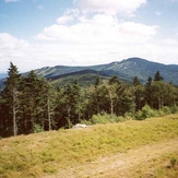
Killington Peak
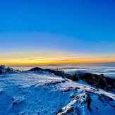
Killington peak at sunset
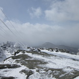
Top of Killingtion Peak
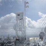
Tower on top of Killington Peak
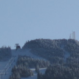
Killington Peak March 2013

