
– Lat/Long: 36.18° N 70.98° E
 Kuh-e Bandaka
Weather Forecast, AfghanistanIssued: 9 am Sat 04 May Local TimeUpdates in: hr min sUpdate imminent
Kuh-e BandakaWeather Forecast, Afghanistan
Issued: 9 am Sat 04 May Local Time
Updates in:
Update imminent hr min s

Issued: 9 am Sat 04 May Local Time
Updates in:
Update imminent hr min s
Days 1–3 Weather SummaryA light covering of new snow mostly falling on Sat afternoon. Temperatures will be well below freezing (max -6°C on Sat morning, min -11°C on Sun night). Wind will be generally light. | Days 4–6 Weather SummaryA light covering of new snow mostly falling on Thu night. Temperatures will be below freezing (max -2°C on Wed morning, min -6°C on Tue night). Wind will be generally light. | Days 7–9 Weather SummaryA heavy fall of snow, heaviest during Sat afternoon. Temperatures will be below freezing (max -3°C on Fri morning, min -9°C on Sun night). Winds increasing (light winds from the WSW on Fri afternoon, fresh winds from the NW by Sun night). | Days 10–12 Weather SummaryMostly dry. Temperatures will be below freezing (max 0°C on Tue morning, min -4°C on Mon morning). Mainly fresh winds. | |||||||||||||||||||||||||||||||||
Saturday 4 | Sunday 5 | Monday 6 | Tuesday 7 | Wednesday 8 | Thursday 9 | Friday 10 | Saturday 11 | Sunday 12 | Monday 13 | Tuesday 14 | Wednesday 15 | |||||||||||||||||||||||||
AM | PM | night | AM | PM | night | AM | PM | night | AM | PM | night | AM | PM | night | AM | PM | night | AM | PM | night | AM | PM | night | AM | PM | night | AM | PM | night | AM | PM | night | AM | PM | night | |
some clouds | snow shwrs | snow shwrs | light snow | snow shwrs | some clouds | clear | clear | clear | clear | clear | clear | clear | some clouds | some clouds | clear | snow shwrs | snow shwrs | snow shwrs | snow shwrs | clear | snow shwrs | mod. snow | snow shwrs | snow shwrs | snow shwrs | snow shwrs | clear | clear | clear | clear | clear | clear | clear | clear | clear | |
km/h | ||||||||||||||||||||||||||||||||||||
Wave Height Map | 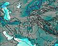 | 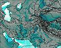 | 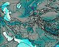 | 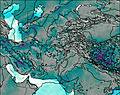 |  |  |  |  | 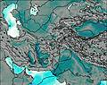 | 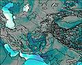 | 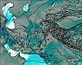 | 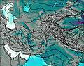 | ||||||||||||||||||||||||
— | 3 | 1.0 | 1.0 | 1.0 | — | — | — | — | — | — | — | — | — | — | — | 2.0 | 4 | 2.0 | 3 | — | 2.0 | 7 | 2.0 | 2.0 | 4 | 1.0 | — | — | — | — | — | — | — | — | — | |
— | — | — | — | — | — | — | — | — | — | — | — | — | — | — | — | — | — | — | — | — | — | — | — | — | — | — | — | — | — | — | — | — | — | — | — | |
max°C | -6 | -6 | -8 | -7 | -7 | -9 | -6 | -6 | -6 | -3 | -3 | -5 | -2 | -2 | -4 | -2 | -3 | -5 | -3 | -3 | -5 | -3 | -4 | -7 | -4 | -5 | -7 | -3 | -2 | -3 | 0 | 0 | -2 | 0 | 0 | -1 |
min°C | -6 | -7 | -10 | -7 | -9 | -11 | -8 | -8 | -9 | -4 | -5 | -6 | -3 | -4 | -5 | -3 | -4 | -6 | -4 | -5 | -6 | -4 | -7 | -8 | -5 | -7 | -9 | -4 | -3 | -4 | -1 | -1 | -3 | -1 | -1 | -3 |
-12 | -12 | -14 | -13 | -14 | -14 | -14 | -15 | -16 | -8 | -8 | -9 | -6 | -8 | -7 | -8 | -4 | -11 | -8 | -8 | -13 | -12 | -14 | -14 | -13 | -15 | -17 | -12 | -10 | -10 | -6 | -6 | -7 | -4 | -5 | -8 | |
4050 | 4100 | 3300 | 4000 | 3950 | 3000 | 3900 | 4150 | 3550 | 4400 | 4600 | 4150 | 4600 | 4700 | 4300 | 4650 | 4600 | 4100 | 4450 | 4550 | 4250 | 4500 | 4350 | 3800 | 4350 | 4300 | 3800 | 4400 | 4700 | 4450 | 4850 | 5000 | 4600 | 4900 | 5050 | 4650 | |
Cloud base (m) | 5650 | 5300 | 4900 | 5000 | 4950 | 4850 | 5150 | 4850 | 9600 | 8950 | 9050 | 6600 | 7950 | 5650 | 5400 | 4800 | 5650 | 4850 | 5300 | 5750 | 5000 | 4850 | 5500 | 4850 | 6500 | |||||||||||
4:48 | — | — | 4:48 | — | — | 4:47 | — | — | 4:46 | — | — | 4:45 | — | — | 4:43 | — | — | 4:43 | — | — | 4:41 | — | — | 4:41 | — | — | 4:41 | — | — | 4:39 | — | — | 4:39 | — | — | |
— | 6:36 | — | — | 6:37 | — | — | 6:37 | — | — | 6:38 | — | — | 6:39 | — | — | 6:39 | — | — | 6:40 | — | — | 6:42 | — | — | 6:43 | — | — | 6:44 | — | — | 6:45 | — | — | 6:45 | — | |
Kuh-e Bandaka Weather (Days 0-3):
The weather forecast for Kuh-e Bandaka is: A light covering of new snow mostly falling on Sat afternoon. Temperatures will be well below freezing (max -6°C on Sat morning, min -11°C on Sun night). Wind will be generally light.
Kuh-e Bandaka Weather (Days 3-6):
A light covering of new snow mostly falling on Thu night. Temperatures will be below freezing (max -2°C on Wed morning, min -6°C on Tue night). Wind will be generally light.
Kuh-e Bandaka Weather (Days 6-9):
A heavy fall of snow, heaviest during Sat afternoon. Temperatures will be below freezing (max -3°C on Fri morning, min -9°C on Sun night). Winds increasing (light winds from the WSW on Fri afternoon, fresh winds from the NW by Sun night).
This table gives the weather forecast for Kuh-e Bandaka at the specific elevation of 5000 m. Our advanced weather models allow us to provide distinct weather forecasts for several elevations of Kuh-e Bandaka. To see the weather forecasts for the other elevations, use the tab navigation above the table. For a wider overview of the weather, consult the Weather Map of Afghanistan.
 Like us
 Follow us
