
– Lat/Long: 64.65° N 16.72° W
 Kverkfjoll
Weather Forecast, IcelandIssued: 5 pm Thu 31 Oct Local TimeUpdates in: hr min sUpdate imminent
KverkfjollWeather Forecast, Iceland
Issued: 5 pm Thu 31 Oct Local Time
Updates in:
Update imminent hr min s

Issued: 5 pm Thu 31 Oct Local Time
Updates in:
Update imminent hr min s
Days 1–4 Weather SummaryA dusting of snow turning to light rain (total 4mm) on Sat night. Freeze-thaw conditions (max 3°C on Sat night, min -18°C on Thu night). Winds increasing (light winds from the WSW on Fri afternoon, gales from the SW by Sun morning). | Days 5–7 Weather SummaryA light covering of new snow mostly falling on Wed morning. Freeze-thaw conditions (max 3°C on Sun afternoon, min -1°C on Wed morning). Winds decreasing (gales from the SW on Sun afternoon, fresh winds from the S by Wed morning). | Days 8–10 Weather SummaryA moderate fall of snow, heaviest on Thu morning. Freeze-thaw conditions (max 1°C on Thu morning, min -7°C on Thu night). Winds decreasing (extremely windy from the SSW on Thu afternoon, light winds from the SSW by Sat morning). | Days 11–13 Weather SummaryA dusting of new snow. Freeze-thaw conditions (max 1°C on Mon morning, min -5°C on Sat night). Winds increasing (calm on Sat night, near gales from the SE by Mon afternoon). | |||||||||||||||||||||||||||||||||
Thu 31 | Friday 1 | Saturday 2 | Sunday 3 | Monday 4 | Tuesday 5 | Wednesday 6 | Thursday 7 | Friday 8 | Saturday 9 | Sunday 10 | Monday 11 | Tue 12 | ||||||||||||||||||||||||
PM | night | AM | PM | night | AM | PM | night | AM | PM | night | AM | PM | night | AM | PM | night | AM | PM | night | AM | PM | night | AM | PM | night | AM | PM | night | AM | PM | night | AM | PM | night | AM | |
some clouds | snow shwrs | some clouds | clear | some clouds | some clouds | cloudy | light rain | rain shwrs | clear | some clouds | cloudy | cloudy | some clouds | cloudy | cloudy | light snow | snow shwrs | clear | snow shwrs | snow shwrs | snow shwrs | snow shwrs | clear | clear | clear | cloudy | some clouds | some clouds | some clouds | clear | some clouds | cloudy | light snow | snow shwrs | some clouds | |
km/h | ||||||||||||||||||||||||||||||||||||
 |  |  |  |  |  |  |  |  |  |  |  |  | ||||||||||||||||||||||||
— | 1.0 | — | — | — | — | — | — | — | — | — | — | — | — | — | — | 4 | 3 | — | 2.0 | 11 | 2.0 | 3 | — | — | — | — | — | — | — | — | — | — | 3 | 1.0 | — | |
— | — | — | — | — | — | — | 2 | 1.4 | — | — | — | — | — | — | — | — | — | — | — | — | — | — | — | — | — | — | — | — | — | — | — | — | — | — | — | |
max°C | -15 | -15 | -9 | -8 | -5 | -1 | 1 | 3 | 3 | 3 | 2 | 2 | 2 | 2 | 2 | 1 | 2 | 0 | -4 | -1 | 1 | -3 | -5 | -6 | -6 | -4 | -3 | -3 | -3 | -4 | -3 | -2 | 1 | 1 | 0 | -2 |
min°C | -17 | -18 | -12 | -9 | -8 | -3 | -1 | 0 | 3 | 2 | 1 | 2 | 2 | 2 | 1 | 1 | 1 | -1 | -5 | -4 | 0 | -5 | -7 | -7 | -7 | -7 | -3 | -3 | -5 | -5 | -4 | -2 | -1 | -1 | -2 | -2 |
-31 | -32 | -23 | -17 | -16 | -11 | -8 | -7 | -4 | -6 | -7 | -6 | -6 | -6 | -7 | -7 | -7 | -10 | -17 | -16 | -12 | -19 | -20 | -18 | -16 | -14 | -7 | -8 | -8 | -9 | -9 | -8 | -8 | -8 | -8 | -9 | |
0 | 0 | 0 | 0 | 0 | 750 | 1650 | 2350 | 2750 | 2550 | 2350 | 2400 | 2400 | 2850 | 2600 | 2100 | 2300 | 1800 | 1150 | 1100 | 2400 | 850 | 650 | 400 | 0 | 0 | 700 | 850 | 650 | 250 | 900 | 1350 | 1350 | 2450 | 1900 | 1250 | |
Cloud base (m) | 650 | 700 | 6100 | 5100 | 700 | 750 | 650 | 650 | 700 | 700 | 650 | 650 | 650 | 700 | 600 | 600 | 650 | 550 | 650 | 6150 | 6400 | 5600 | 4900 | 1750 | 750 | 700 | 650 | 600 | 600 | 600 | ||||||
— | — | 8:56 | — | — | 8:59 | — | — | 9:02 | — | — | 9:06 | — | — | 9:08 | — | — | 9:11 | — | — | 9:15 | — | — | 9:18 | — | — | 9:22 | — | — | 9:26 | — | — | 9:29 | — | — | 9:33 | |
4:45 | — | — | 4:43 | — | — | 4:39 | — | — | 4:36 | — | — | 4:32 | — | — | 4:30 | — | — | 4:27 | — | — | 4:22 | — | — | 4:20 | — | — | 4:16 | — | — | 4:14 | — | — | 4:10 | — | — | |
Kverkfjoll Weather (Days 0-3):
The weather forecast for Kverkfjoll is: A dusting of snow turning to light rain (total 4mm) on Sat night. Freeze-thaw conditions (max 3°C on Sat night, min -18°C on Thu night). Winds increasing (light winds from the WSW on Fri afternoon, gales from the SW by Sun morning).
Kverkfjoll Weather (Days 3-6):
A light covering of new snow mostly falling on Wed morning. Freeze-thaw conditions (max 3°C on Sun afternoon, min -1°C on Wed morning). Winds decreasing (gales from the SW on Sun afternoon, fresh winds from the S by Wed morning).
Kverkfjoll Weather (Days 6-9):
A moderate fall of snow, heaviest on Thu morning. Freeze-thaw conditions (max 1°C on Thu morning, min -7°C on Thu night). Winds decreasing (extremely windy from the SSW on Thu afternoon, light winds from the SSW by Sat morning).
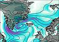
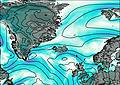
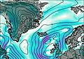
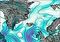
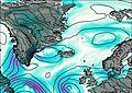
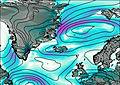
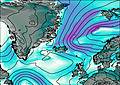
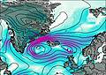
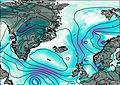
This table gives the weather forecast for Kverkfjoll at the specific elevation of 1920 m. Our advanced weather models allow us to provide distinct weather forecasts for several elevations of Kverkfjoll. To see the weather forecasts for the other elevations, use the tab navigation above the table. For a wider overview of the weather, consult the Weather Map of Iceland.

