
– Lat/Long: 35.80° N 105.77° W
 Lake Peak
Weather Forecast, United StatesIssued: 5 am Mon 06 May Local TimeUpdates in: hr min sUpdate imminent
Lake PeakWeather Forecast, United States
Issued: 5 am Mon 06 May Local Time
Updates in:
Update imminent hr min s

Issued: 5 am Mon 06 May Local Time
Updates in:
Update imminent hr min s
Days 1–3 Weather SummaryMostly dry. Freeze-thaw conditions (max 9°C on Tue afternoon, min -3°C on Mon morning). Winds decreasing (gales from the W on Tue afternoon, light winds from the NNE by Wed night). | Days 4–6 Weather SummaryMild at first with light rain (total 5mm) on Fri afternoon followed by colder weather and light fall of snow, heaviest on Sat morning. Freeze-thaw conditions (max 4°C on Thu afternoon, min 0°C on Thu morning). Winds decreasing (fresh winds from the SE on Thu afternoon, calm by Sat morning). | |||||||||||||||||
Monday 6 | Tuesday 7 | Wednesday 8 | Thursday 9 | Friday 10 | Saturday 11 | |||||||||||||
AM | PM | night | AM | PM | night | AM | PM | night | AM | PM | night | AM | PM | night | AM | PM | night | |
clear | clear | clear | clear | clear | clear | clear | clear | rain shwrs | some clouds | some clouds | some clouds | cloudy | rain shwrs | light snow | mod. snow | light snow | rain shwrs | |
km/h | ||||||||||||||||||
Wave Height Map |  |  |  |  | 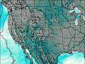 | 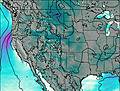 | ||||||||||||
— | — | — | — | — | — | — | — | — | — | — | — | — | — | 1.0 | 7 | 3 | — | |
— | — | — | — | — | — | — | — | 0.1 | — | — | — | — | 1.8 | 2.0 | — | 1.4 | 0.1 | |
max°C | 1 | 4 | 1 | 6 | 9 | 6 | 4 | 5 | 5 | 2 | 4 | 1 | 1 | 4 | 2 | 1 | 3 | 4 |
min°C | -3 | 3 | 0 | 2 | 8 | 1 | 1 | 5 | 0 | 0 | 2 | 0 | 0 | 2 | 2 | 0 | 1 | 2 |
-11 | -5 | -8 | -5 | 2 | -5 | -6 | -2 | -5 | -6 | -4 | -6 | -5 | -2 | -1 | -4 | -3 | 0 | |
2650 | 3400 | 3200 | 3300 | 4100 | 3650 | 3200 | 3650 | 3650 | 3050 | 3250 | 3200 | 3000 | 3500 | 3300 | 3100 | 3200 | 3450 | |
Cloud base (m) | 5250 | 3000 | 3400 | 2950 | 2900 | 2950 | 2900 | 2900 | 2900 | 3000 | ||||||||
6:05 | — | — | 6:03 | — | — | 6:03 | — | — | 6:01 | — | — | 6:01 | — | — | 6:00 | — | — | |
— | 7:53 | — | — | 7:54 | — | — | 7:55 | — | — | 7:57 | — | — | 7:58 | — | — | 7:58 | — | |
Lake Peak Weather (Days 0-3):
The weather forecast for Lake Peak is: Mostly dry. Freeze-thaw conditions (max 9°C on Tue afternoon, min -3°C on Mon morning). Winds decreasing (gales from the W on Tue afternoon, light winds from the NNE by Wed night).
Lake Peak Weather (Days 3-6):
Mild at first with light rain (total 5mm) on Fri afternoon followed by colder weather and light fall of snow, heaviest on Sat morning. Freeze-thaw conditions (max 4°C on Thu afternoon, min 0°C on Thu morning). Winds decreasing (fresh winds from the SE on Thu afternoon, calm by Sat morning).
This table gives the weather forecast for Lake Peak at the specific elevation of 3000 m. Our advanced weather models allow us to provide distinct weather forecasts for several elevations of Lake Peak. To see the weather forecasts for the other elevations, use the tab navigation above the table. For a wider overview of the weather, consult the Weather Map of New-Mexico.
 Like us
 Follow us
