– Lat/Long: 46.38° N 7.15° E
 Le Tarent
Weather Forecast, SwitzerlandIssued: 7 pm Sat 04 May Local TimeUpdates in: hr min sUpdate imminent
Le TarentWeather Forecast, Switzerland
Issued: 7 pm Sat 04 May Local Time
Updates in:
Update imminent hr min s

Issued: 7 pm Sat 04 May Local Time
Updates in:
Update imminent hr min s
Days 1–4 Weather SummaryModerate rain (total 14mm), heaviest on Mon morning giving way to a moderate fall of snow, heaviest on Mon afternoon. Freeze-thaw conditions (max 8°C on Sun afternoon, min -1°C on Tue morning). Wind will be generally light. | Days 5–7 Weather SummaryA dusting of new snow. Freeze-thaw conditions (max 8°C on Fri afternoon, min -1°C on Tue night). Wind will be generally light. | ||||||||||||||||||
Sunday 5 | Monday 6 | Tuesday 7 | Wednesday 8 | Thursday 9 | Friday 10 | ||||||||||||||
night | AM | PM | night | AM | PM | night | AM | PM | night | AM | PM | night | AM | PM | night | AM | PM | night | |
light rain | light rain | rain shwrs | rain shwrs | light rain | mod. snow | light snow | light snow | light snow | light snow | cloudy | light rain | rain shwrs | clear | rain shwrs | some clouds | clear | some clouds | clear | |
km/h | |||||||||||||||||||
Wave Height Map |  |  |  |  |  |  |  | ||||||||||||
— | — | — | — | — | 7 | 4 | 2.0 | 4 | 2.0 | — | — | — | — | — | — | — | — | — | |
3 | 2 | 3 | 3 | 4 | — | — | — | — | — | — | 0.2 | 0.2 | — | 0.1 | — | — | — | — | |
max°C | 5 | 4 | 8 | 7 | 4 | 2 | 2 | 0 | -1 | 0 | 0 | 3 | 2 | 5 | 7 | 6 | 6 | 8 | 6 |
min°C | 3 | 3 | 8 | 4 | 3 | 2 | 0 | -1 | -1 | -1 | 0 | 1 | 1 | 2 | 7 | 3 | 4 | 7 | 4 |
0 | 0 | 6 | 2 | 1 | -1 | -2 | -3 | -4 | -6 | -4 | -3 | -2 | -1 | 6 | 3 | 4 | 6 | 3 | |
2600 | 2800 | 3050 | 3000 | 2550 | 2350 | 2100 | 1900 | 1900 | 1950 | 2000 | 2350 | 2500 | 2950 | 2900 | 3050 | 2950 | 2900 | 3200 | |
Cloud base (m) | 2350 | 1500 | 2400 | 3300 | 1650 | 1500 | 1500 | 1500 | 1500 | 1500 | 950 | 1650 | 1850 | 2150 | 2600 | 6000 | 2800 | ||
— | 6:09 | — | — | 6:09 | — | — | 6:07 | — | — | 6:05 | — | — | 6:05 | — | — | 6:03 | — | — | |
— | — | — | 8:45 | — | — | 8:46 | — | — | 8:47 | — | — | 8:49 | — | — | 8:51 | — | — | 8:52 | |
Le Tarent Weather (Days 0-3):
The weather forecast for Le Tarent is: Moderate rain (total 14mm), heaviest on Mon morning giving way to a moderate fall of snow, heaviest on Mon afternoon. Freeze-thaw conditions (max 8°C on Sun afternoon, min -1°C on Tue morning). Wind will be generally light.
Le Tarent Weather (Days 3-6):
A dusting of new snow. Freeze-thaw conditions (max 8°C on Fri afternoon, min -1°C on Tue night). Wind will be generally light.
This table gives the weather forecast for Le Tarent at the specific elevation of 2000 m. Our advanced weather models allow us to provide distinct weather forecasts for several elevations of Le Tarent. To see the weather forecasts for the other elevations, use the tab navigation above the table. For a wider overview of the weather, consult the Weather Map of Switzerland.
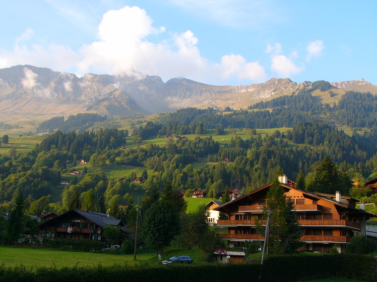
Le Tarent Photos
View all
Bernese Alps photos (151) |
Alps photos (1434) |
photos from mountains in Switzerland (632) |
all photos
 Upload new photo
Le Tarent
 Like us
 Follow us
