– Lat/Long: 40.25° N 105.62° W
 Longs Peak
Weather Forecast, United StatesIssued: 11 am Sun 28 Apr Local TimeUpdates in: hr min sUpdate imminent
Longs PeakWeather Forecast, United States
Issued: 11 am Sun 28 Apr Local Time
Updates in:
Update imminent hr min s

Issued: 11 am Sun 28 Apr Local Time
Updates in:
Update imminent hr min s
Days 1–3 Weather SummaryA dusting of new snow. Freeze-thaw conditions (max 2°C on Tue afternoon, min -6°C on Sun morning). Winds increasing (light winds from the WNW on Sun morning, near gales from the W by Tue morning). | Days 4–6 Weather SummaryA moderate fall of snow, heaviest on Wed night. Freeze-thaw conditions (max 3°C on Wed morning, min -10°C on Thu night). Winds decreasing (near gales from the SW on Wed morning, light winds from the WNW by Thu afternoon). | Days 7–9 Weather SummaryA light covering of new snow mostly falling on Mon night. Freeze-thaw conditions (max 6°C on Sun afternoon, min -8°C on Mon night). Winds increasing (light winds from the S on Sat night, near gales from the WSW by Mon night). | Days 10–12 Weather SummaryA heavy fall of snow, heaviest during Tue afternoon. Temperatures will be below freezing (max 0°C on Fri morning, min -12°C on Tue night). Winds decreasing (gales from the W on Wed morning, light winds from the S by Thu afternoon). | |||||||||||||||||||||||||||||||||
Sunday 28 | Monday 29 | Tuesday 30 | Wednesday 1 | Thursday 2 | Friday 3 | Saturday 4 | Sunday 5 | Monday 6 | Tuesday 7 | Wednesday 8 | Thursday 9 | |||||||||||||||||||||||||
AM | PM | night | AM | PM | night | AM | PM | night | AM | PM | night | AM | PM | night | AM | PM | night | AM | PM | night | AM | PM | night | AM | PM | night | AM | PM | night | AM | PM | night | AM | PM | night | |
some clouds | snow shwrs | some clouds | some clouds | some clouds | clear | clear | clear | some clouds | rain shwrs | rain shwrs | snow shwrs | light snow | light snow | snow shwrs | some clouds | some clouds | clear | some clouds | snow shwrs | clear | some clouds | some clouds | some clouds | clear | some clouds | snow shwrs | snow shwrs | snow shwrs | snow shwrs | some clouds | snow shwrs | snow shwrs | clear | light snow | snow shwrs | |
km/h | ||||||||||||||||||||||||||||||||||||
Wave Height Map | 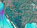 | 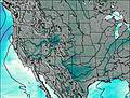 | 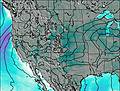 | 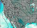 | 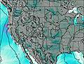 | 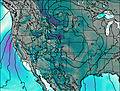 | 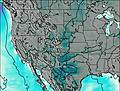 | 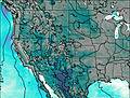 | 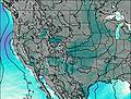 | 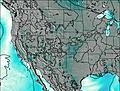 | 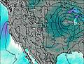 |  | ||||||||||||||||||||||||
— | 2.0 | — | — | — | — | — | — | — | — | — | 9 | 5 | 2.0 | 1.0 | — | — | — | — | 1.0 | — | — | — | — | — | — | 6 | 4 | 5 | 4 | — | 2.0 | 1.0 | — | 2.0 | 5 | |
— | — | — | — | — | — | — | — | — | 0.1 | 0.3 | — | — | — | — | — | — | — | — | — | — | — | — | — | — | — | — | — | — | — | — | — | — | — | — | — | |
max°C | -4 | -3 | -5 | -2 | 0 | -1 | -1 | 2 | 0 | 3 | 3 | -3 | -8 | -8 | -10 | -4 | -1 | -3 | 1 | 1 | -1 | 5 | 6 | 3 | 5 | 5 | -2 | -6 | -6 | -10 | -7 | -6 | -7 | -2 | -2 | -4 |
min°C | -6 | -3 | -6 | -4 | 0 | -3 | -3 | 1 | -1 | 1 | 1 | -9 | -9 | -8 | -10 | -7 | -3 | -4 | -2 | 0 | -3 | 3 | 6 | 1 | 4 | 3 | -8 | -6 | -7 | -12 | -10 | -6 | -8 | -4 | -3 | -4 |
-11 | -9 | -11 | -10 | -6 | -13 | -13 | -7 | -6 | -6 | -5 | -17 | -17 | -12 | -16 | -14 | -10 | -11 | -8 | -4 | -6 | -2 | 1 | -4 | 0 | -4 | -19 | -15 | -18 | -26 | -23 | -17 | -16 | -10 | -8 | -9 | |
2600 | 3150 | 2450 | 2850 | 3550 | 3200 | 3000 | 3700 | 3300 | 3600 | 3850 | 2450 | 2100 | 2450 | 1700 | 2450 | 3150 | 2900 | 3250 | 3650 | 2950 | 3850 | 4250 | 4000 | 4050 | 4100 | 2550 | 2600 | 2750 | 1750 | 2050 | 2750 | 2200 | 2900 | 3250 | 2900 | |
Cloud base (m) | 3000 | 3450 | 3050 | 3150 | 3600 | 9000 | 3150 | 4950 | 4950 | 2950 | 2950 | 3400 | 3100 | 3100 | 3450 | 4200 | 2950 | 5550 | 5150 | 2900 | 2950 | 2950 | 3150 | 3100 | 3150 | 3050 | 3000 | 2950 | ||||||||
6:05 | — | — | 6:03 | — | — | 6:01 | — | — | 6:01 | — | — | 5:58 | — | — | 5:58 | — | — | 5:56 | — | — | 5:56 | — | — | 5:54 | — | — | 5:54 | — | — | 5:52 | — | — | 5:50 | — | — | |
— | 7:54 | — | — | 7:55 | — | — | 7:57 | — | — | 7:58 | — | — | 7:59 | — | — | 8:00 | — | — | 8:00 | — | — | 8:01 | — | — | 8:02 | — | — | 8:04 | — | — | 8:05 | — | — | 8:06 | — | |
Longs Peak Weather (Days 0-3):
The weather forecast for Longs Peak is: A dusting of new snow. Freeze-thaw conditions (max 2°C on Tue afternoon, min -6°C on Sun morning). Winds increasing (light winds from the WNW on Sun morning, near gales from the W by Tue morning).
Longs Peak Weather (Days 3-6):
A moderate fall of snow, heaviest on Wed night. Freeze-thaw conditions (max 3°C on Wed morning, min -10°C on Thu night). Winds decreasing (near gales from the SW on Wed morning, light winds from the WNW by Thu afternoon).
Longs Peak Weather (Days 6-9):
A light covering of new snow mostly falling on Mon night. Freeze-thaw conditions (max 6°C on Sun afternoon, min -8°C on Mon night). Winds increasing (light winds from the S on Sat night, near gales from the WSW by Mon night).
This table gives the weather forecast for Longs Peak at the specific elevation of 3500 m. Our advanced weather models allow us to provide distinct weather forecasts for several elevations of Longs Peak. To see the weather forecasts for the other elevations, use the tab navigation above the table. For a wider overview of the weather, consult the Weather Map of Colorado.
| Weather Station | Temp. | Weather | Wind | Gusts | Cloud / Visibility |
|---|---|---|---|---|---|
* NOTE: not all weather observatories update at the same frequency which is the reason why some locations may show data from stations that are further away than known closer ones.
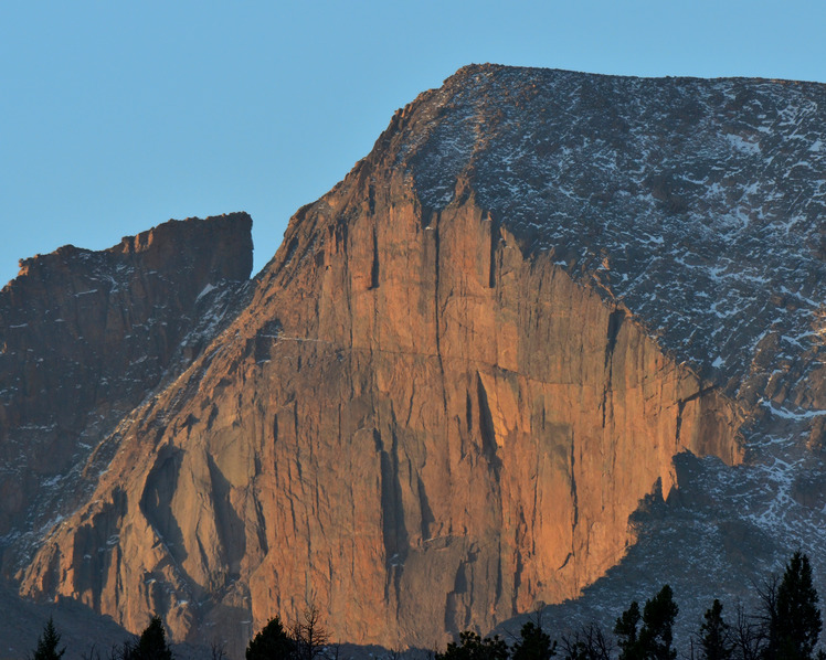
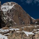
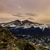
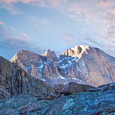
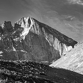
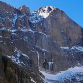
Longs Peak Photos
View all
Front Range photos (83) |
Rocky Mountains (USA) photos (225) |
photos from mountains in United States (2751) |
all photos
 Upload new photo
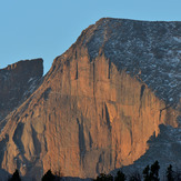
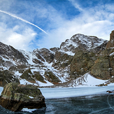
 See 11 more Longs Peak photos
Sunrise on the Diamond
Approaching Chasm Lake below the Diamond
Longs Peak
Longs peak
Longs peak
Diamond Cliff
The Diamond The diamond from Chasm Lake
 Like us
 Follow us
