
– Lat/Long: 46.90° S 37.75° E
 Marion Island
Weather Forecast, IndiaIssued: 7 pm Thu 31 Oct Local TimeUpdates in: hr min sUpdate imminent
Marion IslandWeather Forecast, India
Issued: 7 pm Thu 31 Oct Local Time
Updates in:
Update imminent hr min s

Issued: 7 pm Thu 31 Oct Local Time
Updates in:
Update imminent hr min s
Days 1–4 Weather SummaryLight rain (total 4mm), mostly falling on Sat night. Freeze-thaw conditions (max 8°C on Sat night, min 0°C on Thu night). Winds decreasing (extremely windy from the NW on Sat night, fresh winds from the NW by Sun afternoon). | Days 5–7 Weather SummarySome drizzle, heaviest during Sun night. Freeze-thaw conditions (max 6°C on Sun night, min -7°C on Mon afternoon). Winds increasing (strong winds from the WSW on Mon morning, extremely windy from the WNW by Tue afternoon). | Days 8–10 Weather SummaryA dusting of snow giving way to moderate rain (total 12mm) heaviest on Sat morning. Freeze-thaw conditions (max 9°C on Sat afternoon, min -6°C on Thu morning). Winds increasing (fresh winds from the NW on Fri afternoon, extremely windy from the NNW by Sat afternoon). | Days 11–13 Weather SummaryA dusting of snow turning to light rain (total 9mm) on Tue night. Freeze-thaw conditions (max 6°C on Tue afternoon, min -5°C on Mon morning). Winds increasing (strong winds from the WNW on Sun afternoon, extremely windy from the WNW by Tue afternoon). | |||||||||||||||||||||||||||||||||
Friday 1 | Saturday 2 | Sunday 3 | Monday 4 | Tuesday 5 | Wednesday 6 | Thursday 7 | Friday 8 | Saturday 9 | Sunday 10 | Monday 11 | Tue 12 | |||||||||||||||||||||||||
night | AM | PM | night | AM | PM | night | AM | PM | night | AM | PM | night | AM | PM | night | AM | PM | night | AM | PM | night | AM | PM | night | AM | PM | night | AM | PM | night | AM | PM | night | AM | PM | |
some clouds | some clouds | clear | rain shwrs | rain shwrs | rain shwrs | rain shwrs | some clouds | clear | rain shwrs | some clouds | clear | clear | some clouds | clear | rain shwrs | some clouds | cloudy | light snow | some clouds | clear | clear | some clouds | some clouds | cloudy | mod. rain | light rain | rain shwrs | rain shwrs | light snow | snow shwrs | clear | clear | rain shwrs | light rain | rain shwrs | |
km/h | ||||||||||||||||||||||||||||||||||||
 |  |  |  |  |  |  |  |  |  |  |  |  | ||||||||||||||||||||||||
— | — | — | — | — | — | — | — | — | — | — | — | — | — | — | — | — | — | 1.0 | — | — | — | — | — | — | — | — | — | — | 1.0 | 3 | — | — | — | — | — | |
— | — | — | 0.4 | 0.1 | 0.1 | 3 | — | — | 1.8 | — | — | — | — | — | 0.1 | — | — | 1.0 | — | — | — | — | — | — | 7 | 4 | 0.4 | 0.1 | 2.0 | — | — | — | 1.5 | 0.1 | 1.4 | |
max°C | 1 | 1 | 3 | 4 | 6 | 7 | 8 | 2 | 4 | 6 | -1 | -7 | -6 | -4 | -1 | 3 | 4 | 4 | 3 | -3 | -6 | -2 | 1 | 3 | 5 | 5 | 9 | 5 | 5 | 3 | 1 | -5 | -4 | 3 | 4 | 6 |
min°C | 0 | 0 | 3 | 4 | 6 | 6 | 3 | 2 | 2 | 0 | -6 | -7 | -7 | -5 | -2 | -1 | 4 | 4 | 1 | -6 | -6 | -6 | 0 | 2 | 4 | 5 | 8 | 3 | 5 | 0 | -4 | -5 | -5 | 0 | 4 | 6 |
-8 | -9 | -4 | -3 | -1 | -2 | -5 | -6 | -4 | -9 | -16 | -18 | -18 | -16 | -14 | -12 | -4 | -4 | -9 | -19 | -19 | -18 | -7 | -4 | -2 | -2 | 3 | -5 | -3 | -7 | -15 | -16 | -17 | -10 | -4 | -2 | |
1300 | 1500 | 2050 | 2350 | 2450 | 2650 | 2350 | 1800 | 2400 | 2150 | 500 | 500 | 500 | 750 | 1050 | 1900 | 2000 | 2000 | 1800 | 500 | 500 | 550 | 1650 | 2050 | 2250 | 2900 | 2950 | 2550 | 2100 | 1300 | 1000 | 600 | 700 | 2150 | 2300 | 2350 | |
Cloud base (m) | 150 | 200 | 250 | 150 | 150 | 200 | 150 | 100 | 200 | 450 | 500 | 2100 | 150 | 150 | 150 | 100 | 150 | 250 | 350 | 500 | 7000 | 50 | 50 | 150 | 1600 | 100 | 50 | 750 | 400 | 100 | 800 | 100 | ||||
— | 4:01 | — | — | 4:00 | — | — | 3:59 | — | — | 3:57 | — | — | 3:56 | — | — | 3:54 | — | — | 3:53 | — | — | 3:51 | — | — | 3:49 | — | — | 3:48 | — | — | 3:47 | — | — | 3:46 | — | |
— | — | 6:22 | — | — | 6:24 | — | — | 6:25 | — | — | 6:28 | — | — | 6:29 | — | — | 6:30 | — | — | 6:31 | — | — | 6:34 | — | — | 6:35 | — | — | 6:37 | — | — | 6:37 | — | — | 6:39 | |
Marion Island Weather (Days 0-3):
The weather forecast for Marion Island is: Light rain (total 4mm), mostly falling on Sat night. Freeze-thaw conditions (max 8°C on Sat night, min 0°C on Thu night). Winds decreasing (extremely windy from the NW on Sat night, fresh winds from the NW by Sun afternoon).
Marion Island Weather (Days 3-6):
Some drizzle, heaviest during Sun night. Freeze-thaw conditions (max 6°C on Sun night, min -7°C on Mon afternoon). Winds increasing (strong winds from the WSW on Mon morning, extremely windy from the WNW by Tue afternoon).
Marion Island Weather (Days 6-9):
A dusting of snow giving way to moderate rain (total 12mm) heaviest on Sat morning. Freeze-thaw conditions (max 9°C on Sat afternoon, min -6°C on Thu morning). Winds increasing (fresh winds from the NW on Fri afternoon, extremely windy from the NNW by Sat afternoon).
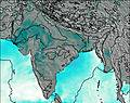
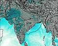
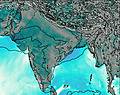
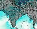
This table gives the weather forecast for Marion Island at the specific elevation of 1230 m. Our advanced weather models allow us to provide distinct weather forecasts for several elevations of Marion Island. To see the weather forecasts for the other elevations, use the tab navigation above the table. For a wider overview of the weather, consult the Weather Map of India.
| Weather Station | Temp. | Weather | Wind | Gusts | Cloud / Visibility |
|---|---|---|---|---|---|
ASCATB33E48S | |||||
ASCATB34E49S | |||||
ASCATB34E50S | |||||
ASCATB33E49S | |||||
ASCATB32E48S | |||||
ASCATB35E51S | |||||
ASCATB32E47S | |||||
ASCATB33E50S | |||||
ASCATB32E46S |
* NOTE: not all weather observatories update at the same frequency which is the reason why some locations may show data from stations that are further away than known closer ones.

