– Lat/Long: 66.75° N 64.97° W
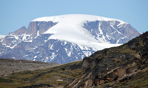
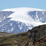
 Midnight Sun Peak
Weather Forecast, CanadaIssued: 1 pm Sun 02 Jun Local TimeUpdates in: hr min sUpdate imminent
Midnight Sun PeakWeather Forecast, Canada
Issued: 1 pm Sun 02 Jun Local Time
Updates in:
Update imminent hr min s

Issued: 1 pm Sun 02 Jun Local Time
Updates in:
Update imminent hr min s
Days 1–4 Weather SummaryA dusting of new snow. Temperatures will be below freezing (max -3°C on Mon morning, min -7°C on Sun night). Wind will be generally light. | Days 5–7 Weather SummaryA dusting of new snow. Temperatures will be below freezing (max -2°C on Sat morning, min -7°C on Wed night). Wind will be generally light. | Days 8–10 Weather SummaryMostly dry. Freeze-thaw conditions (max 7°C on Tue morning, min -7°C on Sat night). Wind will be generally light. | Days 11–13 Weather SummaryMostly dry. Very mild (max 12°C on Wed morning, min 7°C on Tue afternoon). Wind will be generally light. | |||||||||||||||||||||||||||||||||
Sun 2 | Monday 3 | Tuesday 4 | Wednesday 5 | Thursday 6 | Friday 7 | Saturday 8 | Sunday 9 | Monday 10 | Tuesday 11 | Wednesday 12 | Thursday 13 | Fri 14 | ||||||||||||||||||||||||
PM | night | AM | PM | night | AM | PM | night | AM | PM | night | AM | PM | night | AM | PM | night | AM | PM | night | AM | PM | night | AM | PM | night | AM | PM | night | AM | PM | night | AM | PM | night | AM | |
clear | clear | cloudy | cloudy | cloudy | light snow | cloudy | some clouds | cloudy | light snow | light snow | some clouds | cloudy | some clouds | cloudy | cloudy | some clouds | some clouds | cloudy | some clouds | some clouds | some clouds | clear | clear | clear | clear | some clouds | clear | some clouds | clear | rain shwrs | clear | rain shwrs | rain shwrs | rain shwrs | some clouds | |
km/h | ||||||||||||||||||||||||||||||||||||
Wave Height Map |  |  |  | 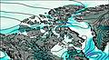 | 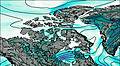 | 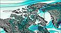 | 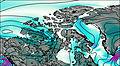 |  |  |  |  | 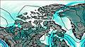 | 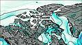 | |||||||||||||||||||||||
— | — | — | — | — | 1.0 | — | — | — | 2.0 | 2.0 | — | — | — | — | — | — | — | — | — | — | — | — | — | — | — | — | — | — | — | — | — | — | — | — | — | |
— | — | — | — | — | — | — | — | — | — | — | — | — | — | — | — | — | — | — | — | — | — | — | — | — | — | — | — | — | — | 0.2 | — | 0.1 | 0.3 | 0.1 | — | |
max°C | -5 | -5 | -3 | -3 | -5 | -5 | -4 | -4 | -4 | -4 | -5 | -5 | -3 | -3 | -4 | -4 | -4 | -2 | -2 | -4 | -4 | -2 | -2 | 0 | 2 | 4 | 7 | 8 | 11 | 12 | 12 | 12 | 12 | 12 | 11 | 10 |
min°C | -5 | -7 | -4 | -4 | -7 | -6 | -4 | -5 | -5 | -4 | -7 | -6 | -4 | -5 | -4 | -4 | -7 | -2 | -3 | -7 | -6 | -3 | -4 | -1 | 1 | 2 | 6 | 7 | 9 | 11 | 12 | 11 | 12 | 11 | 10 | 10 |
-5 | -7 | -7 | -7 | -11 | -10 | -6 | -5 | -9 | -8 | -12 | -11 | -7 | -5 | -4 | -7 | -11 | -2 | -6 | -10 | -6 | -5 | -7 | -1 | 1 | 0 | 5 | 6 | 8 | 11 | 12 | 11 | 12 | 10 | 9 | 9 | |
350 | 0 | 500 | 400 | 0 | 250 | 450 | 0 | 400 | 400 | 0 | 350 | 600 | 0 | 450 | 450 | 0 | 750 | 600 | 0 | 400 | 750 | 0 | 1050 | 1450 | 2850 | 3200 | 3300 | 3200 | 3250 | 3400 | 3400 | 3450 | 3400 | 3300 | 3050 | |
Cloud base (m) | 900 | 2850 | 1800 | 750 | 750 | 750 | 750 | 750 | 750 | 750 | 750 | 750 | 750 | 700 | 750 | 750 | 4750 | 700 | 750 | 750 | 700 | 750 | 750 | 8400 | 750 | 700 | 750 | 750 | 750 | 750 | 4750 | |||||
— | — | 12:00 | — | — | 12:00 | — | — | 12:00 | — | — | 12:00 | — | — | 12:00 | — | — | 12:00 | — | — | 12:00 | — | — | 12:00 | — | — | 12:00 | — | — | 12:00 | — | — | 12:00 | — | — | 12:00 | |
12:00 | — | 12:00 | — | — | 12:00 | — | — | 12:00 | — | — | 12:00 | — | — | 12:00 | — | — | 12:00 | — | — | 12:00 | — | — | 12:00 | — | — | 12:00 | — | — | 12:00 | — | — | 12:00 | — | — | — | |
Midnight Sun Peak Weather (Days 0-3):
The weather forecast for Midnight Sun Peak is: A dusting of new snow. Temperatures will be below freezing (max -3°C on Mon morning, min -7°C on Sun night). Wind will be generally light.
Midnight Sun Peak Weather (Days 3-6):
A dusting of new snow. Temperatures will be below freezing (max -2°C on Sat morning, min -7°C on Wed night). Wind will be generally light.
Midnight Sun Peak Weather (Days 6-9):
Mostly dry. Freeze-thaw conditions (max 7°C on Tue morning, min -7°C on Sat night). Wind will be generally light.
This table gives the weather forecast for Midnight Sun Peak at the specific elevation of 1000 m. Our advanced weather models allow us to provide distinct weather forecasts for several elevations of Midnight Sun Peak. To see the weather forecasts for the other elevations, use the tab navigation above the table. For a wider overview of the weather, consult the Weather Map of Nunavut.
| Weather Station | Temp. | Weather | Wind | Gusts | Cloud / Visibility |
|---|---|---|---|---|---|
Pangnirtung- NU | |||||
Pangnirtung Airport | |||||
Qikiqtarjuaq A- NU | |||||
Qikiqtarjuaq Climate- NU | |||||
Broughton Island Airport |
* NOTE: not all weather observatories update at the same frequency which is the reason why some locations may show data from stations that are further away than known closer ones.
 Like us
 Follow us
