– Lat/Long: 45.82° N 6.68° E
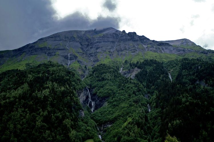
 Mont Joly
Weather Forecast, FranceIssued: 1 am Sun 12 May Local TimeUpdates in: hr min sUpdate imminent
Mont JolyWeather Forecast, France
Issued: 1 am Sun 12 May Local Time
Updates in:
Update imminent hr min s

Issued: 1 am Sun 12 May Local Time
Updates in:
Update imminent hr min s
Days 1–3 Weather SummaryModerate rain (total 19mm) heaviest on Sun night, then becoming colder with a dusting of snow on Tue night. Freeze-thaw conditions (max 6°C on Sun afternoon, min 0°C on Tue night). Wind will be generally light. | Days 4–6 Weather SummaryA heavy fall of snow, heaviest during Wed night. Freeze-thaw conditions (max 1°C on Wed afternoon, min -3°C on Thu night). Wind will be generally light. | |||||||||||||||||
Sunday 12 | Monday 13 | Tuesday 14 | Wednesday 15 | Thursday 16 | Friday 17 | |||||||||||||
AM | PM | night | AM | PM | night | AM | PM | night | AM | PM | night | AM | PM | night | AM | PM | night | |
rain shwrs | risk tstorm | rain shwrs | rain shwrs | risk tstorm | rain shwrs | cloudy | light rain | light snow | cloudy | light snow | mod. snow | light snow | mod. snow | mod. snow | some clouds | some clouds | snow shwrs | |
km/h | ||||||||||||||||||
Wave Height Map |  |  |  |  |  |  | ||||||||||||
— | — | — | — | — | — | — | — | 4 | — | 3 | 6 | 1.0 | 6 | 6 | — | — | 1.0 | |
0.1 | 4 | 7 | 0.7 | 4 | 1.4 | — | 2.0 | — | — | — | — | — | — | — | — | — | — | |
max°C | 5 | 6 | 3 | 4 | 5 | 4 | 3 | 3 | 2 | 0 | 1 | -1 | -1 | -1 | -2 | 0 | 1 | 1 |
min°C | 4 | 5 | 3 | 3 | 5 | 3 | 3 | 3 | 0 | 0 | 0 | -2 | -2 | -1 | -3 | -1 | 1 | 1 |
4 | 3 | 2 | 1 | 3 | 0 | 1 | 0 | -2 | -3 | 0 | -4 | -4 | -1 | -6 | -1 | -1 | 1 | |
3200 | 3250 | 3050 | 3000 | 3100 | 3100 | 2950 | 2950 | 2600 | 2550 | 2550 | 2300 | 2400 | 2300 | 2100 | 2500 | 2700 | 2650 | |
Cloud base (m) | 3050 | 2750 | 2200 | 3500 | 3150 | 2550 | 2300 | 2050 | 2050 | 2050 | 2050 | 2100 | 2050 | 2050 | 2200 | 2800 | 2700 | |
6:03 | — | — | 6:03 | — | — | 6:01 | — | — | 6:01 | — | — | 6:00 | — | — | 5:58 | — | — | |
— | — | 8:54 | — | — | 8:55 | — | — | 8:57 | — | — | 8:58 | — | — | 8:59 | — | — | 9:00 | |
Mont Joly Weather (Days 0-3):
The weather forecast for Mont Joly is: Moderate rain (total 19mm) heaviest on Sun night, then becoming colder with a dusting of snow on Tue night. Freeze-thaw conditions (max 6°C on Sun afternoon, min 0°C on Tue night). Wind will be generally light.
Mont Joly Weather (Days 3-6):
A heavy fall of snow, heaviest during Wed night. Freeze-thaw conditions (max 1°C on Wed afternoon, min -3°C on Thu night). Wind will be generally light.
This table gives the weather forecast for Mont Joly at the specific elevation of 2525 m. Our advanced weather models allow us to provide distinct weather forecasts for several elevations of Mont Joly. To see the weather forecasts for the other elevations, use the tab navigation above the table. For a wider overview of the weather, consult the Weather Map of France.
Mont Joly Photos
View all
Savoy Alps photos (118) |
Alps photos (1434) |
photos from mountains in France (267) |
all photos
 Upload new photo
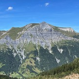

Mont Joly
Mont Joly
 Like us
 Follow us
