
– Lat/Long: 49.58° S 69.50° E
 Mont Ross
Weather Forecast, French Southern and Antarctic LandsIssued: 10 pm Sun 05 May Local TimeUpdates in: hr min sUpdate imminent
Mont RossWeather Forecast, French Southern and Antarctic Lands
Issued: 10 pm Sun 05 May Local Time
Updates in:
Update imminent hr min s

Issued: 10 pm Sun 05 May Local Time
Updates in:
Update imminent hr min s
Days 1–4 Weather SummaryLight rain (total 5mm) at first, then becoming colder with a dusting of snow on Tue afternoon. Freeze-thaw conditions (max 5°C on Mon night, min -3°C on Tue night). Winds increasing (light winds from the NNW on Sun night, stormy winds from the W by Tue morning). | Days 5–7 Weather SummaryA light covering of new snow mostly falling on Fri morning. Freeze-thaw conditions (max 4°C on Thu night, min -5°C on Fri night). Winds increasing (light winds from the W on Thu morning, stormy winds from the WNW by Thu night). | Days 8–10 Weather SummaryHeavy rain (total 39mm), mostly on Sun morning. Becoming colder with a light covering of snow, mostly falling on Tue afternoon. Freeze-thaw conditions (max 9°C on Sun morning, min -6°C on Tue afternoon). Winds increasing (near gales from the W on Sat night, extremely windy from the WSW by Tue morning). | Days 11–13 Weather SummaryA moderate fall of snow, heaviest on Tue night. Temperatures will be below freezing (max -2°C on Thu night, min -8°C on Tue night). Winds increasing (light winds from the NNE on Wed night, severe gales from the WSW by Fri night). | |||||||||||||||||||||||||||||||||
Monday 6 | Tuesday 7 | Wednesday 8 | Thursday 9 | Friday 10 | Saturday 11 | Sunday 12 | Monday 13 | Tuesday 14 | Wednesday 15 | Thursday 16 | Fri 17 | |||||||||||||||||||||||||
night | AM | PM | night | AM | PM | night | AM | PM | night | AM | PM | night | AM | PM | night | AM | PM | night | AM | PM | night | AM | PM | night | AM | PM | night | AM | PM | night | AM | PM | night | AM | PM | |
some clouds | some clouds | clear | light rain | light rain | snow shwrs | clear | clear | clear | some clouds | cloudy | some clouds | some clouds | light snow | snow shwrs | clear | clear | some clouds | snow shwrs | heavy rain | mod. rain | mod. rain | rain shwrs | some clouds | light snow | light snow | snow shwrs | snow shwrs | snow shwrs | light snow | cloudy | cloudy | cloudy | snow shwrs | light snow | snow shwrs | |
km/h | ||||||||||||||||||||||||||||||||||||
Wave Height Map | 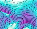 | 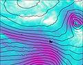 | 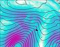 | 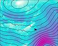 | 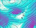 | 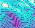 | 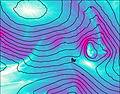 | 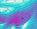 | 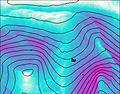 | 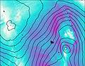 | 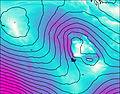 | 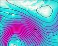 |  | |||||||||||||||||||||||
— | — | — | — | — | 1.0 | — | — | — | — | — | — | — | 2.0 | 3 | — | — | — | 1.0 | — | — | — | — | — | 1.0 | 2.0 | 3 | 4 | 2.0 | 1.0 | — | — | — | 1.0 | 2.0 | 2.0 | |
— | — | — | 1.5 | 3 | — | — | — | — | — | — | — | — | — | — | — | — | — | 9 | 14 | 7 | 8 | 1.0 | — | — | — | — | — | — | — | — | — | — | — | — | — | |
max°C | 0 | -1 | 1 | 5 | 5 | 0 | -1 | -2 | -1 | 0 | -1 | 0 | 4 | 1 | -1 | -3 | -3 | -2 | 6 | 9 | 8 | 9 | 4 | -1 | -2 | -4 | -6 | -7 | -7 | -7 | -4 | -3 | -3 | -2 | -4 | -5 |
min°C | -1 | -1 | -1 | 3 | 3 | -1 | -3 | -2 | -2 | -1 | -1 | -1 | 0 | 0 | -3 | -5 | -4 | -3 | -1 | 8 | 8 | 6 | 1 | -1 | -4 | -5 | -6 | -8 | -8 | -7 | -6 | -4 | -3 | -4 | -5 | -6 |
-7 | -11 | -10 | -3 | -6 | -12 | -14 | -12 | -12 | -6 | -5 | -9 | -8 | -10 | -14 | -17 | -16 | -14 | -10 | 1 | 1 | -2 | -9 | -12 | -15 | -19 | -19 | -21 | -20 | -19 | -15 | -10 | -10 | -12 | -17 | -18 | |
800 | 850 | 1450 | 2300 | 1650 | 800 | 650 | 600 | 750 | 1000 | 850 | 900 | 1650 | 1050 | 650 | 500 | 550 | 650 | 1500 | 2900 | 2750 | 2550 | 1100 | 800 | 550 | 300 | 250 | 150 | 150 | 250 | 350 | 500 | 600 | 550 | 300 | 350 | |
Cloud base (m) | 250 | 200 | 250 | 400 | 150 | 200 | 200 | 250 | 250 | 200 | 350 | 200 | 1500 | 200 | 200 | 300 | 250 | 250 | 800 | 200 | 200 | 150 | 150 | 150 | 250 | 100 | 150 | 250 | 550 | 400 | 300 | 200 | 200 | 200 | 200 | 200 |
— | 7:35 | — | — | 7:37 | — | — | 7:37 | — | — | 7:39 | — | — | 7:41 | — | — | 7:41 | — | — | 7:43 | — | — | 7:45 | — | — | 7:46 | — | — | 7:48 | — | — | 7:48 | — | — | 7:50 | — | |
— | — | 5:00 | — | — | 4:59 | — | — | 4:57 | — | — | 4:55 | — | — | 4:53 | — | — | 4:52 | — | — | 4:52 | — | — | 4:50 | — | — | 4:49 | — | — | 4:47 | — | — | 4:45 | — | — | 4:45 | |
Mont Ross Weather (Days 0-3):
The weather forecast for Mont Ross is: Light rain (total 5mm) at first, then becoming colder with a dusting of snow on Tue afternoon. Freeze-thaw conditions (max 5°C on Mon night, min -3°C on Tue night). Winds increasing (light winds from the NNW on Sun night, stormy winds from the W by Tue morning).
Mont Ross Weather (Days 3-6):
A light covering of new snow mostly falling on Fri morning. Freeze-thaw conditions (max 4°C on Thu night, min -5°C on Fri night). Winds increasing (light winds from the W on Thu morning, stormy winds from the WNW by Thu night).
Mont Ross Weather (Days 6-9):
Heavy rain (total 39mm), mostly on Sun morning. Becoming colder with a light covering of snow, mostly falling on Tue afternoon. Freeze-thaw conditions (max 9°C on Sun morning, min -6°C on Tue afternoon). Winds increasing (near gales from the W on Sat night, extremely windy from the WSW by Tue morning).
This table gives the weather forecast for Mont Ross at the specific elevation of 1000 m. Our advanced weather models allow us to provide distinct weather forecasts for several elevations of Mont Ross. To see the weather forecasts for the other elevations, use the tab navigation above the table. For a wider overview of the weather, consult the Weather Map of French Southern and Antarctic Lands.
 Like us
 Follow us
