
– Lat/Long: 41.22° S 173.50° E
 Mount Duppa
Weather Forecast, New ZealandIssued: 11 pm Mon 20 May Local TimeUpdates in: hr min sUpdate imminent
Mount DuppaWeather Forecast, New Zealand
Issued: 11 pm Mon 20 May Local Time
Updates in:
Update imminent hr min s

Issued: 11 pm Mon 20 May Local Time
Updates in:
Update imminent hr min s
Days 1–4 Weather SummaryModerate rain (total 14mm), heaviest on Tue morning. Mild temperatures (max 6°C on Mon night, min 2°C on Wed night). Winds decreasing (severe gales from the SE on Tue afternoon, light winds from the SSE by Thu morning). | Days 5–7 Weather SummarySome drizzle, heaviest during Sat afternoon. Temperatures will be slightly above freezing (max 4°C on Fri morning, min 2°C on Fri night). Winds increasing (calm on Fri morning, fresh winds from the WSW by Sat night). | Days 8–10 Weather SummaryDrizzle at first, then turning colder with dusting of snow on Tue afternoon. Freeze-thaw conditions (max 5°C on Wed afternoon, min -1°C on Tue night). Winds increasing (calm on Mon morning, fresh winds from the WSW by Tue morning). | Days 11–13 Weather SummaryLight rain (total 3mm), mostly falling on Sat afternoon. Mild temperatures (max 6°C on Thu afternoon, min 1°C on Sat night). Winds decreasing (near gales from the WSW on Fri night, light winds from the SE by Sat morning). | |||||||||||||||||||||||||||||||||
Tuesday 21 | Wednesday 22 | Thursday 23 | Friday 24 | Saturday 25 | Sunday 26 | Monday 27 | Tuesday 28 | Wednesday 29 | Thursday 30 | Friday 31 | Sat 1 | |||||||||||||||||||||||||
night | AM | PM | night | AM | PM | night | AM | PM | night | AM | PM | night | AM | PM | night | AM | PM | night | AM | PM | night | AM | PM | night | AM | PM | night | AM | PM | night | AM | PM | night | AM | PM | |
light rain | mod. rain | light rain | cloudy | some clouds | light rain | cloudy | some clouds | some clouds | some clouds | clear | some clouds | some clouds | cloudy | light rain | clear | cloudy | light rain | light rain | light rain | light rain | clear | light rain | snow shwrs | clear | some clouds | clear | some clouds | clear | clear | clear | clear | clear | some clouds | light rain | light rain | |
km/h | ||||||||||||||||||||||||||||||||||||
Wave Height Map |  |  |  |  |  |  |  | 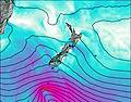 | 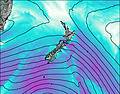 | 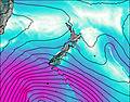 | 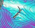 | 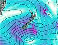 | 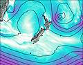 | |||||||||||||||||||||||
— | — | — | — | — | — | — | — | — | — | — | — | — | — | — | — | — | — | — | — | — | — | — | 2.0 | — | — | — | — | — | — | — | — | — | — | — | — | |
0.2 | 10 | 4 | — | — | 0.1 | — | — | — | — | — | — | — | — | 0.9 | — | — | 0.2 | 0.7 | 0.1 | 0.1 | — | 0.3 | — | — | — | — | — | — | — | — | — | — | — | 0.8 | 2 | |
max°C | 6 | 5 | 5 | 4 | 3 | 3 | 3 | 3 | 3 | 3 | 4 | 4 | 3 | 3 | 3 | 4 | 2 | 3 | 2 | 2 | 2 | 4 | 4 | 1 | 1 | 4 | 5 | 4 | 5 | 6 | 6 | 6 | 5 | 6 | 5 | 3 |
min°C | 5 | 5 | 4 | 4 | 3 | 3 | 2 | 2 | 3 | 3 | 3 | 3 | 2 | 2 | 2 | 3 | 2 | 3 | 2 | 2 | 2 | 2 | 3 | 1 | -1 | 2 | 4 | 3 | 3 | 5 | 5 | 6 | 4 | 4 | 4 | 2 |
0 | -2 | -4 | -4 | -4 | -2 | -2 | 0 | 1 | 1 | 3 | 0 | -1 | -1 | -2 | -2 | -2 | -2 | -1 | 0 | 0 | -4 | 0 | -4 | -6 | -1 | 0 | 0 | 0 | 2 | 3 | 2 | -2 | -3 | 2 | -4 | |
2350 | 2050 | 2150 | 2000 | 1700 | 1650 | 1600 | 1650 | 1550 | 1850 | 1900 | 1850 | 1800 | 1550 | 1600 | 2050 | 1650 | 1750 | 1650 | 1500 | 1500 | 1750 | 1850 | 1250 | 1100 | 1900 | 2300 | 2200 | 1950 | 2350 | 2400 | 2450 | 2100 | 2550 | 2100 | 1700 | |
Cloud base (m) | 700 | 300 | 250 | 500 | 850 | 2100 | 2250 | 850 | 1900 | 9200 | 1650 | 750 | 650 | 300 | 400 | 2000 | 400 | 300 | 600 | 700 | 600 | 700 | 350 | 8050 | 7000 | 6500 | 600 | 350 | ||||||||
— | 7:31 | — | — | 7:33 | — | — | 7:33 | — | — | 7:35 | — | — | 7:35 | — | — | 7:37 | — | — | 7:37 | — | — | 7:37 | — | — | 7:39 | — | — | 7:39 | — | — | 7:41 | — | — | 7:41 | — | |
— | — | 5:12 | — | — | 5:10 | — | — | 5:09 | — | — | 5:08 | — | — | 5:08 | — | — | 5:07 | — | — | 5:07 | — | — | 5:07 | — | — | 5:06 | — | — | 5:06 | — | — | 5:05 | — | — | 5:05 | |
Mount Duppa Weather (Days 0-3):
The weather forecast for Mount Duppa is: Moderate rain (total 14mm), heaviest on Tue morning. Mild temperatures (max 6°C on Mon night, min 2°C on Wed night). Winds decreasing (severe gales from the SE on Tue afternoon, light winds from the SSE by Thu morning).
Mount Duppa Weather (Days 3-6):
Some drizzle, heaviest during Sat afternoon. Temperatures will be slightly above freezing (max 4°C on Fri morning, min 2°C on Fri night). Winds increasing (calm on Fri morning, fresh winds from the WSW by Sat night).
Mount Duppa Weather (Days 6-9):
Drizzle at first, then turning colder with dusting of snow on Tue afternoon. Freeze-thaw conditions (max 5°C on Wed afternoon, min -1°C on Tue night). Winds increasing (calm on Mon morning, fresh winds from the WSW by Tue morning).
This table gives the weather forecast for Mount Duppa at the specific elevation of 1143 m. Our advanced weather models allow us to provide distinct weather forecasts for several elevations of Mount Duppa. To see the weather forecasts for the other elevations, use the tab navigation above the table. For a wider overview of the weather, consult the Weather Map of New Zealand.
 Like us
 Follow us
