
– Lat/Long: 36.35° S 148.35° E
 Mount Tate (New South Wales)
Weather Forecast, AustraliaIssued: 9 pm Wed 08 May Local TimeUpdates in: hr min sUpdate imminent
Mount Tate (New South Wales)Weather Forecast, Australia
Issued: 9 pm Wed 08 May Local Time
Updates in:
Update imminent hr min s

Issued: 9 pm Wed 08 May Local Time
Updates in:
Update imminent hr min s
Days 1–4 Weather SummaryLight rain (total 6mm) at first, then becoming colder with a dusting of snow on Fri night. Mild temperatures (max 5°C on Thu morning, min 1°C on Fri night). Winds increasing (calm on Wed night, fresh winds from the ESE by Sat afternoon). | Days 5–7 Weather SummaryLight rain (total 3mm), mostly falling on Sat night. Mild temperatures (max 6°C on Mon morning, min 2°C on Sun morning). Wind will be generally light. | ||||||||||||||||||
Thursday 9 | Friday 10 | Saturday 11 | Sunday 12 | Monday 13 | Tuesday 14 | ||||||||||||||
night | AM | PM | night | AM | PM | night | AM | PM | night | AM | PM | night | AM | PM | night | AM | PM | night | |
some clouds | rain shwrs | rain shwrs | some clouds | light rain | light rain | light snow | light rain | light rain | light rain | rain shwrs | rain shwrs | clear | clear | some clouds | some clouds | some clouds | clear | clear | |
km/h | |||||||||||||||||||
Wave Height Map | 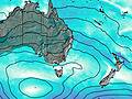 | 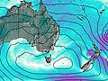 | 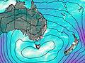 | 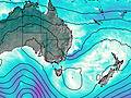 | 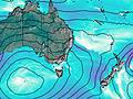 | 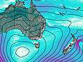 | 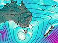 | ||||||||||||
— | — | — | — | — | — | 1.0 | — | — | — | — | — | — | — | — | — | — | — | — | |
— | 0.4 | 2 | — | 1.0 | 0.8 | — | 0.8 | 0.8 | 2 | 0.1 | 0.3 | — | — | — | — | — | — | — | |
max°C | 3 | 5 | 4 | 3 | 3 | 3 | 2 | 2 | 2 | 3 | 4 | 4 | 4 | 6 | 6 | 5 | 6 | 6 | 5 |
min°C | 3 | 4 | 4 | 3 | 3 | 3 | 1 | 2 | 2 | 3 | 2 | 4 | 4 | 5 | 5 | 5 | 5 | 4 | 4 |
1 | 3 | 3 | 0 | 0 | -1 | -5 | -4 | -4 | -2 | 2 | 4 | 4 | 3 | 3 | 2 | 2 | 0 | 0 | |
2550 | 2550 | 2650 | 2550 | 2550 | 2500 | 2300 | 2550 | 2500 | 2650 | 2550 | 2700 | 2700 | 2800 | 2850 | 3000 | 3000 | 3000 | 3000 | |
Cloud base (m) | 2500 | 2500 | 2500 | 2550 | 2800 | 1600 | 900 | 900 | 850 | 850 | 950 | 2200 | 2600 | 2500 | 2550 | 6900 | 2550 | 2350 | |
— | 6:50 | — | — | 6:52 | — | — | 6:52 | — | — | 6:54 | — | — | 6:54 | — | — | 6:56 | — | — | |
— | — | 5:13 | — | — | 5:12 | — | — | 5:10 | — | — | 5:10 | — | — | 5:09 | — | — | 5:08 | — | |
Mount Tate (New South Wales) Weather (Days 0-3):
The weather forecast for Mount Tate (New South Wales) is: Light rain (total 6mm) at first, then becoming colder with a dusting of snow on Fri night. Mild temperatures (max 5°C on Thu morning, min 1°C on Fri night). Winds increasing (calm on Wed night, fresh winds from the ESE by Sat afternoon).
Mount Tate (New South Wales) Weather (Days 3-6):
Light rain (total 3mm), mostly falling on Sat night. Mild temperatures (max 6°C on Mon morning, min 2°C on Sun morning). Wind will be generally light.
This table gives the weather forecast for Mount Tate (New South Wales) at the specific elevation of 2069 m. Our advanced weather models allow us to provide distinct weather forecasts for several elevations of Mount Tate (New South Wales). To see the weather forecasts for the other elevations, use the tab navigation above the table. For a wider overview of the weather, consult the Weather Map of New-South-Wales.
 Like us
 Follow us
