– Lat/Long: 53.10° N 6.41° W
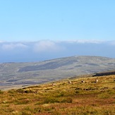
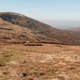
 Mullaghcleevaun
Weather Forecast, IrelandIssued: 11 am Sat 22 Feb Local TimeUpdates in: hr min sUpdate imminent
Mullaghcleevaun Weather Forecast, Ireland
Issued: 11 am Sat 22 Feb Local Time
Updates in:
Update imminent hr min s

Issued: 11 am Sat 22 Feb Local Time
Updates in:
Update imminent hr min s
Days 1–3 Weather SummaryModerate rain (total 17mm) heaviest on Sun morning, then becoming colder with a dusting of snow on Mon afternoon. Freeze-thaw conditions (max 7°C on Sun morning, min 0°C on Mon night). Winds increasing (moderate winds from the WSW on Sat afternoon, stormy winds from the SW by Sun morning). | Days 4–6 Weather SummaryA dusting of new snow. Freeze-thaw conditions (max 2°C on Wed morning, min -1°C on Tue night). Winds decreasing (strong winds from the WSW on Wed morning, calm by Wed night). | Days 7–9 Weather SummaryLight rain (total 7mm), mostly falling on Fri night. Mild temperatures (max 9°C on Sun morning, min 1°C on Sat morning). Winds increasing (moderate winds from the WSW on Sat night, near gales from the WSW by Sun afternoon). | Days 10–12 Weather SummaryA dusting of new snow. Freeze-thaw conditions (max 9°C on Wed morning, min 0°C on Mon morning). Winds increasing (fresh winds from the W on Mon morning, gales from the W by Mon night). | |||||||||||||||||||||||||||||||||
Saturday 22 | Sunday 23 | Monday 24 | Tuesday 25 | Wednesday 26 | Thursday 27 | Friday 28 | Saturday 1 | Sunday 2 | Monday 3 | Tuesday 4 | Wednesday 5 | |||||||||||||||||||||||||
AM | PM | night | AM | PM | night | AM | PM | night | AM | PM | night | AM | PM | night | AM | PM | night | AM | PM | night | AM | PM | night | AM | PM | night | AM | PM | night | AM | PM | night | AM | PM | night | |
clear | rain shwrs | rain shwrs | heavy rain | light rain | rain shwrs | some clouds | snow shwrs | some clouds | some clouds | clear | some clouds | light rain | snow shwrs | some clouds | cloudy | cloudy | light rain | light rain | light rain | light rain | clear | rain shwrs | some clouds | some clouds | some clouds | light rain | some clouds | some clouds | light rain | cloudy | rain shwrs | some clouds | clear | clear | snow shwrs | |
km/h | ||||||||||||||||||||||||||||||||||||
 |  |  |  |  |  |  |  |  |  |  |  | |||||||||||||||||||||||||
— | — | — | — | — | — | — | 1.0 | — | — | — | — | — | 1.0 | — | — | — | — | — | — | — | — | — | — | — | — | — | — | — | — | — | — | — | — | — | 1.0 | |
— | 0.1 | 0.6 | 13 | 3 | 0.1 | — | 0.2 | — | — | — | — | 0.3 | — | — | — | — | 0.5 | 0.7 | 0.8 | 4 | — | 0.1 | — | — | — | 1.4 | — | — | 0.2 | — | 0.3 | — | — | — | — | |
max°C | 3 | 4 | 5 | 7 | 5 | 4 | 3 | 3 | 1 | 1 | 1 | 0 | 2 | 1 | -1 | 1 | 1 | 2 | 3 | 4 | 4 | 2 | 2 | 4 | 9 | 9 | 7 | 1 | 1 | 3 | 5 | 4 | 7 | 9 | 9 | 8 |
min°C | 3 | 3 | 3 | 7 | 4 | 2 | 2 | 2 | 0 | 0 | 0 | -1 | 1 | 0 | -1 | -1 | 1 | 1 | 2 | 4 | 2 | 1 | 2 | 1 | 6 | 7 | 1 | 0 | 1 | 1 | 3 | 3 | 3 | 9 | 8 | 0 |
-3 | -2 | -3 | 0 | -4 | -5 | -5 | -4 | -7 | -7 | -6 | -7 | -6 | -7 | -7 | -1 | -3 | -3 | -4 | -2 | -4 | -6 | -4 | -4 | 1 | 2 | -6 | -7 | -7 | -8 | -4 | -4 | -4 | 5 | 3 | -8 | |
1300 | 1300 | 1600 | 2400 | 1750 | 1400 | 1200 | 1200 | 850 | 850 | 1000 | 650 | 1000 | 1050 | 600 | 750 | 1050 | 1100 | 1250 | 1600 | 1500 | 1050 | 1100 | 1100 | 2700 | 3050 | 2000 | 900 | 1000 | 1050 | 1300 | 1400 | 2800 | 2950 | 2800 | 2700 | |
Cloud base (m) | 500 | 650 | 750 | 200 | 200 | 400 | 1450 | 700 | 450 | 250 | 850 | 750 | 450 | 250 | 300 | 5950 | 550 | 450 | 250 | 250 | 350 | 300 | 650 | 700 | 250 | 550 | 500 | 450 | 350 | 550 | 600 | 300 | 400 | 300 | ||
7:28 | — | — | 7:26 | — | — | 7:24 | — | — | 7:22 | — | — | 7:18 | — | — | 7:16 | — | — | 7:15 | — | — | 7:13 | — | — | 7:09 | — | — | 7:07 | — | — | 7:05 | — | — | 7:03 | — | — | |
— | 5:50 | — | — | 5:52 | — | — | 5:53 | — | — | 5:55 | — | — | 5:58 | — | — | 5:59 | — | — | 6:00 | — | — | 6:02 | — | — | 6:05 | — | — | 6:07 | — | — | 6:08 | — | — | 6:10 | — | |
Mullaghcleevaun Weather (Days 0-3):
The weather forecast for Mullaghcleevaun is: Moderate rain (total 17mm) heaviest on Sun morning, then becoming colder with a dusting of snow on Mon afternoon. Freeze-thaw conditions (max 7°C on Sun morning, min 0°C on Mon night). Winds increasing (moderate winds from the WSW on Sat afternoon, stormy winds from the SW by Sun morning).
Mullaghcleevaun Weather (Days 3-6):
A dusting of new snow. Freeze-thaw conditions (max 2°C on Wed morning, min -1°C on Tue night). Winds decreasing (strong winds from the WSW on Wed morning, calm by Wed night).
Mullaghcleevaun Weather (Days 6-9):
Light rain (total 7mm), mostly falling on Fri night. Mild temperatures (max 9°C on Sun morning, min 1°C on Sat morning). Winds increasing (moderate winds from the WSW on Sat night, near gales from the WSW by Sun afternoon).
This table gives the weather forecast for Mullaghcleevaun at the specific elevation of 849 m. Our advanced weather models allow us to provide distinct weather forecasts for several elevations of Mullaghcleevaun. To see the weather forecasts for the other elevations, use the tab navigation above the table. For a wider overview of the weather, consult the Weather Map of Ireland.
| Weather Station | Temp. | Weather | Wind | Gusts | Cloud / Visibility |
|---|---|---|---|---|---|
Casement Air Base | |||||
SHIP1933 | |||||
SHIP264 | |||||
SHIP5596 |
* NOTE: not all weather observatories update at the same frequency which is the reason why some locations may show data from stations that are further away than known closer ones.
Mullaghcleevaun Photos
View all
Wicklow Mountains photos (57) |
Ireland Ranges photos (358) |
photos from mountains in Ireland (408) |
all photos
 Upload new photo
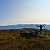
Hail the mountains
Summit by Julie Gribben
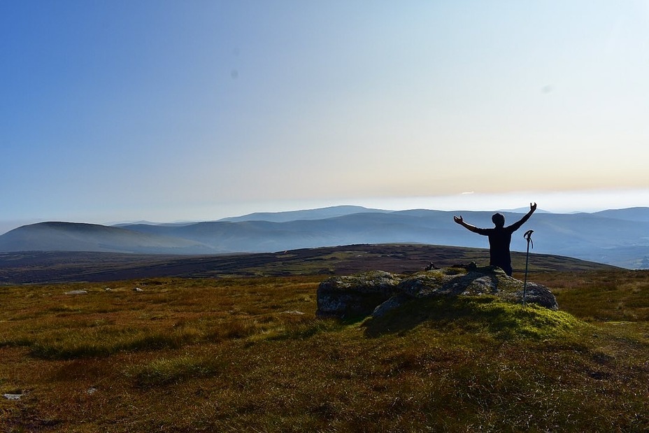
Silhouettes by Julie Gribben
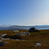
Looking east
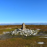
Mullaghcleevaun

