– Lat/Long: 64.00° N 16.65° W
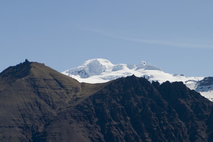
 Öræfajökull
Weather Forecast, IcelandIssued: 5 pm Thu 31 Oct Local TimeUpdates in: hr min sUpdate imminent
ÖræfajökullWeather Forecast, Iceland
Issued: 5 pm Thu 31 Oct Local Time
Updates in:
Update imminent hr min s

Issued: 5 pm Thu 31 Oct Local Time
Updates in:
Update imminent hr min s
Days 1–4 Weather SummaryA light covering of new snow mostly falling on Sat night. Freeze-thaw conditions (max 2°C on Sat night, min -16°C on Thu afternoon). Winds decreasing (near gales from the W on Thu afternoon, moderate winds from the WSW by Fri afternoon). | Days 5–7 Weather SummaryA heavy fall of snow, heaviest during Wed morning. Freeze-thaw conditions (max 1°C on Sun afternoon, min -5°C on Wed morning). Winds increasing (fresh winds from the S on Mon night, near gales from the SSE by Tue night). | Days 8–10 Weather SummaryA heavy fall of snow, heaviest during Thu morning. Freeze-thaw conditions (max 1°C on Thu morning, min -9°C on Thu afternoon). Winds decreasing (severe gales from the SW on Thu afternoon, light winds from the S by Sat morning). | Days 11–13 Weather SummaryA moderate fall of snow, heaviest on Mon afternoon. Temperatures will be below freezing (max 0°C on Mon morning, min -5°C on Tue afternoon). Winds increasing (calm on Sat night, gales from the SE by Mon afternoon). | |||||||||||||||||||||||||||||||||
Thu 31 | Friday 1 | Saturday 2 | Sunday 3 | Monday 4 | Tuesday 5 | Wednesday 6 | Thursday 7 | Friday 8 | Saturday 9 | Sunday 10 | Monday 11 | Tue 12 | ||||||||||||||||||||||||
PM | night | AM | PM | night | AM | PM | night | AM | PM | night | AM | PM | night | AM | PM | night | AM | PM | night | AM | PM | night | AM | PM | night | AM | PM | night | AM | PM | night | AM | PM | night | AM | |
clear | clear | cloudy | clear | snow shwrs | some clouds | cloudy | light snow | light snow | cloudy | light snow | light snow | light snow | some clouds | some clouds | mod. snow | heavy snow | heavy snow | light snow | snow shwrs | heavy snow | light snow | snow shwrs | clear | cloudy | some clouds | some clouds | some clouds | some clouds | cloudy | cloudy | cloudy | cloudy | heavy snow | snow shwrs | some clouds | |
km/h | ||||||||||||||||||||||||||||||||||||
 |  |  |  |  |  |  |  |  |  |  |  |  | ||||||||||||||||||||||||
— | — | — | — | 2.0 | — | — | 4 | 3 | — | 1.0 | 2.0 | 1.0 | — | — | 6 | 25 | 15 | 2.0 | 10 | 16 | 4 | 6 | — | — | — | — | — | — | — | — | — | — | 14 | 2.0 | — | |
— | — | — | — | — | — | — | — | — | — | — | — | — | — | — | — | — | — | — | — | — | — | — | — | — | — | — | — | — | — | — | — | — | — | — | — | |
max°C | -15 | -11 | -8 | -6 | -4 | 0 | 1 | 2 | 2 | 1 | 1 | 1 | 1 | 1 | 0 | 1 | 1 | -2 | -7 | -1 | 1 | -7 | -8 | -5 | -5 | -1 | -1 | -2 | -2 | -3 | -3 | -2 | 0 | 0 | -1 | -4 |
min°C | -16 | -15 | -9 | -7 | -8 | -1 | 0 | 1 | 2 | 1 | 0 | 0 | 1 | 0 | -1 | 1 | 0 | -5 | -7 | -5 | -5 | -9 | -9 | -6 | -5 | -5 | -1 | -2 | -2 | -3 | -4 | -3 | -1 | -1 | -3 | -4 |
-31 | -27 | -19 | -15 | -18 | -10 | -8 | -6 | -5 | -7 | -8 | -8 | -6 | -7 | -9 | -7 | -8 | -15 | -20 | -16 | -17 | -22 | -22 | -16 | -13 | -11 | -4 | -7 | -4 | -7 | -9 | -10 | -9 | -8 | -9 | -11 | |
50 | 0 | 0 | 0 | 0 | 1800 | 2100 | 2400 | 2500 | 2350 | 2200 | 2300 | 2200 | 2250 | 2050 | 2250 | 2400 | 1600 | 950 | 1100 | 2200 | 850 | 600 | 550 | 700 | 950 | 1250 | 1100 | 1250 | 1200 | 1100 | 1550 | 1800 | 2150 | 1700 | 1300 | |
Cloud base (m) | 750 | 5750 | 650 | 500 | 450 | 450 | 450 | 500 | 450 | 450 | 450 | 500 | 500 | 450 | 450 | 450 | 450 | 500 | 400 | 450 | 450 | 500 | 5600 | 5900 | 1500 | 850 | 700 | 450 | 450 | 450 | 450 | 600 | ||||
— | — | 8:51 | — | — | 8:55 | — | — | 8:57 | — | — | 9:00 | — | — | 9:03 | — | — | 9:07 | — | — | 9:11 | — | — | 9:14 | — | — | 9:17 | — | — | 9:19 | — | — | 9:23 | — | — | 9:26 | |
4:50 | — | — | 4:46 | — | — | 4:44 | — | — | 4:40 | — | — | 4:37 | — | — | 4:34 | — | — | 4:30 | — | — | 4:28 | — | — | 4:24 | — | — | 4:22 | — | — | 4:19 | — | — | 4:15 | — | — | |
Öræfajökull Weather (Days 0-3):
The weather forecast for Öræfajökull is: A light covering of new snow mostly falling on Sat night. Freeze-thaw conditions (max 2°C on Sat night, min -16°C on Thu afternoon). Winds decreasing (near gales from the W on Thu afternoon, moderate winds from the WSW by Fri afternoon).
Öræfajökull Weather (Days 3-6):
A heavy fall of snow, heaviest during Wed morning. Freeze-thaw conditions (max 1°C on Sun afternoon, min -5°C on Wed morning). Winds increasing (fresh winds from the S on Mon night, near gales from the SSE by Tue night).
Öræfajökull Weather (Days 6-9):
A heavy fall of snow, heaviest during Thu morning. Freeze-thaw conditions (max 1°C on Thu morning, min -9°C on Thu afternoon). Winds decreasing (severe gales from the SW on Thu afternoon, light winds from the S by Sat morning).
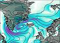
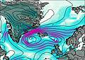
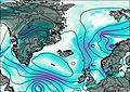
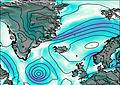
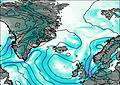
This table gives the weather forecast for Öræfajökull at the specific elevation of 2110 m. Our advanced weather models allow us to provide distinct weather forecasts for several elevations of Öræfajökull. To see the weather forecasts for the other elevations, use the tab navigation above the table. For a wider overview of the weather, consult the Weather Map of Iceland.
Öræfajökull Photos
View all
Iceland photos (2) |
Atlantic Islands photos (70) |
photos from mountains in Iceland (22) |
all photos
 Upload new photo
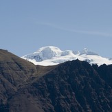
Öræfajökull

