
– Lat/Long: 45.80° N 110.90° W
 Saddle Peak-MT
Weather Forecast, United StatesIssued: 11 pm Sun 19 May Local TimeUpdates in: hr min sUpdate imminent
Saddle Peak-MTWeather Forecast, United States
Issued: 11 pm Sun 19 May Local Time
Updates in:
Update imminent hr min s

Issued: 11 pm Sun 19 May Local Time
Updates in:
Update imminent hr min s
Days 1–4 Weather SummaryA dusting of snow turning to light rain (total 6mm) on Wed afternoon. Freeze-thaw conditions (max 7°C on Tue afternoon, min 0°C on Sun night). Wind will be generally light. | Days 5–7 Weather SummaryModerate rain (total 10mm) on Wed night. Becoming colder with heavy fall of snow, heaviest during Wed night. Freeze-thaw conditions (max 9°C on Fri afternoon, min -2°C on Wed night). Winds increasing (light winds from the W on Thu night, fresh winds from the SSW by Fri night). | ||||||||||||||||||
Monday 20 | Tuesday 21 | Wednesday 22 | Thursday 23 | Friday 24 | Saturday 25 | ||||||||||||||
night | AM | PM | night | AM | PM | night | AM | PM | night | AM | PM | night | AM | PM | night | AM | PM | night | |
some clouds | cloudy | light snow | light snow | rain shwrs | rain shwrs | rain shwrs | light rain | rain shwrs | mod. snow | light snow | some clouds | some clouds | clear | light rain | rain shwrs | light snow | light snow | light snow | |
km/h | |||||||||||||||||||
Wave Height Map | 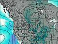 | 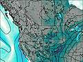 | 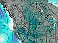 | 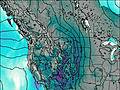 |  |  |  | ||||||||||||
— | — | 1.0 | 2.0 | — | — | — | — | — | 10 | 4 | — | — | — | — | — | 4 | 2.0 | 4 | |
— | — | 1.2 | — | 0.3 | 0.3 | 0.3 | 1.1 | 2 | 10 | — | — | — | — | 0.2 | 0.4 | — | — | — | |
max°C | 2 | 2 | 3 | 1 | 4 | 7 | 5 | 5 | 7 | 4 | -1 | 2 | 0 | 6 | 9 | 5 | 0 | 0 | -1 |
min°C | 0 | 0 | 2 | 0 | 1 | 7 | 2 | 2 | 6 | -2 | -2 | 0 | -1 | 3 | 9 | 4 | -2 | -1 | -1 |
0 | 0 | 0 | -2 | -1 | 4 | -2 | -3 | 4 | -7 | -7 | -4 | -4 | -1 | 6 | -1 | -8 | -6 | -7 | |
2100 | 2000 | 2300 | 2100 | 2200 | 2750 | 2900 | 2350 | 2750 | 2550 | 1750 | 1950 | 1850 | 2550 | 3000 | 3150 | 2000 | 1850 | 1800 | |
Cloud base (m) | 4850 | 1900 | 1900 | 1850 | 1800 | 2800 | 3900 | 2400 | 2200 | 1750 | 1650 | 1650 | 2050 | 8100 | 3050 | 3850 | 1850 | 1650 | 2350 |
— | 5:46 | — | — | 5:45 | — | — | 5:43 | — | — | 5:43 | — | — | 5:41 | — | — | 5:41 | — | — | |
— | — | 8:54 | — | — | 8:55 | — | — | 8:57 | — | — | 8:58 | — | — | 8:59 | — | — | — | 9:00 | |
Saddle Peak-MT Weather (Days 0-3):
The weather forecast for Saddle Peak-MT is: A dusting of snow turning to light rain (total 6mm) on Wed afternoon. Freeze-thaw conditions (max 7°C on Tue afternoon, min 0°C on Sun night). Wind will be generally light.
Saddle Peak-MT Weather (Days 3-6):
Moderate rain (total 10mm) on Wed night. Becoming colder with heavy fall of snow, heaviest during Wed night. Freeze-thaw conditions (max 9°C on Fri afternoon, min -2°C on Wed night). Winds increasing (light winds from the W on Thu night, fresh winds from the SSW by Fri night).
This table gives the weather forecast for Saddle Peak-MT at the specific elevation of 2000 m. Our advanced weather models allow us to provide distinct weather forecasts for several elevations of Saddle Peak-MT. To see the weather forecasts for the other elevations, use the tab navigation above the table. For a wider overview of the weather, consult the Weather Map of Montana.
 Like us
 Follow us
