– Lat/Long: 40.27° N 105.68° W
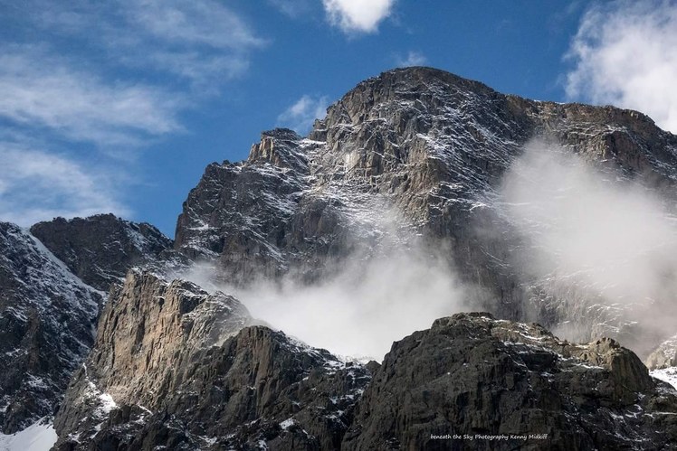
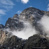
 Taylor Peak
Weather Forecast, United StatesIssued: 11 pm Thu 02 May Local TimeUpdates in: hr min sUpdate imminent
Taylor PeakWeather Forecast, United States
Issued: 11 pm Thu 02 May Local Time
Updates in:
Update imminent hr min s

Issued: 11 pm Thu 02 May Local Time
Updates in:
Update imminent hr min s
Days 1–4 Weather SummaryA light covering of new snow mostly falling on Fri night. Freeze-thaw conditions (max 6°C on Sun afternoon, min -8°C on Fri night). Winds decreasing (near gales from the WSW on Fri morning, light winds from the WSW by Fri night). | Days 5–7 Weather SummaryA moderate fall of snow, heaviest on Mon night. Freeze-thaw conditions (max 1°C on Sun night, min -14°C on Tue night). Winds increasing (light winds from the SW on Sun night, near gales from the WNW by Mon afternoon). | ||||||||||||||||||
Friday 3 | Saturday 4 | Sunday 5 | Monday 6 | Tuesday 7 | Wednesday 8 | ||||||||||||||
night | AM | PM | night | AM | PM | night | AM | PM | night | AM | PM | night | AM | PM | night | AM | PM | night | |
some clouds | some clouds | some clouds | snow shwrs | clear | some clouds | snow shwrs | cloudy | cloudy | snow shwrs | snow shwrs | light snow | heavy snow | snow shwrs | light snow | light snow | cloudy | cloudy | cloudy | |
km/h | |||||||||||||||||||
Wave Height Map |  |  |  | 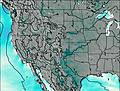 | 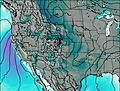 | 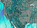 | 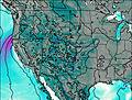 | ||||||||||||
— | — | — | 3 | — | — | 2.0 | — | — | 1.0 | 2.0 | 1.0 | 11 | 1.0 | 2.0 | 1.0 | — | — | — | |
— | — | — | — | — | — | — | — | — | — | — | — | — | — | — | — | — | — | — | |
max°C | -5 | 2 | 1 | -6 | 1 | 3 | -1 | 5 | 6 | 1 | -6 | -5 | -8 | -6 | -6 | -10 | -8 | -6 | -8 |
min°C | -6 | -1 | -2 | -8 | -3 | 0 | -3 | 2 | 6 | -6 | -7 | -6 | -10 | -9 | -7 | -14 | -10 | -6 | -9 |
-11 | -9 | -8 | -12 | -7 | -2 | -7 | -1 | 2 | -14 | -16 | -16 | -20 | -20 | -17 | -22 | -18 | -14 | -13 | |
2550 | 3350 | 3650 | 2400 | 3050 | 3850 | 3100 | 3800 | 4300 | 3450 | 2400 | 2850 | 2200 | 2250 | 2750 | 1750 | 1950 | 2650 | 2150 | |
Cloud base (m) | 3200 | 5600 | 4900 | 3200 | 3200 | 4700 | 3200 | 4700 | 8950 | 3250 | 3600 | 3250 | 3250 | 3400 | 3250 | 3250 | 3450 | 3250 | |
— | 5:58 | — | — | 5:56 | — | — | 5:56 | — | — | 5:54 | — | — | 5:54 | — | — | 5:52 | — | — | |
— | — | 8:00 | — | — | 8:00 | — | — | 8:01 | — | — | 8:02 | — | — | 8:04 | — | — | 8:05 | — | |
Taylor Peak Weather (Days 0-3):
The weather forecast for Taylor Peak is: A light covering of new snow mostly falling on Fri night. Freeze-thaw conditions (max 6°C on Sun afternoon, min -8°C on Fri night). Winds decreasing (near gales from the WSW on Fri morning, light winds from the WSW by Fri night).
Taylor Peak Weather (Days 3-6):
A moderate fall of snow, heaviest on Mon night. Freeze-thaw conditions (max 1°C on Sun night, min -14°C on Tue night). Winds increasing (light winds from the SW on Sun night, near gales from the WNW by Mon afternoon).
This table gives the weather forecast for Taylor Peak at the specific elevation of 3500 m. Our advanced weather models allow us to provide distinct weather forecasts for several elevations of Taylor Peak. To see the weather forecasts for the other elevations, use the tab navigation above the table. For a wider overview of the weather, consult the Weather Map of Colorado.
 Like us
 Follow us
