– Lat/Long: 47.40° N 10.98° E
 Wetterwandeck
Weather Forecast, AustriaIssued: 1 am Wed 15 May Local TimeUpdates in: hr min sUpdate imminent
WetterwandeckWeather Forecast, Austria
Issued: 1 am Wed 15 May Local Time
Updates in:
Update imminent hr min s

Issued: 1 am Wed 15 May Local Time
Updates in:
Update imminent hr min s
Days 1–3 Weather SummaryMild at first with light rain (total 2mm) on Wed afternoon followed by colder weather and light fall of snow, heaviest on Thu night. Freeze-thaw conditions (max 2°C on Wed morning, min -2°C on Fri morning). Wind will be generally light. | Days 4–6 Weather SummaryA light covering of new snow mostly falling on Sat night. Becoming milder with moderate rain (total 11mm) heaviest on Mon night. Freeze-thaw conditions (max 4°C on Mon afternoon, min -1°C on Sat morning). Wind will be generally light. | |||||||||||||||||
Wednesday 15 | Thursday 16 | Friday 17 | Saturday 18 | Sunday 19 | Monday 20 | |||||||||||||
AM | PM | night | AM | PM | night | AM | PM | night | AM | PM | night | AM | PM | night | AM | PM | night | |
cloudy | light rain | snow shwrs | some clouds | snow shwrs | light snow | light snow | cloudy | clear | clear | cloudy | snow shwrs | clear | risk tstorm | light snow | rain shwrs | risk tstorm | risk tstorm | |
km/h | ||||||||||||||||||
Wave Height Map |  |  |  | 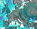 | 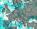 | 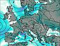 | ||||||||||||
— | — | 1.0 | — | 1.0 | 5 | 3 | — | — | — | — | 4 | — | — | 1.0 | — | — | — | |
— | 2 | — | — | — | — | — | — | — | — | — | — | — | 1.4 | — | 0.9 | 4 | 5 | |
max°C | 2 | 2 | 2 | 0 | 2 | 1 | -2 | -1 | -1 | 0 | 2 | 1 | 1 | 2 | 2 | 2 | 4 | 4 |
min°C | 2 | 2 | 0 | -1 | 1 | -1 | -2 | -2 | -1 | -1 | 1 | 0 | 0 | 2 | 1 | 1 | 3 | 1 |
0 | -1 | -3 | -4 | -1 | -4 | -7 | -7 | -7 | -6 | 0 | -3 | -3 | -1 | 1 | 1 | 1 | -2 | |
2950 | 3000 | 2950 | 2700 | 2850 | 2550 | 2300 | 2500 | 2450 | 2700 | 2850 | 2700 | 2800 | 3000 | 3000 | 2950 | 3250 | 2950 | |
Cloud base (m) | 2600 | 5400 | 2100 | 2150 | 800 | 850 | 1500 | 2600 | 1550 | 2050 | 2300 | 1700 | 3350 | 2100 | 1900 | |||
5:39 | — | — | 5:37 | — | — | 5:35 | — | — | 5:35 | — | — | 5:33 | — | — | 5:33 | — | — | |
— | — | 8:45 | — | — | 8:46 | — | — | 8:49 | — | — | 8:50 | — | — | 8:51 | — | — | 8:52 | |
Wetterwandeck Weather (Days 0-3):
The weather forecast for Wetterwandeck is: Mild at first with light rain (total 2mm) on Wed afternoon followed by colder weather and light fall of snow, heaviest on Thu night. Freeze-thaw conditions (max 2°C on Wed morning, min -2°C on Fri morning). Wind will be generally light.
Wetterwandeck Weather (Days 3-6):
A light covering of new snow mostly falling on Sat night. Becoming milder with moderate rain (total 11mm) heaviest on Mon night. Freeze-thaw conditions (max 4°C on Mon afternoon, min -1°C on Sat morning). Wind will be generally light.
This table gives the weather forecast for Wetterwandeck at the specific elevation of 2698 m. Our advanced weather models allow us to provide distinct weather forecasts for several elevations of Wetterwandeck. To see the weather forecasts for the other elevations, use the tab navigation above the table. For a wider overview of the weather, consult the Weather Map of Austria.
| Weather Station | Temp. | Weather | Wind | Gusts | Cloud / Visibility |
|---|---|---|---|---|---|
Zugspitze | |||||
Moos LP | |||||
Osterfelder | |||||
Grubig Landeplatz | |||||
Marienberg |
* NOTE: not all weather observatories update at the same frequency which is the reason why some locations may show data from stations that are further away than known closer ones.
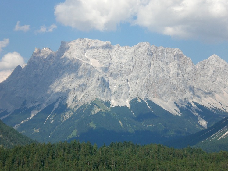
Wetterwandeck Photos
View all
Northern Limestone Alps photos (8) |
Alps photos (1434) |
photos from mountains in Austria (218) |
all photos
 Upload new photo
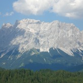
Wetterwandeck
 Like us
 Follow us
