– Lat/Long: 47.46° N 121.64° W
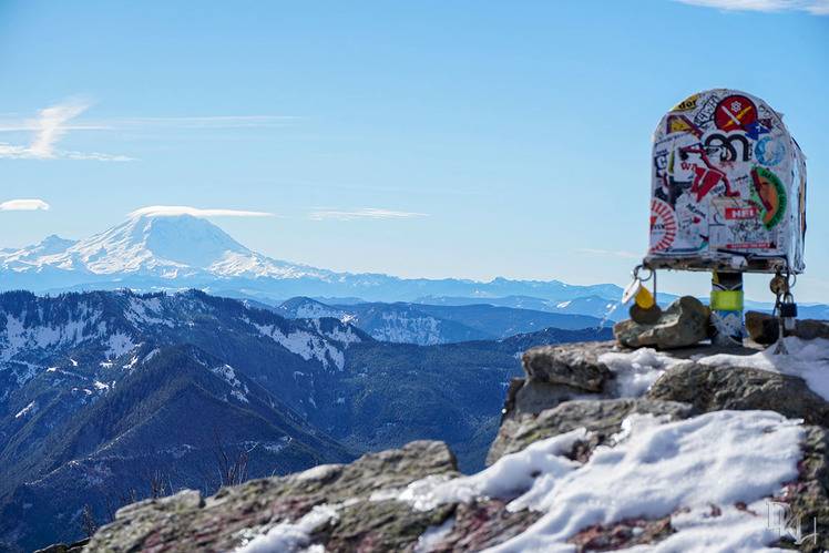
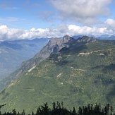
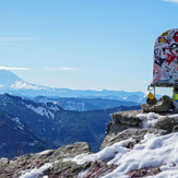
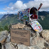
 Mailbox Peak
Weather Forecast, United StatesIssued: 4 pm Fri 31 May Local TimeUpdates in: hr min sUpdate imminent
Mailbox PeakWeather Forecast, United States
Issued: 4 pm Fri 31 May Local Time
Updates in:
Update imminent hr min s

Issued: 4 pm Fri 31 May Local Time
Updates in:
Update imminent hr min s
Days 1–4 Weather SummaryHeavy rain (total 51mm), heaviest during Sun night. Later becoming colder with a dusting of snow on Mon morning. Freeze-thaw conditions (max 10°C on Fri afternoon, min 0°C on Mon morning). Winds increasing (calm on Fri afternoon, strong winds from the SW by Sun afternoon). | Days 5–7 Weather SummaryA light covering of new snow mostly falling on Mon night. Becoming milder with light rain (total 8mm) on Tue afternoon. Freeze-thaw conditions (max 16°C on Thu morning, min 0°C on Mon night). Winds decreasing (strong winds from the WSW on Mon afternoon, calm by Wed night). | ||||||||||||||||
Fri 31 | Saturday 1 | Sunday 2 | Monday 3 | Tuesday 4 | Wednesday 5 | ||||||||||||
PM | night | AM | PM | night | AM | PM | night | AM | PM | night | AM | PM | night | AM | PM | night | |
some clouds | rain shwrs | light rain | light rain | rain shwrs | mod. rain | heavy rain | heavy rain | snow shwrs | light snow | snow shwrs | light rain | light rain | rain shwrs | rain shwrs | clear | some clouds | |
km/h | |||||||||||||||||
Wave Height Map |  | 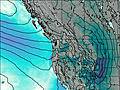 | 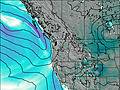 | 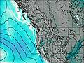 |  |  | |||||||||||
— | — | — | — | — | — | — | — | 2.0 | 2.0 | 3 | — | — | — | — | — | — | |
— | 0.1 | 1.6 | 0.1 | 1.0 | 7 | 12 | 24 | 5 | — | — | 3 | 4 | 1.8 | 0.1 | — | — | |
max°C | 10 | 9 | 3 | 4 | 4 | 4 | 5 | 5 | 2 | 1 | 1 | 4 | 4 | 4 | 6 | 10 | 15 |
min°C | 9 | 6 | 3 | 4 | 4 | 3 | 4 | 2 | 0 | 1 | 0 | 3 | 4 | 2 | 3 | 9 | 11 |
9 | 5 | 0 | 0 | 1 | 0 | 0 | -4 | -7 | -6 | -6 | -2 | -1 | 0 | 3 | 9 | 11 | |
3100 | 2900 | 2200 | 2250 | 2300 | 2450 | 2500 | 1900 | 1450 | 1700 | 1700 | 2600 | 2250 | 2850 | 3550 | 3750 | 4150 | |
Cloud base (m) | 6000 | 550 | 600 | 600 | 500 | 350 | 350 | 400 | 450 | 650 | 400 | 500 | 700 | 8950 | 8350 | ||
— | — | 5:13 | — | — | 5:11 | — | — | 5:11 | — | — | 5:11 | — | — | 5:11 | — | — | |
— | 8:54 | — | — | 8:55 | — | — | 8:57 | — | — | 8:58 | — | — | 8:58 | — | — | 8:59 | |
Mailbox Peak Weather (Days 0-3):
The weather forecast for Mailbox Peak is: Heavy rain (total 51mm), heaviest during Sun night. Later becoming colder with a dusting of snow on Mon morning. Freeze-thaw conditions (max 10°C on Fri afternoon, min 0°C on Mon morning). Winds increasing (calm on Fri afternoon, strong winds from the SW by Sun afternoon).
Mailbox Peak Weather (Days 3-6):
A light covering of new snow mostly falling on Mon night. Becoming milder with light rain (total 8mm) on Tue afternoon. Freeze-thaw conditions (max 16°C on Thu morning, min 0°C on Mon night). Winds decreasing (strong winds from the WSW on Mon afternoon, calm by Wed night).
This table gives the weather forecast for Mailbox Peak at the specific elevation of 1476 m. Our advanced weather models allow us to provide distinct weather forecasts for several elevations of Mailbox Peak. To see the weather forecasts for the other elevations, use the tab navigation above the table. For a wider overview of the weather, consult the Weather Map of Washington.
| Weather Station | Temp. | Weather | Wind | Gusts | Cloud / Visibility |
|---|---|---|---|---|---|
* NOTE: not all weather observatories update at the same frequency which is the reason why some locations may show data from stations that are further away than known closer ones.
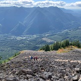
Mailbox Peak Photos
View all
Cascade Range photos (411) |
Pacific Coast Ranges photos (963) |
photos from mountains in United States (2757) |
all photos
 Upload new photo
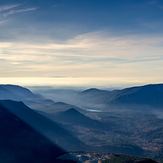
 See 8 more Mailbox Peak photos
Mailbox Peak
Stone field
View
Mailbox Peak Summit
Mailbox
 Like us
 Follow us
