
– Lat/Long: 2.92° N 76.05° W
 Nevado de Huila
Weather Forecast, ColombiaIssued: 12 pm Fri 31 May Local TimeUpdates in: hr min sUpdate imminent
Nevado de HuilaWeather Forecast, Colombia
Issued: 12 pm Fri 31 May Local Time
Updates in:
Update imminent hr min s

Issued: 12 pm Fri 31 May Local Time
Updates in:
Update imminent hr min s
Days 1–3 Weather SummaryA light covering of new snow mostly falling on Fri morning. Temperatures will be below freezing (max -3°C on Fri morning, min -5°C on Fri night). Mainly fresh winds. | Days 4–6 Weather SummaryA moderate fall of snow, heaviest on Mon morning. Temperatures will be below freezing (max -2°C on Tue afternoon, min -5°C on Wed night). Winds decreasing (fresh winds from the E on Mon morning, light winds from the SE by Tue night). | Days 7–9 Weather SummaryA moderate fall of snow, heaviest on Thu afternoon. Temperatures will be below freezing (max -3°C on Thu morning, min -5°C on Thu night). Winds decreasing (fresh winds from the E on Fri morning, light winds from the SE by Sat night). | Days 10–12 Weather SummaryA heavy fall of snow, heaviest during Mon night. Temperatures will be below freezing (max -3°C on Wed morning, min -5°C on Sun night). Wind will be generally light. | |||||||||||||||||||||||||||||||||
Friday 31 | Saturday 1 | Sunday 2 | Monday 3 | Tuesday 4 | Wednesday 5 | Thursday 6 | Friday 7 | Saturday 8 | Sunday 9 | Monday 10 | Tuesday 11 | |||||||||||||||||||||||||
AM | PM | night | AM | PM | night | AM | PM | night | AM | PM | night | AM | PM | night | AM | PM | night | AM | PM | night | AM | PM | night | AM | PM | night | AM | PM | night | AM | PM | night | AM | PM | night | |
snow shwrs | snow shwrs | clear | snow shwrs | some clouds | clear | snow shwrs | snow shwrs | clear | snow shwrs | snow shwrs | light snow | snow shwrs | snow shwrs | snow shwrs | light snow | snow shwrs | some clouds | light snow | snow shwrs | some clouds | snow shwrs | snow shwrs | some clouds | light snow | light snow | some clouds | snow shwrs | snow shwrs | some clouds | snow shwrs | snow shwrs | heavy snow | snow shwrs | snow shwrs | some clouds | |
km/h | ||||||||||||||||||||||||||||||||||||
Wave Height Map |  |  |  |  | 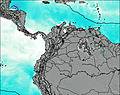 | 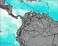 | 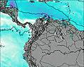 | 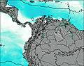 | 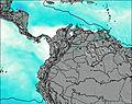 | 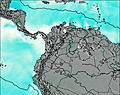 | 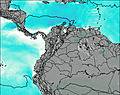 | 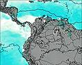 | ||||||||||||||||||||||||
2.0 | 3 | — | 1.0 | — | — | 1.0 | 2.0 | — | 2.0 | 3 | 2.0 | 2.0 | 2.0 | 1.0 | 4 | 1.0 | — | 1.0 | 3 | — | 2.0 | 3 | — | 2.0 | 2.0 | — | 2.0 | 3 | — | 3 | 5 | 18 | 3 | 4 | — | |
— | — | — | — | — | — | — | — | — | — | — | — | — | — | — | — | — | — | — | — | — | — | — | — | — | — | — | — | — | — | — | — | — | — | — | — | |
max°C | -3 | -3 | -4 | -3 | -3 | -4 | -3 | -3 | -4 | -3 | -3 | -4 | -3 | -2 | -4 | -4 | -4 | -5 | -3 | -4 | -4 | -3 | -3 | -5 | -4 | -4 | -5 | -4 | -4 | -5 | -4 | -4 | -4 | -4 | -4 | -5 |
min°C | -3 | -4 | -5 | -3 | -4 | -5 | -3 | -4 | -5 | -3 | -4 | -4 | -3 | -3 | -4 | -4 | -4 | -5 | -4 | -4 | -5 | -3 | -4 | -5 | -4 | -5 | -5 | -4 | -4 | -5 | -4 | -4 | -5 | -5 | -4 | -5 |
-11 | -11 | -12 | -10 | -11 | -12 | -10 | -11 | -13 | -11 | -12 | -11 | -9 | -8 | -9 | -10 | -10 | -11 | -11 | -12 | -12 | -11 | -11 | -13 | -10 | -11 | -10 | -10 | -9 | -10 | -11 | -10 | -11 | -11 | -10 | -11 | |
5250 | 5250 | 4900 | 5300 | 5300 | 4800 | 5200 | 5200 | 4850 | 5200 | 5200 | 5000 | 5150 | 5300 | 5000 | 5000 | 5050 | 4800 | 5000 | 5100 | 4800 | 5150 | 5150 | 4850 | 5000 | 5000 | 4750 | 5100 | 5100 | 4800 | 5050 | 5050 | 4900 | 4950 | 5100 | 4800 | |
Cloud base (m) | 3600 | 5500 | 3650 | 4550 | 4700 | 3600 | 3600 | 3600 | 3550 | 3600 | 3600 | 3600 | 3700 | 3650 | 3600 | 3650 | 3650 | 3600 | 3600 | 3600 | 3700 | 3700 | 3600 | 4800 | 3650 | 3600 | 3600 | 3650 | ||||||||
5:52 | — | — | 5:52 | — | — | 5:52 | — | — | 5:54 | — | — | 5:54 | — | — | 5:54 | — | — | 5:54 | — | — | 5:54 | — | — | 5:54 | — | — | 5:54 | — | — | 5:54 | — | — | 5:54 | — | — | |
— | 6:09 | — | — | 6:09 | — | — | 6:09 | — | — | 6:10 | — | — | 6:10 | — | — | 6:10 | — | — | 6:10 | — | — | 6:10 | — | — | 6:12 | — | — | 6:12 | — | — | 6:12 | — | — | 6:12 | — | |
Nevado de Huila Weather (Days 0-3):
The weather forecast for Nevado de Huila is: A light covering of new snow mostly falling on Fri morning. Temperatures will be below freezing (max -3°C on Fri morning, min -5°C on Fri night). Mainly fresh winds.
Nevado de Huila Weather (Days 3-6):
A moderate fall of snow, heaviest on Mon morning. Temperatures will be below freezing (max -2°C on Tue afternoon, min -5°C on Wed night). Winds decreasing (fresh winds from the E on Mon morning, light winds from the SE by Tue night).
Nevado de Huila Weather (Days 6-9):
A moderate fall of snow, heaviest on Thu afternoon. Temperatures will be below freezing (max -3°C on Thu morning, min -5°C on Thu night). Winds decreasing (fresh winds from the E on Fri morning, light winds from the SE by Sat night).
This table gives the weather forecast for Nevado de Huila at the specific elevation of 5750 m. Our advanced weather models allow us to provide distinct weather forecasts for several elevations of Nevado de Huila. To see the weather forecasts for the other elevations, use the tab navigation above the table. For a wider overview of the weather, consult the Weather Map of Colombia.
| Weather Station | Temp. | Weather | Wind | Gusts | Cloud / Visibility |
|---|---|---|---|---|---|
Cal / lfonso Bonilla Aragón International Airport | |||||
CaliAlfonsoBonillaAragon | |||||
NeivaBenitoSalas | |||||
Neiva Huil / enito Salas Airport | |||||
Armeni / eropuerto Internacional El Edén Airport |
* NOTE: not all weather observatories update at the same frequency which is the reason why some locations may show data from stations that are further away than known closer ones.
 Like us
 Follow us
