View
all Nevado de Toluca photos (30) |
photos from Sierra Madre Occidental (34) |
photos from Mexican Ranges (362) |
photos from Mexico (358) |
all photos
 Upload new photo
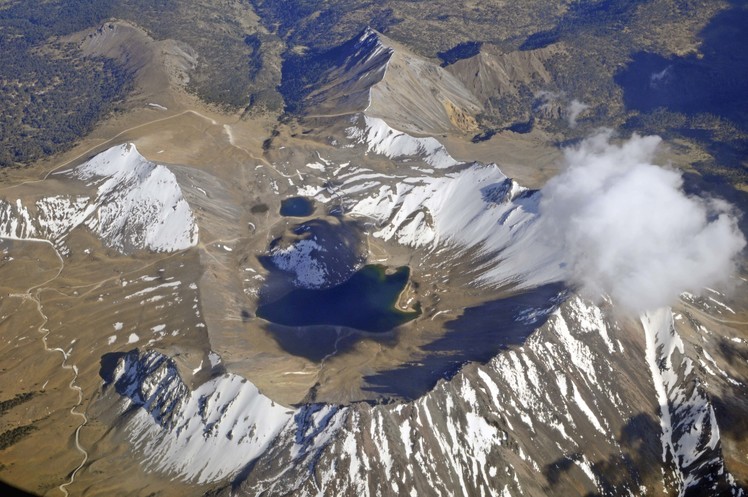
Nevado de Toluca Photo: 'flying over Nevado de Toluca' by Wolfgang Piecha

flying over Nevado de Toluca
Mexico | Nevado de Toluca
| Average rating: 4.3 | (use stars to vote) |
Flight over the south-western edge of the Nevado. The carpark, entry point for all hikes, is visible at 9 o'clock, at an altitude of 4.000m. From there the main trail leads straight up to the rim. This part can be pretty crowded on weekends. Experienced hikers then follow the rim to their right, with the "Eagle/Aguilar" at 6 o'clock and "Friar's peak/Fraile" at 2 o'clock (under the clouds). This ambitious tour takes around 6 hours.
|
Click to submit a comment on this Nevado de Toluca photo
(Note: new comments may not appear immediately) |

