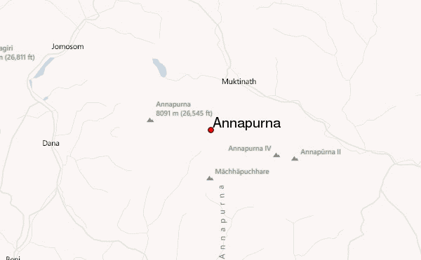
– Lat/Long: 28.58° N 83.95° E
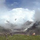
 Annapurna – Climbing, Hiking & Mountaineering information

Annapurna guide
- Elevation: 26547 ft
- Difficulty: Major Mountain Expedition
- Best months to climb: April, May
- Convenient center: Pokhara, Nepal
Annapurna Climbing NotesBe the first to submit your climbing note! Please submit any useful information about climbing Annapurna that may be useful to other climbers. Consider things such as access and accommodation at the base of Annapurna, as well as the logistics of climbing to the summit. |
| Select a
mountain summit from the menu |
||
|
Select a Mountain Summit
|
||


Use this relief map to navigate to mountain peaks in the area of Annapurna.
10 other mountain peaks closest to Annapurna:
| 1. | Gangapurna (24460 ft) | 1.5 miles |
| 2. | Singu Chuli (21330 ft) | 3.0 miles |
| 3. | Annapurna Sanctuary (13551 ft) | 5.7 miles |
| 4. | Machhapuchhare (22967 ft) | 5.8 miles |
| 5. | Machapuchare (22944 ft) | 6.1 miles |
| 6. | Hiunchuli (21133 ft) | 6.2 miles |
| 7. | Tilicho Peak (23407 ft) | 11.2 miles |
| 8. | Chulu Far East (19880 ft) | 13.1 miles |
| 9. | Nilgiri Himal (23167 ft) | 14.6 miles |
| 10. | Pisang Peak (19985 ft) | 15.0 miles |


