– Lat/Long: 28.58° N 83.95° E
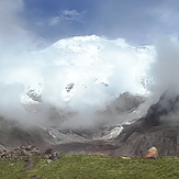
 Annapurna
Weather Forecast, NepalIssued: 4 pm Mon 07 Apr Local TimeUpdates in: hr min sUpdate imminent
Annapurna Weather Forecast, Nepal
Issued: 4 pm Mon 07 Apr Local Time
Updates in:
Update imminent hr min s

Issued: 4 pm Mon 07 Apr Local Time
Updates in:
Update imminent hr min s
Days 1–4 Weather SummaryA moderate fall of snow, heaviest on Thu morning. Extremely cold (max -24°C on Tue night, min -27°C on Mon afternoon). Wind will be generally light. | Days 5–7 Weather SummaryA heavy fall of snow, heaviest during Sat afternoon. Extremely cold (max -24°C on Thu night, min -28°C on Sat morning). Wind will be generally light. | Days 8–10 Weather SummaryA heavy fall of snow, heaviest during Mon afternoon. Extremely cold (max -24°C on Mon afternoon, min -26°C on Sun night). Wind will be generally light. | Days 11–13 Weather SummaryA heavy fall of snow, heaviest during Wed afternoon. Extremely cold (max -22°C on Thu night, min -24°C on Wed night). Wind will be generally light. | |||||||||||||||||||||||||||||||||
Mon 7 | Tuesday 8 | Wednesday 9 | Thursday 10 | Friday 11 | Saturday 12 | Sunday 13 | Monday 14 | Tuesday 15 | Wednesday 16 | Thursday 17 | Friday 18 | Sat 19 | ||||||||||||||||||||||||
PM | night | AM | PM | night | AM | PM | night | AM | PM | night | AM | PM | night | AM | PM | night | AM | PM | night | AM | PM | night | AM | PM | night | AM | PM | night | AM | PM | night | AM | PM | night | AM | |
some clouds | clear | some clouds | snow shwrs | some clouds | some clouds | snow shwrs | snow shwrs | snow shwrs | mod. snow | some clouds | snow shwrs | mod. snow | snow shwrs | snow shwrs | heavy snow | snow shwrs | snow shwrs | snow shwrs | some clouds | snow shwrs | snow shwrs | some clouds | snow shwrs | mod. snow | snow shwrs | light snow | mod. snow | heavy snow | light snow | snow shwrs | some clouds | snow shwrs | light snow | some clouds | some clouds | |
km/h | ||||||||||||||||||||||||||||||||||||
 |  |  |  |  |  |  |  |  |  |  |  |  | ||||||||||||||||||||||||
— | — | — | 4 | — | — | 5 | 4 | 5 | 7 | — | 2.0 | 10 | 9 | 5 | 21 | 2.0 | 1.0 | 14 | — | 2.0 | 22 | — | 1.0 | 6 | 1.0 | 2.0 | 7 | 11 | 3 | 3 | — | 1.0 | 2.0 | — | — | |
— | — | — | — | — | — | — | — | — | — | — | — | — | — | — | — | — | — | — | — | — | — | — | — | — | — | — | — | — | — | — | — | — | — | — | — | |
max°C | -26 | -26 | -26 | -25 | -24 | -24 | -24 | -25 | -26 | -25 | -24 | -25 | -25 | -25 | -27 | -26 | -25 | -26 | -25 | -25 | -26 | -24 | -25 | -25 | -24 | -24 | -24 | -23 | -23 | -24 | -23 | -22 | -24 | -23 | -23 | -24 |
min°C | -27 | -26 | -26 | -26 | -25 | -25 | -24 | -26 | -26 | -25 | -25 | -26 | -26 | -26 | -28 | -27 | -27 | -26 | -25 | -26 | -26 | -25 | -25 | -25 | -25 | -25 | -25 | -23 | -24 | -24 | -23 | -24 | -24 | -24 | -24 | -24 |
-36 | -36 | -26 | -35 | -37 | -30 | -32 | -36 | -35 | -36 | -31 | -37 | -37 | -32 | -42 | -41 | -40 | -37 | -25 | -33 | -36 | -33 | -38 | -31 | -33 | -30 | -30 | -30 | -33 | -24 | -32 | -32 | -31 | -33 | -36 | -33 | |
4400 | 4050 | 4550 | 4450 | 4300 | 4600 | 4500 | 4300 | 4450 | 4400 | 4300 | 4550 | 4400 | 4150 | 4250 | 4050 | 3850 | 4250 | 4200 | 3850 | 4350 | 4350 | 4050 | 4400 | 4400 | 4100 | 4500 | 4450 | 4300 | 4450 | 4500 | 4100 | 4550 | 4500 | 4300 | 4800 | |
Cloud base (m) | 6400 | 9550 | 4850 | 4750 | 4650 | 4850 | 4900 | 5600 | 4700 | 5700 | 4700 | 4700 | 4700 | |||||||||||||||||||||||
— | — | 5:50 | — | — | 5:50 | — | — | 5:48 | — | — | 5:48 | — | — | 5:47 | — | — | 5:46 | — | — | 5:45 | — | — | 5:43 | — | — | 5:43 | — | — | 5:41 | — | — | 5:41 | — | — | 5:39 | |
6:30 | — | — | 6:30 | — | — | 6:30 | — | — | 6:31 | — | — | 6:31 | — | — | 6:32 | — | — | 6:32 | — | — | 6:34 | — | — | 6:34 | — | — | 6:35 | — | — | 6:36 | — | — | 6:36 | — | — | |
Annapurna Weather (Days 0-3):
The weather forecast for Annapurna is: A moderate fall of snow, heaviest on Thu morning. Extremely cold (max -24°C on Tue night, min -27°C on Mon afternoon). Wind will be generally light.
Annapurna Weather (Days 3-6):
A heavy fall of snow, heaviest during Sat afternoon. Extremely cold (max -24°C on Thu night, min -28°C on Sat morning). Wind will be generally light.
Annapurna Weather (Days 6-9):
A heavy fall of snow, heaviest during Mon afternoon. Extremely cold (max -24°C on Mon afternoon, min -26°C on Sun night). Wind will be generally light.
This table gives the weather forecast for Annapurna at the specific elevation of 8091 m. Our advanced weather models allow us to provide distinct weather forecasts for several elevations of Annapurna. To see the weather forecasts for the other elevations, use the tab navigation above the table. For a wider overview of the weather, consult the Weather Map of Nepal.
| Weather Station | Temp. | Weather | Wind | Gusts | Cloud / Visibility |
|---|---|---|---|---|---|
Tingri | |||||
* NOTE: not all weather observatories update at the same frequency which is the reason why some locations may show data from stations that are further away than known closer ones.
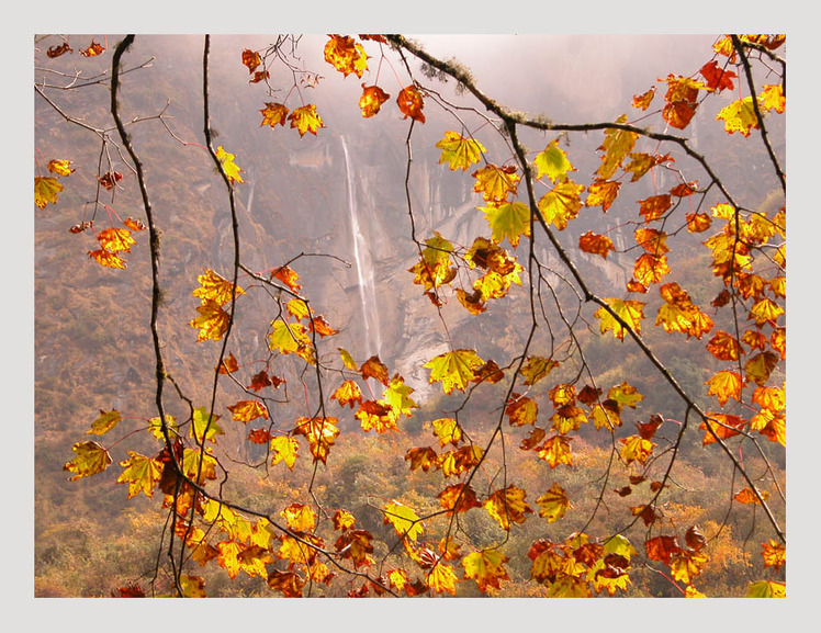
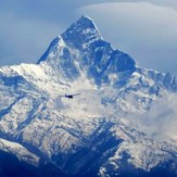
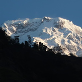
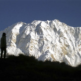
Annapurna Photos
View all
Central Nepal Himalaya photos (107) |
Greater Himalaya photos (215) |
photos from mountains in Nepal (179) |
all photos
 Upload new photo
Annapourna Area
Annapurna South
Looking at Annapurna 1
Annapurna

