
– Lat/Long: 40.28° N 44.75° E
 Agmagan-karadag
Weather Forecast, ArmeniaIssued: 3 pm Mon 28 Apr Local TimeUpdates in: hr min sUpdate imminent
Agmagan-karadag Weather Forecast, Armenia
Issued: 3 pm Mon 28 Apr Local Time
Updates in:
Update imminent hr min s

Issued: 3 pm Mon 28 Apr Local Time
Updates in:
Update imminent hr min s
Days 1–4 Weather SummaryA dusting of snow on Mon night. Freezing level rising with drizzle on Wed afternoon. Freeze-thaw conditions (max 6°C on Thu morning, min -1°C on Mon night). Winds increasing (light winds from the S on Mon night, strong winds from the WSW by Wed afternoon). | Days 5–7 Weather SummaryLight rain (total 8mm), mostly falling on Fri afternoon. Mild temperatures (max 8°C on Thu afternoon, min 2°C on Sat morning). Winds decreasing (near gales from the S on Thu night, light winds from the SW by Sat night). | ||||||||||||||||
Mon 28 | Tuesday 29 | Wednesday 30 | Thursday 1 | Friday 2 | Saturday 3 | ||||||||||||
PM | night | AM | PM | night | AM | PM | night | AM | PM | night | AM | PM | night | AM | PM | night | |
clear | snow shwrs | some clouds | cloudy | rain shwrs | rain shwrs | rain shwrs | rain shwrs | clear | clear | clear | some clouds | rain shwrs | rain shwrs | risk tstorm | cloudy | clear | |
km/h | |||||||||||||||||
 |  |  |  |  |  | ||||||||||||
— | 3 | — | — | — | — | — | — | — | — | — | — | — | — | — | — | — | |
— | — | — | — | 0.1 | 0.2 | 1.0 | 0.1 | — | — | — | — | 4 | 3 | 0.5 | — | — | |
max°C | 2 | 1 | 0 | 2 | 2 | 2 | 4 | 4 | 6 | 8 | 8 | 7 | 6 | 7 | 4 | 6 | 5 |
min°C | 2 | -1 | -1 | 0 | 1 | 2 | 3 | 4 | 5 | 7 | 8 | 5 | 4 | 3 | 2 | 5 | 4 |
0 | -4 | -6 | -4 | -4 | -4 | -4 | -1 | 1 | 4 | 4 | -2 | -1 | -3 | -3 | 0 | -1 | |
3200 | 2900 | 2800 | 3000 | 3250 | 3250 | 3350 | 3550 | 3700 | 3950 | 4050 | 3750 | 3650 | 3950 | 3300 | 3650 | 3600 | |
Cloud base (m) | 3250 | 2600 | 2300 | 2150 | 2400 | 8750 | 9300 | 9500 | 4500 | 8300 | 5850 | 4350 | |||||
— | — | 6:03 | — | — | 6:01 | — | — | 6:00 | — | — | 5:58 | — | — | 5:58 | — | — | |
7:52 | — | — | 7:52 | — | — | 7:53 | — | — | 7:55 | — | — | 7:57 | — | — | 7:58 | — | |
Loading...
Agmagan-karadag Weather (Days 0-3):
The weather forecast for Agmagan-karadag is: A dusting of snow on Mon night. Freezing level rising with drizzle on Wed afternoon. Freeze-thaw conditions (max 6°C on Thu morning, min -1°C on Mon night). Winds increasing (light winds from the S on Mon night, strong winds from the WSW by Wed afternoon).
Agmagan-karadag Weather (Days 3-6):
Light rain (total 8mm), mostly falling on Fri afternoon. Mild temperatures (max 8°C on Thu afternoon, min 2°C on Sat morning). Winds decreasing (near gales from the S on Thu night, light winds from the SW by Sat night).
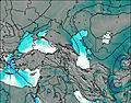
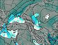
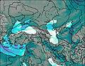
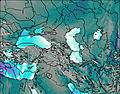
This table gives the weather forecast for Agmagan-karadag at the specific elevation of 3000 m. Our advanced weather models allow us to provide distinct weather forecasts for several elevations of Agmagan-karadag. To see the weather forecasts for the other elevations, use the tab navigation above the table. For a wider overview of the weather, consult the Weather Map of Armenia.
| Weather Station | Temp. | Weather | Wind | Gusts | Cloud / Visibility |
|---|---|---|---|---|---|
Hrazdan | |||||
Gavar | |||||
Sevan Ozero | |||||
Armavir(37787-0) | |||||
Vanadzor | |||||
* NOTE: not all weather observatories update at the same frequency which is the reason why some locations may show data from stations that are further away than known closer ones.

