– Lat/Long: 49.30° S 73.05° W
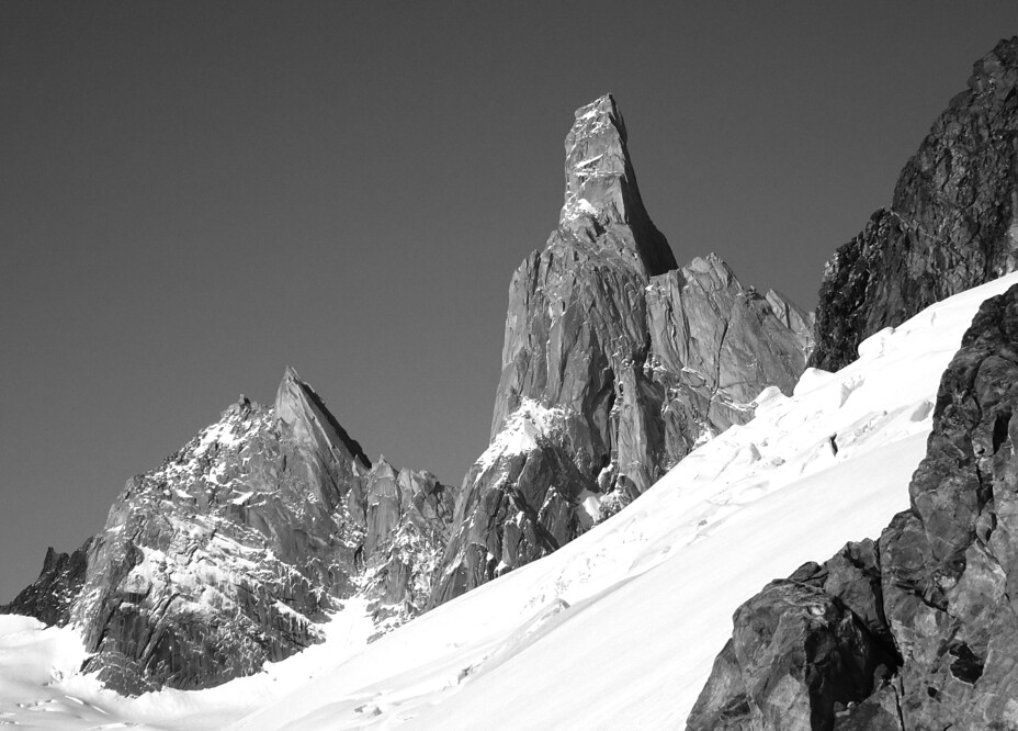
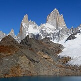
 Aguja De La S
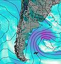
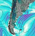
Weather Forecast, ArgentinaIssued: 8 pm Mon 12 May Local TimeUpdates in: hr min sUpdate imminent
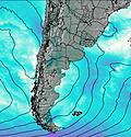
Issued: 8 pm Mon 12 May Local Time
Updates in:
Update imminent hr min s

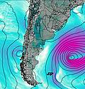
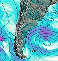
Issued: 8 pm Mon 12 May Local Time
Updates in:
Update imminent hr min s
Days 1–4 Weather SummaryA heavy fall of snow, heaviest during Wed night. Temperatures will be below freezing (max -5°C on Wed night, min -12°C on Tue night). Winds increasing (fresh winds from the NW on Mon night, extremely windy from the WNW by Wed night). | Days 5–7 Weather SummaryA heavy fall of snow, heaviest during Fri night. Temperatures will be well below freezing (max -8°C on Thu night, min -14°C on Sat night). Winds decreasing (near gales from the NW on Thu night, calm by Fri afternoon). | ||||||||||||||||||
Tuesday 13 | Wednesday 14 | Thursday 15 | Friday 16 | Saturday 17 | Sunday 18 | ||||||||||||||
night | AM | PM | night | AM | PM | night | AM | PM | night | AM | PM | night | AM | PM | night | AM | PM | night | |
snow shwrs | snow shwrs | snow shwrs | heavy snow | mod. snow | snow shwrs | heavy snow | mod. snow | mod. snow | snow shwrs | snow shwrs | some clouds | mod. snow | light snow | cloudy | clear | clear | clear | clear | |
km/h | |||||||||||||||||||
 |  |  |  |  |  |  | |||||||||||||
1.0 | 1.0 | 8 | 23 | 9 | 6 | 34 | 10 | 6 | 7 | 4 | — | 7 | 3 | — | — | — | — | — | |
— | — | — | — | — | — | — | — | — | — | — | — | — | — | — | — | — | — | — | |
max°C | -6 | -7 | -6 | -9 | -9 | -6 | -5 | -11 | -11 | -8 | -9 | -8 | -10 | -12 | -11 | -13 | -14 | -13 | -13 |
min°C | -8 | -7 | -7 | -12 | -11 | -8 | -9 | -12 | -11 | -11 | -9 | -9 | -12 | -12 | -12 | -14 | -14 | -14 | -14 |
-19 | -18 | -17 | -28 | -26 | -21 | -24 | -27 | -25 | -22 | -17 | -9 | -19 | -20 | -18 | -24 | -24 | -14 | -22 | |
1050 | 1100 | 1300 | 900 | 850 | 1000 | 1150 | 800 | 850 | 650 | 850 | 950 | 500 | 300 | 600 | 0 | 0 | 350 | 0 | |
Cloud base (m) | 750 | 1300 | 700 | 700 | 700 | 700 | 650 | 700 | 750 | 750 | 700 | 700 | 700 | 700 | 700 | 2050 | 750 | 1950 | |
— | 9:12 | — | — | 9:15 | — | — | 9:15 | — | — | 9:17 | — | — | 9:18 | — | — | 9:19 | — | — | |
— | — | 6:22 | — | — | 6:21 | — | — | 6:19 | — | — | 6:17 | — | — | 6:16 | — | — | 6:15 | — | |
Loading...
Aguja De La S Weather (Days 0-3):
The weather forecast for Aguja De La S is: A heavy fall of snow, heaviest during Wed night. Temperatures will be below freezing (max -5°C on Wed night, min -12°C on Tue night). Winds increasing (fresh winds from the NW on Mon night, extremely windy from the WNW by Wed night).
Aguja De La S Weather (Days 3-6):
A heavy fall of snow, heaviest during Fri night. Temperatures will be well below freezing (max -8°C on Thu night, min -14°C on Sat night). Winds decreasing (near gales from the NW on Thu night, calm by Fri afternoon).
This table gives the weather forecast for Aguja De La S at the specific elevation of 2335 m. Our advanced weather models allow us to provide distinct weather forecasts for several elevations of Aguja De La S. To see the weather forecasts for the other elevations, use the tab navigation above the table. For a wider overview of the weather, consult the Weather Map of Argentina.
| Weather Station | Temp. | Weather | Wind | Gusts | Cloud / Visibility |
|---|---|---|---|---|---|
Aeropuerto Internacional de El Calafate Airport | |||||
Magallanes Villa Tehuelche | |||||
Rio Gallegos Airport | |||||
Balmaceda Airport | |||||
Coyhaique | |||||
Puerto Aysan | |||||
Instituto de la Patagonia (Jorge Schytte) |
* NOTE: not all weather observatories update at the same frequency which is the reason why some locations may show data from stations that are further away than known closer ones.
Aguja De La S Photos
View all
Central Argentina-Chile photos (462) |
Andes photos (977) |
photos from mountains in Argentina (244) |
all photos
 Upload new photo
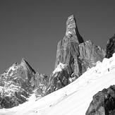
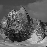
From a different angle
Face to face
Land of wind and stone