
– Lat/Long: 48.62° N 113.62° W
 Almost-a-Dog Mountain
Weather Forecast, United StatesIssued: 11 pm Tue 22 Apr Local TimeUpdates in: hr min sUpdate imminent
Almost-a-Dog Mountain Weather Forecast, United States
Issued: 11 pm Tue 22 Apr Local Time
Updates in:
Update imminent hr min s

Issued: 11 pm Tue 22 Apr Local Time
Updates in:
Update imminent hr min s
Days 1–4 Weather SummaryMostly dry. Freeze-thaw conditions (max 7°C on Fri afternoon, min -5°C on Tue night). Wind will be generally light. | Days 5–7 Weather SummaryA dusting of snow giving way to moderate rain (total 13mm) heaviest on Mon afternoon. Very mild (max 10°C on Sat afternoon, min 2°C on Sun night). Wind will be generally light. | ||||||||||||||||||
Wednesday 23 | Thursday 24 | Friday 25 | Saturday 26 | Sunday 27 | Monday 28 | ||||||||||||||
night | AM | PM | night | AM | PM | night | AM | PM | night | AM | PM | night | AM | PM | night | AM | PM | night | |
clear | some clouds | rain shwrs | clear | clear | some clouds | clear | clear | clear | clear | clear | clear | some clouds | light rain | light rain | light snow | light rain | light rain | some clouds | |
km/h | |||||||||||||||||||
 |  |  |  |  |  |  | |||||||||||||
— | — | — | — | — | — | — | — | — | — | — | — | — | — | — | 1.0 | — | — | — | |
— | — | 0.1 | — | — | — | — | — | — | — | — | — | — | 2 | 3 | 3 | 0.5 | 4 | — | |
max°C | -4 | 0 | 2 | -1 | 3 | 5 | 1 | 5 | 7 | 4 | 7 | 10 | 8 | 4 | 5 | 4 | 3 | 2 | 2 |
min°C | -5 | -2 | 1 | -2 | 1 | 4 | 0 | 3 | 7 | 3 | 6 | 9 | 4 | 4 | 4 | 2 | 2 | 2 | 1 |
-5 | -4 | 0 | -4 | -2 | 2 | -3 | 1 | 6 | 3 | 5 | 8 | 2 | 4 | 4 | 1 | 0 | 1 | -3 | |
1200 | 1750 | 2150 | 1750 | 2150 | 2450 | 2050 | 2600 | 2750 | 2700 | 2800 | 3000 | 3050 | 2600 | 2600 | 2500 | 2300 | 2400 | 2200 | |
Cloud base (m) | 2550 | 2900 | 2750 | 3100 | 3150 | 3350 | 2350 | 1850 | 1950 | 1850 | 1900 | 2050 | |||||||
— | 6:28 | — | — | 6:26 | — | — | 6:24 | — | — | 6:22 | — | — | 6:22 | — | — | 6:20 | — | — | |
— | — | 8:37 | — | — | 8:37 | — | — | 8:39 | — | — | 8:40 | — | — | 8:43 | — | — | 8:44 | — | |
Loading...
Almost-a-Dog Mountain Weather (Days 0-3):
The weather forecast for Almost-a-Dog Mountain is: Mostly dry. Freeze-thaw conditions (max 7°C on Fri afternoon, min -5°C on Tue night). Wind will be generally light.
Almost-a-Dog Mountain Weather (Days 3-6):
A dusting of snow giving way to moderate rain (total 13mm) heaviest on Mon afternoon. Very mild (max 10°C on Sat afternoon, min 2°C on Sun night). Wind will be generally light.
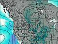
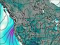
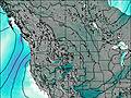
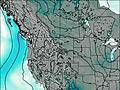
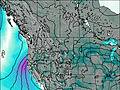
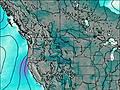
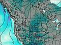
This table gives the weather forecast for Almost-a-Dog Mountain at the specific elevation of 2000 m. Our advanced weather models allow us to provide distinct weather forecasts for several elevations of Almost-a-Dog Mountain. To see the weather forecasts for the other elevations, use the tab navigation above the table. For a wider overview of the weather, consult the Weather Map of Montana.
| Weather Station | Temp. | Weather | Wind | Gusts | Cloud / Visibility |
|---|---|---|---|---|---|
Carway-Alta | |||||
WatertonParkGate- Alta | |||||
Bullhorn Headwaters- Alta | |||||
Kalispell-Glacier Park International Airport (MT) | |||||
* NOTE: not all weather observatories update at the same frequency which is the reason why some locations may show data from stations that are further away than known closer ones.

