– Lat/Long: 40.87° N 41.53° E
 Altiparmak
Weather Forecast, TurkeyIssued: 8 am Fri 25 Apr Local TimeUpdates in: hr min sUpdate imminent
Altiparmak Weather Forecast, Turkey
Issued: 8 am Fri 25 Apr Local Time
Updates in:
Update imminent hr min s

Issued: 8 am Fri 25 Apr Local Time
Updates in:
Update imminent hr min s
Days 1–3 Weather SummaryA light covering of new snow mostly falling on Sat night. Freeze-thaw conditions (max 3°C on Sat afternoon, min -4°C on Sun night). Winds decreasing (fresh winds from the SSW on Fri morning, calm by Sun night). | Days 4–6 Weather SummaryA dusting of snow turning to light rain (total 4mm) on Wed afternoon. Freeze-thaw conditions (max 4°C on Wed afternoon, min -4°C on Mon morning). Wind will be generally light. | |||||||||||||||||
Friday 25 | Saturday 26 | Sunday 27 | Monday 28 | Tuesday 29 | Wednesday 30 | |||||||||||||
AM | PM | night | AM | PM | night | AM | PM | night | AM | PM | night | AM | PM | night | AM | PM | night | |
some clouds | rain shwrs | clear | some clouds | rain shwrs | snow shwrs | some clouds | snow shwrs | some clouds | cloudy | some clouds | clear | clear | cloudy | snow shwrs | rain shwrs | risk tstorm | rain shwrs | |
km/h | ||||||||||||||||||
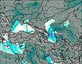 | 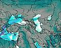 | 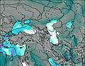 |  |  |  | |||||||||||||
— | — | — | — | — | 5 | — | 1.0 | — | — | — | — | — | — | 3 | — | — | — | |
— | 0.2 | — | — | 0.3 | — | — | — | — | — | — | — | — | — | — | 0.6 | 4 | 0.3 | |
max°C | 0 | 2 | 0 | 1 | 3 | 0 | -2 | -1 | -2 | -4 | -2 | 0 | 1 | 2 | 1 | 2 | 4 | 4 |
min°C | -1 | 2 | -1 | -1 | 2 | -3 | -3 | -1 | -4 | -4 | -2 | -1 | 1 | 2 | 0 | 1 | 2 | 3 |
-8 | -4 | -6 | -6 | -2 | -7 | -7 | -4 | -7 | -4 | -4 | -4 | -3 | 0 | -2 | -3 | 0 | 0 | |
2900 | 3250 | 2900 | 2850 | 3350 | 2800 | 2600 | 2800 | 2500 | 2200 | 2600 | 2750 | 3100 | 3250 | 2950 | 3200 | 3450 | 3500 | |
Cloud base (m) | 2250 | 4500 | 2950 | 2800 | 3100 | 2850 | 1850 | 2300 | 2500 | 1850 | 1850 | 2000 | 6200 | 1650 | 2250 | 2950 | 3500 | |
5:20 | — | — | 5:18 | — | — | 5:16 | — | — | 5:16 | — | — | 5:15 | — | — | 5:13 | — | — | |
— | 7:02 | — | — | 7:04 | — | — | 7:05 | — | — | 7:06 | — | — | 7:07 | — | — | 7:07 | — | |
Loading...
Altiparmak Weather (Days 0-3):
The weather forecast for Altiparmak is: A light covering of new snow mostly falling on Sat night. Freeze-thaw conditions (max 3°C on Sat afternoon, min -4°C on Sun night). Winds decreasing (fresh winds from the SSW on Fri morning, calm by Sun night).
Altiparmak Weather (Days 3-6):
A dusting of snow turning to light rain (total 4mm) on Wed afternoon. Freeze-thaw conditions (max 4°C on Wed afternoon, min -4°C on Mon morning). Wind will be generally light.
This table gives the weather forecast for Altiparmak at the specific elevation of 3000 m. Our advanced weather models allow us to provide distinct weather forecasts for several elevations of Altiparmak. To see the weather forecasts for the other elevations, use the tab navigation above the table. For a wider overview of the weather, consult the Weather Map of Turkey.
* NOTE: not all weather observatories update at the same frequency which is the reason why some locations may show data from stations that are further away than known closer ones.
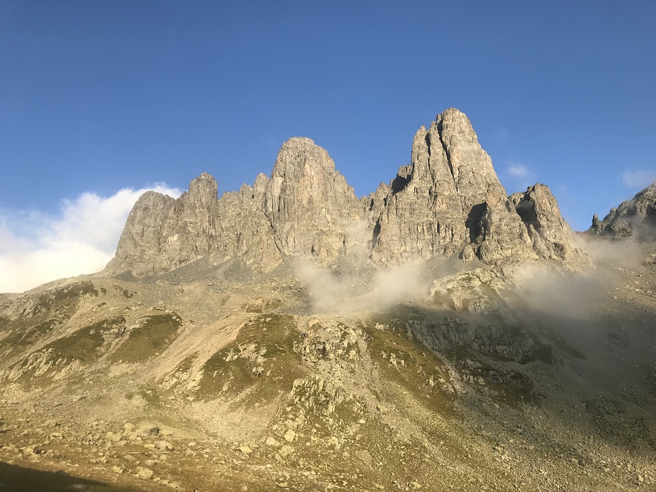
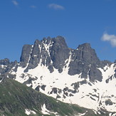
Altiparmak Photos
View all
Northern Anatolia (Black Sea) photos (76) |
Anatolia photos (509) |
photos from mountains in Turkey (476) |
all photos
 Upload new photo
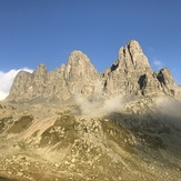
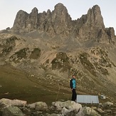
Altıparmak
Altıparmak
Altiparmak

