– Lat/Long: 34.22° N 47.24° E
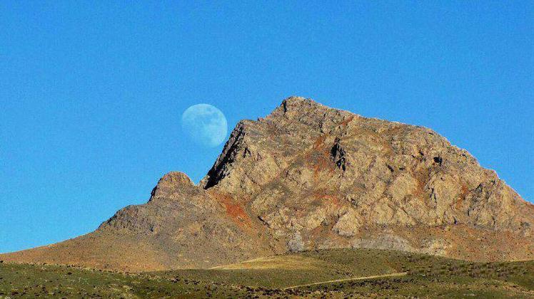
 Alvand
Weather Forecast, IranIssued: 8 pm Fri 18 Apr Local TimeUpdates in: hr min sUpdate imminent
Alvand Weather Forecast, Iran
Issued: 8 pm Fri 18 Apr Local Time
Updates in:
Update imminent hr min s

Issued: 8 pm Fri 18 Apr Local Time
Updates in:
Update imminent hr min s
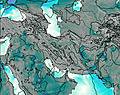
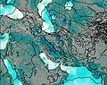
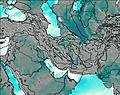
Days 1–4 Weather SummaryMostly dry. Freeze-thaw conditions (max 3°C on Mon afternoon, min -3°C on Fri night). Wind will be generally light. | Days 5–7 Weather SummaryMostly dry. Mild temperatures (max 5°C on Wed afternoon, min 1°C on Mon night). Winds increasing (calm on Tue morning, gales from the WNW by Wed night). | ||||||||||||||||||
Saturday 19 | Sunday 20 | Monday 21 | Tuesday 22 | Wednesday 23 | Thursday 24 | ||||||||||||||
night | AM | PM | night | AM | PM | night | AM | PM | night | AM | PM | night | AM | PM | night | AM | PM | night | |
clear | clear | clear | clear | clear | clear | clear | clear | some clouds | some clouds | some clouds | some clouds | clear | clear | clear | clear | clear | some clouds | cloudy | |
km/h | |||||||||||||||||||
 |  |  |  |  |  |  | |||||||||||||
— | — | — | — | — | — | — | — | — | — | — | — | — | — | — | — | — | — | — | |
— | — | — | — | — | — | — | — | — | — | — | — | — | — | — | — | — | — | — | |
max°C | -3 | -3 | -1 | -1 | 0 | 1 | 1 | 1 | 3 | 2 | 3 | 4 | 3 | 4 | 5 | 5 | 4 | 5 | 7 |
min°C | -3 | -3 | -1 | -1 | -1 | 1 | 0 | 1 | 3 | 1 | 2 | 4 | 3 | 3 | 5 | 2 | 3 | 4 | 5 |
-6 | -7 | -6 | -5 | -7 | -4 | -6 | -2 | 0 | -2 | 2 | 0 | -3 | -2 | 0 | -6 | -4 | -1 | 0 | |
3100 | 3100 | 3400 | 3450 | 3450 | 3750 | 3650 | 3700 | 3900 | 3850 | 3800 | 4150 | 4000 | 4000 | 4250 | 4100 | 4050 | 4300 | 4350 | |
Cloud base (m) | 8700 | 8650 | 8650 | 6350 | 4800 | 4850 | 4750 | 4450 | 4550 | 6550 | |||||||||
— | 5:45 | — | — | 5:43 | — | — | 5:43 | — | — | 5:41 | — | — | 5:39 | — | — | 5:39 | — | — | |
— | — | 6:54 | — | — | 6:55 | — | — | 6:57 | — | — | 6:57 | — | — | 6:58 | — | — | 6:59 | — | |
Loading...
Alvand Weather (Days 0-3):
The weather forecast for Alvand is: Mostly dry. Freeze-thaw conditions (max 3°C on Mon afternoon, min -3°C on Fri night). Wind will be generally light.
Alvand Weather (Days 3-6):
Mostly dry. Mild temperatures (max 5°C on Wed afternoon, min 1°C on Mon night). Winds increasing (calm on Tue morning, gales from the WNW by Wed night).
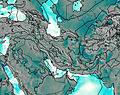
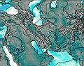
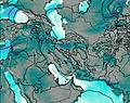
This table gives the weather forecast for Alvand at the specific elevation of 3570 m. Our advanced weather models allow us to provide distinct weather forecasts for several elevations of Alvand. To see the weather forecasts for the other elevations, use the tab navigation above the table. For a wider overview of the weather, consult the Weather Map of Iran.
| Weather Station | Temp. | Weather | Wind | Gusts | Cloud / Visibility |
|---|---|---|---|---|---|
Kermansha / hahid Ashrafi Esfahani Airport | |||||
Kermanshah | |||||
Ilam Airport | |||||
Sanandaj Airport | |||||
Khorram Abad | |||||
Khoram Abad Airport | |||||
Hamadan Airport | |||||
Sulaymaniyah Airport |
* NOTE: not all weather observatories update at the same frequency which is the reason why some locations may show data from stations that are further away than known closer ones.
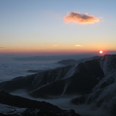
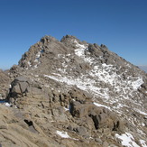
Alvand Photos
View all
Kermanshah photos (290) |
Zagros photos (1203) |
photos from mountains in Iran (11692) |
all photos
 Upload new photo
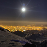
 See 165 more Alvand photos
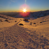
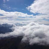
Alvand
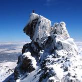
Alvand Cat-Shape cliff
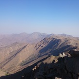
view of alvand from yakhchal peak
Ali Taherkhani
alvand complex
ALVAND
naser ramezani alvand

