
– Lat/Long: 58.36° N 134.14° W
 Annex Peak
Weather Forecast, United StatesIssued: 3 am Tue 29 Apr Local TimeUpdates in: hr min sUpdate imminent
Annex Peak Weather Forecast, United States
Issued: 3 am Tue 29 Apr Local Time
Updates in:
Update imminent hr min s

Issued: 3 am Tue 29 Apr Local Time
Updates in:
Update imminent hr min s
Days 1–3 Weather SummaryA dusting of snow. Milder later with heavy rain (total 71mm) on Thu morning. Mild temperatures (max 5°C on Thu afternoon, min 1°C on Tue night). Wind will be generally light. | Days 4–6 Weather SummaryModerate rain (total 14mm), heaviest on Fri morning giving way to a moderate fall of snow, heaviest on Sun night. Temperatures will be slightly above freezing (max 3°C on Fri afternoon, min 1°C on Fri night). Wind will be generally light. | |||||||||||||||||
Tuesday 29 | Wednesday 30 | Thursday 1 | Friday 2 | Saturday 3 | Sunday 4 | |||||||||||||
AM | PM | night | AM | PM | night | AM | PM | night | AM | PM | night | AM | PM | night | AM | PM | night | |
light rain | mod. rain | light snow | light rain | light rain | heavy rain | heavy rain | mod. rain | heavy rain | mod. rain | light rain | light snow | light snow | rain shwrs | some clouds | cloudy | light snow | mod. snow | |
km/h | ||||||||||||||||||
 |  |  |  |  |  | |||||||||||||
— | — | 2.0 | — | — | — | — | — | — | — | — | 4 | 1.0 | — | — | — | 3 | 10 | |
4 | 6 | 2.0 | 0.2 | 0.9 | 15 | 14 | 10 | 18 | 9 | 1.7 | — | 0.6 | 2 | — | — | — | — | |
max°C | 3 | 3 | 2 | 3 | 4 | 4 | 4 | 5 | 5 | 2 | 3 | 2 | 3 | 3 | 2 | 2 | 2 | 1 |
min°C | 3 | 2 | 1 | 2 | 4 | 3 | 3 | 5 | 3 | 2 | 3 | 1 | 2 | 3 | 1 | 2 | 2 | 1 |
-1 | -2 | -2 | 0 | 2 | 3 | 1 | 3 | 1 | -1 | 0 | -2 | -1 | 0 | 1 | 0 | 0 | -2 | |
950 | 1000 | 750 | 800 | 1050 | 1050 | 1350 | 1500 | 1400 | 850 | 900 | 750 | 700 | 850 | 600 | 800 | 800 | 850 | |
Cloud base (m) | 250 | 250 | 250 | 350 | 500 | 850 | 200 | 200 | 200 | 200 | 250 | 450 | 250 | 350 | 550 | 650 | 350 | 200 |
5:07 | — | — | 5:05 | — | — | 5:03 | — | — | 5:00 | — | — | 4:58 | — | — | 4:54 | — | — | |
— | 8:40 | — | — | 8:43 | — | — | 8:45 | — | — | 8:47 | — | — | 8:50 | — | — | 8:52 | — | |
Loading...
Annex Peak Weather (Days 0-3):
The weather forecast for Annex Peak is: A dusting of snow. Milder later with heavy rain (total 71mm) on Thu morning. Mild temperatures (max 5°C on Thu afternoon, min 1°C on Tue night). Wind will be generally light.
Annex Peak Weather (Days 3-6):
Moderate rain (total 14mm), heaviest on Fri morning giving way to a moderate fall of snow, heaviest on Sun night. Temperatures will be slightly above freezing (max 3°C on Fri afternoon, min 1°C on Fri night). Wind will be generally light.
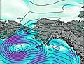
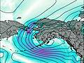
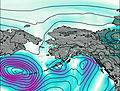
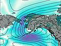
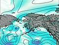
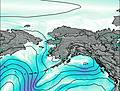
This table gives the weather forecast for Annex Peak at the specific elevation of 500 m. Our advanced weather models allow us to provide distinct weather forecasts for several elevations of Annex Peak. To see the weather forecasts for the other elevations, use the tab navigation above the table. For a wider overview of the weather, consult the Weather Map of Alaska United States.

