– Lat/Long: 0.48° S 78.14° W
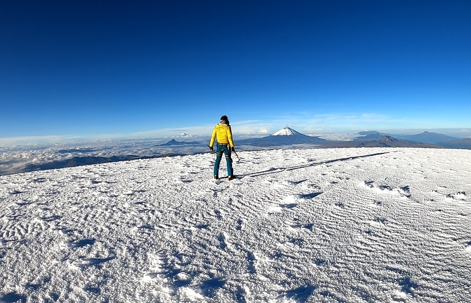
 Antisana
Weather Forecast, EcuadorIssued: 6 pm Thu 24 Apr Local TimeUpdates in: 3hr 40min 24sUpdate imminent
Issued: 6 pm Thu 24 Apr Local Time
Updates in:
Update imminent 3hr 40min 24s

Issued: 6 pm Thu 24 Apr Local Time
Updates in:
Update imminent 3hr 40min 24s
Days 1–4 Weather SummaryA moderate fall of snow, heaviest on Thu afternoon. Freeze-thaw conditions (max 1°C on Thu afternoon, min -1°C on Thu night). Wind will be generally light. | Days 5–7 Weather SummaryA moderate fall of snow, heaviest on Tue night. Freeze-thaw conditions (max 1°C on Mon morning, min -1°C on Sun night). Wind will be generally light. | ||||||||||||||||
Thu 24 | Friday 25 | Saturday 26 | Sunday 27 | Monday 28 | Tuesday 29 | ||||||||||||
PM | night | AM | PM | night | AM | PM | night | AM | PM | night | AM | PM | night | AM | PM | night | |
snow shwrs | snow shwrs | snow shwrs | light snow | light snow | light snow | light snow | light snow | light snow | light snow | some clouds | snow shwrs | light snow | some clouds | snow shwrs | light snow | light snow | |
mph | |||||||||||||||||
 |  |  |  |  |  | ||||||||||||
0.4 | 1 | 0.4 | 1 | 2 | 1 | 1 | 1 | 0.4 | 0.4 | — | 0.4 | 0.4 | — | 0.4 | 1 | 2 | |
— | — | — | — | — | — | — | — | — | — | — | — | — | — | — | — | — | |
max°F | 34 | 32 | 34 | 34 | 32 | 32 | 34 | 32 | 32 | 32 | 32 | 34 | 34 | 32 | 34 | 34 | 32 |
min°F | 32 | 30 | 34 | 32 | 32 | 32 | 32 | 30 | 32 | 32 | 30 | 34 | 32 | 30 | 34 | 32 | 30 |
28 | 25 | 27 | 27 | 25 | 25 | 25 | 23 | 25 | 28 | 21 | 25 | 23 | 21 | 27 | 25 | 23 | |
16900 | 16200 | 17100 | 16700 | 16200 | 16600 | 16900 | 16100 | 16700 | 16600 | 16100 | 16700 | 16900 | 15700 | 17100 | 16700 | 16100 | |
Cloud base (ft) | 13600 | — | 15600 | — | — | 14600 | — | — | 13600 | 13600 | — | 13600 | — | 15900 | 15600 | — | — |
— | — | 6:07 | — | — | 6:07 | — | — | 6:07 | — | — | 6:07 | — | — | 6:05 | — | — | |
6:13 | — | — | 6:13 | — | — | 6:13 | — | — | 6:13 | — | — | 6:12 | — | — | 6:12 | — | |
Days 7-12 Weather Summary
Interested in the 12-day Forecast? Unlock the full forecast and many more features by becoming a Pro member.
 MountainPro
Your membership benefits:
- Expert mountain forecasts
- 12 day forecast
- Hourly forecast detail
- Offline mapping (app only)
- Unlock our mobile app
- Remove ads
Antisana Weather (Days 0-3):
The weather forecast for Antisana is: A moderate fall of snow, heaviest on Thu afternoon. Freeze-thaw conditions (max 1°C on Thu afternoon, min -1°C on Thu night). Wind will be generally light.
Antisana Weather (Days 3-6):
A moderate fall of snow, heaviest on Tue night. Freeze-thaw conditions (max 1°C on Mon morning, min -1°C on Sun night). Wind will be generally light.
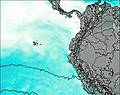
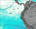
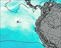
This table gives the weather forecast for Antisana at the specific elevation of 5000 m. Our advanced weather models allow us to provide distinct weather forecasts for several elevations of Antisana. To see the weather forecasts for the other elevations, use the tab navigation above the table. For a wider overview of the weather, consult the Weather Map of Ecuador.
| Weather Station | Temp. | Weather | Wind | Gusts | Cloud / Visibility |
|---|---|---|---|---|---|
Quito New International Airport | |||||
lightning 54km NE of Rosa Zarate | |||||
Ipiale / an Luis Airport | |||||
Puerto Asis | |||||
lightning 13km SSW of San Jose | |||||
Pasto-Antonio Nariño Airport | |||||
lightning 4km N of Barbacoas |
* NOTE: not all weather observatories update at the same frequency which is the reason why some locations may show data from stations that are further away than known closer ones.
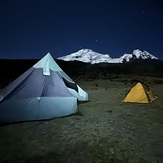
Antisana Photos
View all
Ecuador Andes photos (73) |
Andes photos (975) |
photos from mountains in Ecuador (79) |
all photos
 Upload new photo
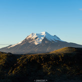
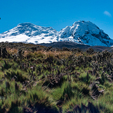
Antisana
Antisana Sunrise
Mañana soleada en los páramos del Antisana
Camp

