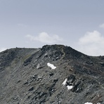
Augstbordhorn climbing notes shared by Mountain-Forecast users
Click here to submit your own climbing note for Augstbordhorn
(NOTE: Texts may be edited by our content team for the purposes of ensuring accurate and relevant information)
-
September 03, 2011
RobSofMar from Netherlands
The Augstbordhorn is a easy to climb / walk mountain. The tour takes about 5 hours in normal conditions. The start of the path (which is at about 2000m height) is rather dull but the air of the conifers and the sound of the bells that the cows wear make up a lot.
After about 1/2 hr the path gets much more interesting and start a bit steep up to a point of about 2700m. From that point on you climb the first top which is at approx. 2800m and after that you still have to walk about 1/2hr to the real top (2973m).
The view is magnificent, especially the mountains at the Saas-Fee region.
When going down there is an alternative route that starts at the ridge between the two tops, you just head downhill for the lake that is visible from there. After that it is quite easy to navigate until you find the path again. This is highly recommended though it involves a steep descend.
All in all a nice, not very difficult mountain with a superb view.
Extra info;
climbed on 31-08-2011 in a party of 1 adult (41, >10yrs of mountaineering experience) and two kids (9 and 10)
(NOTE: Texts may be edited by our content team for the purposes of ensuring accurate and relevant information)
RobSofMar from Netherlands
The Augstbordhorn is a easy to climb / walk mountain. The tour takes about 5 hours in normal conditions. The start of the path (which is at about 2000m height) is rather dull but the air of the conifers and the sound of the bells that the cows wear make up a lot.
After about 1/2 hr the path gets much more interesting and start a bit steep up to a point of about 2700m. From that point on you climb the first top which is at approx. 2800m and after that you still have to walk about 1/2hr to the real top (2973m).
The view is magnificent, especially the mountains at the Saas-Fee region.
When going down there is an alternative route that starts at the ridge between the two tops, you just head downhill for the lake that is visible from there. After that it is quite easy to navigate until you find the path again. This is highly recommended though it involves a steep descend.
All in all a nice, not very difficult mountain with a superb view.
Extra info;
climbed on 31-08-2011 in a party of 1 adult (41, >10yrs of mountaineering experience) and two kids (9 and 10)


 Like us
 Follow us
 Follow us