– Lat/Long: 54.29° N 2.43° W
 Aye Gill Pike – Climbing, Hiking & Mountaineering information

Aye Gill Pike guide
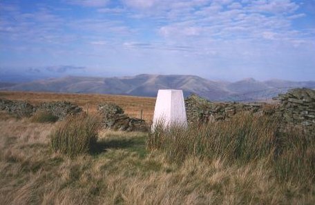
- Elevation: 1824 ft
- Difficulty:
- Best months to climb:
- Convenient center:
Aye Gill Pike Climbing NotesBe the first to submit your climbing note! Please submit any useful information about climbing Aye Gill Pike that may be useful to other climbers. Consider things such as access and accommodation at the base of Aye Gill Pike, as well as the logistics of climbing to the summit. |
| Select a
mountain summit from the menu |
||
|
Select a Mountain Summit
|
||


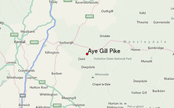
Use this relief map to navigate to mountain peaks in the area of Aye Gill Pike.
10 other mountain peaks closest to Aye Gill Pike:
| 1. | Baugh Fell (2225 ft) | 2.3 miles |
| 2. | Great Coum (2254 ft) | 3.4 miles |
| 3. | Crag Hill (Yorkshire) (2238 ft) | 3.7 miles |
| 4. | Calf Top (1998 ft) | 3.9 miles |
| 5. | Whernside (2412 ft) | 4.1 miles |
| 6. | Green Hill (Lancashire) (2060 ft) | 4.2 miles |
| 7. | Great Knoutberry Hill (2205 ft) | 4.3 miles |
| 8. | Swarth Fell (2234 ft) | 5.5 miles |
| 9. | Gragareth (2057 ft) | 6.2 miles |
| 10. | The Calf (2218 ft) | 6.2 miles |

