– Lat/Long: 52.21° N 9.83° W
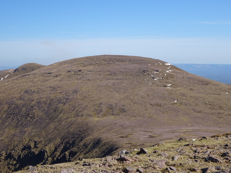
 Baurtregaum
Weather Forecast, IrelandIssued: 12 pm Wed 16 Apr Local TimeUpdates in: hr min sUpdate imminent
Baurtregaum Weather Forecast, Ireland
Issued: 12 pm Wed 16 Apr Local Time
Updates in:
Update imminent hr min s

Issued: 12 pm Wed 16 Apr Local Time
Updates in:
Update imminent hr min s
Days 1–3 Weather SummaryHeavy rain (total 37mm), heaviest during Thu night. Mild temperatures (max 9°C on Fri afternoon, min 2°C on Wed night). Winds increasing (calm on Wed night, fresh winds from the E by Fri night). | Days 4–6 Weather SummaryLight rain (total 5mm), mostly falling on Sat morning. Mild temperatures (max 9°C on Sun afternoon, min 5°C on Sun night). Winds increasing (calm on Sat night, fresh winds from the S by Mon night). | |||||||||||||||||
Wednesday 16 | Thursday 17 | Friday 18 | Saturday 19 | Sunday 20 | Monday 21 | |||||||||||||
AM | PM | night | AM | PM | night | AM | PM | night | AM | PM | night | AM | PM | night | AM | PM | night | |
some clouds | clear | some clouds | cloudy | light rain | heavy rain | mod. rain | light rain | mod. rain | light rain | light rain | light rain | light rain | light rain | rain shwrs | cloudy | light rain | rain shwrs | |
km/h | ||||||||||||||||||
 |  |  |  |  |  | |||||||||||||
— | — | — | — | — | — | — | — | — | — | — | — | — | — | — | — | — | — | |
— | — | — | — | 0.6 | 24 | 5 | 2 | 5 | 2 | 0.4 | 0.2 | 0.2 | 0.3 | 1.2 | — | 0.1 | 0.1 | |
max°C | 5 | 5 | 4 | 6 | 7 | 5 | 7 | 9 | 9 | 8 | 8 | 7 | 8 | 9 | 7 | 8 | 8 | 8 |
min°C | 4 | 5 | 2 | 5 | 6 | 4 | 6 | 9 | 7 | 7 | 8 | 7 | 7 | 8 | 5 | 6 | 7 | 6 |
0 | 2 | -1 | 3 | 5 | 0 | 3 | 6 | 5 | 5 | 7 | 6 | 4 | 5 | 2 | 3 | 4 | 2 | |
1000 | 1100 | 1000 | 1100 | 1200 | 1150 | 1850 | 2000 | 2050 | 1900 | 1950 | 1900 | 2200 | 2050 | 1500 | 1350 | 1400 | 1750 | |
Cloud base (m) | 550 | 1700 | 4550 | 1950 | 200 | 50 | 200 | 50 | 50 | 50 | 150 | 350 | 300 | 200 | 650 | 2000 | 700 | |
6:41 | — | — | 6:39 | — | — | 6:35 | — | — | 6:33 | — | — | 6:31 | — | — | 6:30 | — | — | |
— | 8:37 | — | — | 8:39 | — | — | 8:40 | — | — | 8:43 | — | — | 8:45 | — | — | 8:45 | — | |
Loading...
Baurtregaum Weather (Days 0-3):
The weather forecast for Baurtregaum is: Heavy rain (total 37mm), heaviest during Thu night. Mild temperatures (max 9°C on Fri afternoon, min 2°C on Wed night). Winds increasing (calm on Wed night, fresh winds from the E by Fri night).
Baurtregaum Weather (Days 3-6):
Light rain (total 5mm), mostly falling on Sat morning. Mild temperatures (max 9°C on Sun afternoon, min 5°C on Sun night). Winds increasing (calm on Sat night, fresh winds from the S by Mon night).
This table gives the weather forecast for Baurtregaum at the specific elevation of 500 m. Our advanced weather models allow us to provide distinct weather forecasts for several elevations of Baurtregaum. To see the weather forecasts for the other elevations, use the tab navigation above the table. For a wider overview of the weather, consult the Weather Map of Ireland.
| Weather Station | Temp. | Weather | Wind | Gusts | Cloud / Visibility |
|---|---|---|---|---|---|
ValentiaObservatory(3953 -1) | |||||
Shannon Airport | |||||
CorkAirport | |||||
Cork Airpor / orcai | |||||
* NOTE: not all weather observatories update at the same frequency which is the reason why some locations may show data from stations that are further away than known closer ones.
Baurtregaum Photos
View all
Dingle Peninsula photos (12) |
Ireland Ranges photos (359) |
photos from mountains in Ireland (409) |
all photos
 Upload new photo
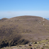
Baurtregaum

