– Lat/Long: 53.52° N 9.83° W
 Benbaun
Weather Forecast, IrelandIssued: 5 pm Tue 28 Oct Local TimeUpdates in: hr min sUpdate imminent
Issued: 5 pm Tue 28 Oct Local Time
Updates in:
Update imminent hr min s

Issued: 5 pm Tue 28 Oct Local Time
Updates in:
Update imminent hr min s
Days 1–4 Weather SummaryHeavy rain (total 29mm), heaviest during Thu afternoon. Mild temperatures (max 8°C on Thu morning, min 3°C on Wed night). Mainly stormy winds. | Days 5–7 Weather SummaryHeavy rain (total 33mm), heaviest during Sun night. Very mild (max 10°C on Sun night, min 3°C on Fri night). Winds increasing (fresh winds from the W on Sat morning, gales from the WSW by Sun night). | ||||||||||||||||
Tue 28 | Wednesday 29 | Thursday 30 | Friday 31 | Saturday 1 | Sunday 2 | ||||||||||||
PM | night | AM | PM | night | AM | PM | night | AM | PM | night | AM | PM | night | AM | PM | night | |
rain shwrs | rain shwrs | rain shwrs | rain shwrs | rain shwrs | mod. rain | mod. rain | rain shwrs | rain shwrs | rain shwrs | rain shwrs | rain shwrs | light rain | rain shwrs | light rain | light rain | heavy rain | |
km/h | |||||||||||||||||
 |  |  |  |  |  | ||||||||||||
— | — | — | — | — | — | — | — | — | — | — | — | — | — | — | — | — | |
1 | 2 | 1.8 | 0.2 | 0.1 | 9 | 9 | 4 | 1.5 | 3 | 3 | 0.7 | 3 | 4 | 0.9 | 2 | 13 | |
max°C | 6 | 4 | 5 | 5 | 4 | 8 | 8 | 5 | 6 | 6 | 5 | 3 | 3 | 4 | 5 | 9 | 10 |
min°C | 5 | 4 | 4 | 4 | 3 | 5 | 7 | 5 | 5 | 6 | 3 | 3 | 3 | 3 | 4 | 7 | 10 |
-2 | -3 | -3 | -2 | -3 | -2 | 0 | -3 | -3 | -1 | -3 | -2 | -4 | -4 | -3 | 1 | 5 | |
1500 | 1150 | 1150 | 1250 | 1300 | 2050 | 2100 | 1400 | 1450 | 1550 | 1300 | 1100 | 1100 | 1100 | 1150 | 1950 | 2650 | |
Cloud base (m) | 800 | 550 | 650 | 350 | 500 | 650 | 50 | 350 | 1550 | 500 | 300 | 700 | 600 | 550 | 750 | 650 | 150 |
— | — | 7:31 | — | — | 7:33 | — | — | 7:35 | — | — | 7:37 | — | — | 7:39 | — | — | |
5:14 | — | — | 5:12 | — | — | 5:09 | — | — | 5:07 | — | — | 5:06 | — | — | 5:04 | — | |
Loading...
Benbaun Weather (Days 0-3):
The weather forecast for Benbaun is: Heavy rain (total 29mm), heaviest during Thu afternoon. Mild temperatures (max 8°C on Thu morning, min 3°C on Wed night). Mainly stormy winds.
Benbaun Weather (Days 3-6):
Heavy rain (total 33mm), heaviest during Sun night. Very mild (max 10°C on Sun night, min 3°C on Fri night). Winds increasing (fresh winds from the W on Sat morning, gales from the WSW by Sun night).
This table gives the weather forecast for Benbaun at the specific elevation of 729 m. Our advanced weather models allow us to provide distinct weather forecasts for several elevations of Benbaun. To see the weather forecasts for the other elevations, use the tab navigation above the table. For a wider overview of the weather, consult the Weather Map of Ireland.
| Weather Station | Temp. | Weather | Wind | Gusts | Cloud / Visibility |
|---|---|---|---|---|---|
Mayo Sailing Club | |||||
Connaught Airport | |||||
ConnaughtAirport | |||||
Belmullet | |||||
Shannon Airport |
* NOTE: not all weather observatories update at the same frequency which is the reason why some locations may show data from stations that are further away than known closer ones.
Benbaun Photos
View all
Connemara Mountains photos (45) |
Ireland Ranges photos (361) |
photos from mountains in Ireland (411) |
all photos
 Upload new photo
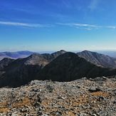


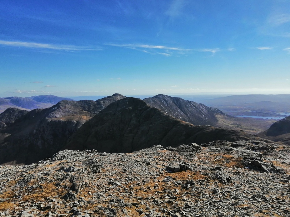
Benbaun towards Benbreen
The highest point in Co. Galway
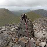
Bennaun Cairn
Views from Benbaun