
– Lat/Long: 41.46° S 145.94° E
 Black Bluff
Weather Forecast, AustraliaIssued: 3 am Sat 19 Apr Local TimeUpdates in: hr min sUpdate imminent
Black Bluff Weather Forecast, Australia
Issued: 3 am Sat 19 Apr Local Time
Updates in:
Update imminent hr min s

Issued: 3 am Sat 19 Apr Local Time
Updates in:
Update imminent hr min s
Days 1–3 Weather SummaryModerate rain (total 13mm), heaviest on Sat night. Very mild (max 11°C on Sat morning, min 8°C on Sat night). Winds decreasing (strong winds from the NW on Sat afternoon, calm by Mon afternoon). | Days 4–6 Weather SummaryModerate rain (total 13mm) heaviest on Thu night, then becoming colder with a dusting of snow on Thu night. Mild temperatures (max 9°C on Tue morning, min 1°C on Thu night). Winds increasing (calm on Tue morning, near gales from the NW by Thu afternoon). | |||||||||||||||||
Saturday 19 | Sunday 20 | Monday 21 | Tuesday 22 | Wednesday 23 | Thursday 24 | |||||||||||||
AM | PM | night | AM | PM | night | AM | PM | night | AM | PM | night | AM | PM | night | AM | PM | night | |
some clouds | light rain | mod. rain | light rain | risk tstorm | rain shwrs | some clouds | rain shwrs | some clouds | rain shwrs | rain shwrs | light rain | rain shwrs | rain shwrs | light rain | light rain | light rain | light snow | |
km/h | ||||||||||||||||||
 |  |  |  |  |  | |||||||||||||
— | — | — | — | — | — | — | — | — | — | — | — | — | — | — | — | — | 1.0 | |
— | 1.0 | 6 | 0.7 | 3 | 1.3 | — | 0.3 | — | 0.2 | 1.1 | 3 | 0.7 | 0.8 | 1.5 | 0.9 | 0.7 | 3 | |
max°C | 11 | 10 | 10 | 9 | 9 | 10 | 11 | 11 | 10 | 9 | 9 | 8 | 7 | 7 | 7 | 8 | 9 | 8 |
min°C | 11 | 9 | 8 | 9 | 9 | 8 | 10 | 10 | 9 | 9 | 8 | 6 | 7 | 7 | 6 | 7 | 8 | 1 |
7 | 4 | 4 | 5 | 5 | 5 | 8 | 10 | 7 | 9 | 8 | 4 | 5 | 6 | 1 | 2 | 2 | -7 | |
2950 | 3000 | 2900 | 2950 | 2900 | 2800 | 2950 | 3150 | 3000 | 2950 | 2850 | 2700 | 2900 | 2950 | 3050 | 2900 | 2800 | 2550 | |
Cloud base (m) | 650 | 1600 | 500 | 500 | 550 | 1550 | 2600 | 2150 | 950 | 950 | 800 | 550 | 650 | 900 | 500 | 500 | 500 | 600 |
6:50 | — | — | 6:50 | — | — | 6:52 | — | — | 6:52 | — | — | 6:54 | — | — | 6:54 | — | — | |
— | 5:39 | — | — | 5:37 | — | — | 5:37 | — | — | 5:36 | — | — | 5:34 | — | — | 5:32 | — | |
Loading...
Black Bluff Weather (Days 0-3):
The weather forecast for Black Bluff is: Moderate rain (total 13mm), heaviest on Sat night. Very mild (max 11°C on Sat morning, min 8°C on Sat night). Winds decreasing (strong winds from the NW on Sat afternoon, calm by Mon afternoon).
Black Bluff Weather (Days 3-6):
Moderate rain (total 13mm) heaviest on Thu night, then becoming colder with a dusting of snow on Thu night. Mild temperatures (max 9°C on Tue morning, min 1°C on Thu night). Winds increasing (calm on Tue morning, near gales from the NW by Thu afternoon).
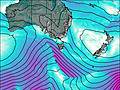
This table gives the weather forecast for Black Bluff at the specific elevation of 1339 m. Our advanced weather models allow us to provide distinct weather forecasts for several elevations of Black Bluff. To see the weather forecasts for the other elevations, use the tab navigation above the table. For a wider overview of the weather, consult the Weather Map of Tasmania.

