– Lat/Long: 51.34° N 115.17° W
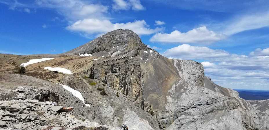
 Blackrock Mountain (Alberta)
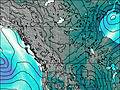
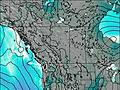
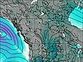
Weather Forecast, CanadaIssued: 11 pm Mon 21 Apr Local TimeUpdates in: hr min sUpdate imminent
Blackrock Mountain (Alberta) Weather Forecast, Canada
Issued: 11 pm Mon 21 Apr Local Time
Updates in:
Update imminent hr min s

Issued: 11 pm Mon 21 Apr Local Time
Updates in:
Update imminent hr min s
Days 1–4 Weather SummaryA light covering of new snow mostly falling on Mon night. Temperatures will be below freezing (max 0°C on Thu afternoon, min -11°C on Mon night). Wind will be generally light. | Days 5–7 Weather SummaryLight rain (total 2mm), mostly falling on Sun afternoon. Freeze-thaw conditions (max 5°C on Sat afternoon, min -3°C on Thu night). Wind will be generally light. | ||||||||||||||||||
Tuesday 22 | Wednesday 23 | Thursday 24 | Friday 25 | Saturday 26 | Sunday 27 | ||||||||||||||
night | AM | PM | night | AM | PM | night | AM | PM | night | AM | PM | night | AM | PM | night | AM | PM | night | |
light snow | some clouds | light snow | some clouds | some clouds | some clouds | some clouds | clear | some clouds | clear | clear | clear | clear | clear | clear | some clouds | clear | light rain | heavy snow | |
km/h | |||||||||||||||||||
 |  |  |  |  |  |  | |||||||||||||
4 | — | 2.0 | — | — | — | — | — | — | — | — | — | — | — | — | — | — | — | 23 | |
— | — | — | — | — | — | — | — | — | — | — | — | — | — | — | — | — | 2 | — | |
max°C | -9 | -8 | -5 | -7 | -4 | -3 | -5 | -3 | 0 | -2 | 0 | 3 | 1 | 3 | 5 | 3 | 4 | 3 | 1 |
min°C | -11 | -9 | -6 | -8 | -6 | -3 | -6 | -4 | -1 | -3 | -1 | 2 | 0 | 2 | 4 | 2 | 3 | 3 | -4 |
-19 | -9 | -10 | -12 | -8 | -3 | -6 | -7 | -4 | -7 | -4 | -1 | -2 | 0 | 4 | 0 | 1 | 0 | -10 | |
850 | 1300 | 1700 | 800 | 1600 | 2100 | 1150 | 1950 | 2400 | 1750 | 2300 | 2650 | 2650 | 2700 | 2900 | 3050 | 2950 | 2800 | 2000 | |
Cloud base (m) | 2000 | 2000 | 2200 | 2850 | 2000 | 2500 | 2000 | 2600 | 2850 | 2900 | 9100 | 3200 | 4050 | 2950 | 2100 | ||||
— | 6:31 | — | — | 6:28 | — | — | 6:26 | — | — | 6:24 | — | — | 6:22 | — | — | 6:20 | — | — | |
— | — | 8:47 | — | — | 8:49 | — | — | 8:51 | — | — | 8:52 | — | — | 8:53 | — | — | 8:55 | — | |
Loading...
Blackrock Mountain (Alberta) Weather (Days 0-3):
The weather forecast for Blackrock Mountain (Alberta) is: A light covering of new snow mostly falling on Mon night. Temperatures will be below freezing (max 0°C on Thu afternoon, min -11°C on Mon night). Wind will be generally light.
Blackrock Mountain (Alberta) Weather (Days 3-6):
Light rain (total 2mm), mostly falling on Sun afternoon. Freeze-thaw conditions (max 5°C on Sat afternoon, min -3°C on Thu night). Wind will be generally light.
This table gives the weather forecast for Blackrock Mountain (Alberta) at the specific elevation of 2462 m. Our advanced weather models allow us to provide distinct weather forecasts for several elevations of Blackrock Mountain (Alberta). To see the weather forecasts for the other elevations, use the tab navigation above the table. For a wider overview of the weather, consult the Weather Map of Alberta.
| Weather Station | Temp. | Weather | Wind | Gusts | Cloud / Visibility |
|---|---|---|---|---|---|
BowValley-Alta | |||||
BanffCs-Alta | |||||
Banff Airport | |||||
Nakiska Ridgetop- Alta | |||||
* NOTE: not all weather observatories update at the same frequency which is the reason why some locations may show data from stations that are further away than known closer ones.
Blackrock Mountain (Alberta) Photos
View all
Canadian Rockies photos (86) |
photos from mountains in Canada (441) |
all photos
 Upload new photo
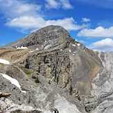
Black Rock Mountain, Alberta

