
– Lat/Long: 38.97° N 104.90° W
 Blodgett Peak
Weather Forecast, United StatesIssued: 11 pm Mon 28 Apr Local TimeUpdates in: hr min sUpdate imminent
Blodgett Peak Weather Forecast, United States
Issued: 11 pm Mon 28 Apr Local Time
Updates in:
Update imminent hr min s

Issued: 11 pm Mon 28 Apr Local Time
Updates in:
Update imminent hr min s
Days 1–4 Weather SummaryModerate rain (total 10mm), heaviest on Thu afternoon. Very mild (max 13°C on Wed morning, min 3°C on Mon night). Wind will be generally light. | Days 5–7 Weather SummarySome drizzle, heaviest during Thu night. Very mild (max 17°C on Sat afternoon, min 4°C on Thu night). Winds increasing (calm on Thu night, strong winds from the SW by Sun afternoon). | ||||||||||||||||||
Tuesday 29 | Wednesday 30 | Thursday 1 | Friday 2 | Saturday 3 | Sunday 4 | ||||||||||||||
night | AM | PM | night | AM | PM | night | AM | PM | night | AM | PM | night | AM | PM | night | AM | PM | night | |
rain shwrs | some clouds | light rain | rain shwrs | some clouds | light rain | rain shwrs | light rain | mod. rain | rain shwrs | some clouds | rain shwrs | clear | clear | risk tstorm | rain shwrs | some clouds | risk tstorm | clear | |
km/h | |||||||||||||||||||
 |  |  |  |  |  |  | |||||||||||||
— | — | — | — | — | — | — | — | — | — | — | — | — | — | — | — | — | — | — | |
0.1 | — | 0.2 | 1.3 | — | 0.5 | 0.7 | 1.8 | 6 | 1.0 | — | 0.1 | — | — | 0.2 | 0.2 | — | 0.2 | — | |
max°C | 7 | 11 | 12 | 8 | 13 | 13 | 9 | 5 | 5 | 6 | 9 | 12 | 9 | 15 | 17 | 12 | 15 | 16 | 12 |
min°C | 3 | 7 | 10 | 7 | 11 | 12 | 5 | 5 | 5 | 4 | 8 | 11 | 7 | 12 | 16 | 11 | 13 | 15 | 10 |
0 | 5 | 9 | 5 | 11 | 11 | 4 | 4 | 5 | 4 | 8 | 9 | 5 | 10 | 15 | 9 | 11 | 13 | 9 | |
2850 | 2900 | 3500 | 3350 | 3400 | 3550 | 3300 | 2750 | 2700 | 3150 | 3000 | 3400 | 3450 | 3700 | 4050 | 3850 | 3850 | 3850 | 3850 | |
Cloud base (m) | 2700 | 5450 | 5000 | 4200 | 6100 | 2650 | 2600 | 2600 | 2650 | 3300 | 3000 | 3600 | 4550 | 8750 | 8950 | 4900 | |||
— | 6:03 | — | — | 6:03 | — | — | 6:01 | — | — | 6:00 | — | — | 5:58 | — | — | 5:58 | — | — | |
— | — | 7:50 | — | — | 7:51 | — | — | 7:51 | — | — | 7:52 | — | — | 7:52 | — | — | 7:53 | — | |
Loading...
Blodgett Peak Weather (Days 0-3):
The weather forecast for Blodgett Peak is: Moderate rain (total 10mm), heaviest on Thu afternoon. Very mild (max 13°C on Wed morning, min 3°C on Mon night). Wind will be generally light.
Blodgett Peak Weather (Days 3-6):
Some drizzle, heaviest during Thu night. Very mild (max 17°C on Sat afternoon, min 4°C on Thu night). Winds increasing (calm on Thu night, strong winds from the SW by Sun afternoon).
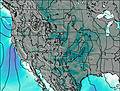
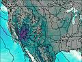
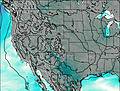
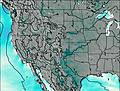
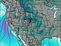
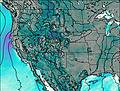
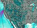
This table gives the weather forecast for Blodgett Peak at the specific elevation of 2000 m. Our advanced weather models allow us to provide distinct weather forecasts for several elevations of Blodgett Peak. To see the weather forecasts for the other elevations, use the tab navigation above the table. For a wider overview of the weather, consult the Weather Map of Colorado.
| Weather Station | Temp. | Weather | Wind | Gusts | Cloud / Visibility |
|---|---|---|---|---|---|
Colorado Springs Airport | |||||
Cheyenne Mtn Airport | |||||
Fort Carson Airport | |||||
Monumen / lbert Mountain Airport | |||||
Schriever AFB | |||||
* NOTE: not all weather observatories update at the same frequency which is the reason why some locations may show data from stations that are further away than known closer ones.

