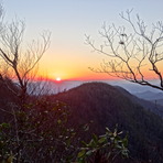
Brasstown Bald climbing notes shared by Mountain-Forecast users
Click here to submit your own climbing note for Brasstown Bald
(NOTE: Texts may be edited by our content team for the purposes of ensuring accurate and relevant information)
-
September 12, 2016
alan kemp from United States
Also a good way to the summit is Jacks Knob trail which crosses SR 180 at the spur road to the summit. There are plenty of switchbacks but still it is steep with almost 1800 feet elevation gain. The trail is well maintained and getting to the top via Wolfpen Ridge has a huge reward. there are restrooms and water along with small store closed from January to April. Temps are usually much cooler at the 4784 foot summit which can be great in the summer but there can be snow in the winter. This is around 3 miles round trip easily done in 3 or 4 hours which is much easier than hiking from Trackrock gap.
-
December 27, 2013
David Greer from United States
The Arkaquah is 5.5 miles and the paved summit trail .6 miles.
Out and back 12.2 miles from Trackrock gap. Out and back travel time completed in 3 hours and 20 minutes trailrunning.
-
August 07, 2013
Steve Henson from United States
For the inexperienced hiker, and most family members, drive
to the paved parking area below the summit.
Then take a short 6/10th of a mile uphill hike to the top of the observation tower for fantastic panoramic views any time of year.
-
March 24, 2013
Mark E. P. Woods from United States
Best climbed via the Arkarqua Trail, from Trackrock Gap to the summit and back. 13.2 miles total. Rather tough day-hike, steep first couple of miles and then a lovely ridge walk to the peak area. Developed public facilities on saddle near peak, paved walkway from parking area the visitors center on peak. Facilities (including bathrooms and water sources) are closed in winter. Great spring just down the trail, piped, issues from behind pump house downslope about 15 meters from trail.
Due to length of round-trip and general difficulty, recommended for experienced and fit hikers only. The high elevation portion nearest the parking area is good all ages family hiking, with little elevation change for 2 miles and good to great views.
(NOTE: Texts may be edited by our content team for the purposes of ensuring accurate and relevant information)
alan kemp from United States
Also a good way to the summit is Jacks Knob trail which crosses SR 180 at the spur road to the summit. There are plenty of switchbacks but still it is steep with almost 1800 feet elevation gain. The trail is well maintained and getting to the top via Wolfpen Ridge has a huge reward. there are restrooms and water along with small store closed from January to April. Temps are usually much cooler at the 4784 foot summit which can be great in the summer but there can be snow in the winter. This is around 3 miles round trip easily done in 3 or 4 hours which is much easier than hiking from Trackrock gap.
David Greer from United States
The Arkaquah is 5.5 miles and the paved summit trail .6 miles.
Out and back 12.2 miles from Trackrock gap. Out and back travel time completed in 3 hours and 20 minutes trailrunning.
Steve Henson from United States
For the inexperienced hiker, and most family members, drive
to the paved parking area below the summit.
Then take a short 6/10th of a mile uphill hike to the top of the observation tower for fantastic panoramic views any time of year.
Mark E. P. Woods from United States
Best climbed via the Arkarqua Trail, from Trackrock Gap to the summit and back. 13.2 miles total. Rather tough day-hike, steep first couple of miles and then a lovely ridge walk to the peak area. Developed public facilities on saddle near peak, paved walkway from parking area the visitors center on peak. Facilities (including bathrooms and water sources) are closed in winter. Great spring just down the trail, piped, issues from behind pump house downslope about 15 meters from trail.
Due to length of round-trip and general difficulty, recommended for experienced and fit hikers only. The high elevation portion nearest the parking area is good all ages family hiking, with little elevation change for 2 miles and good to great views.


 Like us
 Follow us
 Follow us