
– Lat/Long: 57.88° N 62.03° W
 Brave Mountain
Weather Forecast, CanadaIssued: 8 pm Mon 28 Apr Local TimeUpdates in: hr min sUpdate imminent
Brave Mountain Weather Forecast, Canada
Issued: 8 pm Mon 28 Apr Local Time
Updates in:
Update imminent hr min s

Issued: 8 pm Mon 28 Apr Local Time
Updates in:
Update imminent hr min s
Days 1–4 Weather SummaryA dusting of new snow. Freeze-thaw conditions (max 3°C on Thu afternoon, min -6°C on Tue night). Winds decreasing (fresh winds from the SW on Mon night, calm by Wed night). | Days 5–7 Weather SummaryA light covering of new snow mostly falling on Sat night. Freeze-thaw conditions (max 2°C on Thu night, min -5°C on Fri night). Winds increasing (calm on Fri night, fresh winds from the SE by Sat afternoon). | ||||||||||||||||||
Tuesday 29 | Wednesday 30 | Thursday 1 | Friday 2 | Saturday 3 | Sunday 4 | ||||||||||||||
night | AM | PM | night | AM | PM | night | AM | PM | night | AM | PM | night | AM | PM | night | AM | PM | night | |
cloudy | cloudy | cloudy | light snow | cloudy | some clouds | clear | clear | some clouds | clear | cloudy | cloudy | cloudy | cloudy | light snow | snow shwrs | cloudy | cloudy | light snow | |
km/h | |||||||||||||||||||
 |  |  |  |  |  |  | |||||||||||||
— | — | — | 1.0 | — | — | — | — | — | — | — | — | — | — | 1.0 | 4 | — | — | 5 | |
— | — | — | — | — | — | — | — | — | — | — | — | — | — | — | — | — | — | — | |
max°C | -1 | 1 | 2 | 1 | -5 | -4 | -4 | 0 | 3 | 2 | 2 | -4 | -4 | -3 | -2 | -1 | 1 | 1 | -2 |
min°C | -4 | 0 | 2 | -6 | -6 | -4 | -5 | -2 | 2 | 1 | -3 | -4 | -5 | -4 | -2 | -2 | 0 | 0 | -4 |
-11 | -7 | -4 | -11 | -12 | -10 | -10 | -5 | -2 | -5 | -8 | -9 | -8 | -7 | -8 | -8 | -5 | -2 | -12 | |
0 | 550 | 1050 | 50 | 0 | 0 | 0 | 0 | 1200 | 1250 | 1000 | 0 | 0 | 0 | 0 | 0 | 500 | 650 | 0 | |
Cloud base (m) | 2150 | 100 | 250 | 50 | 350 | 250 | 200 | 4000 | 2100 | 250 | 700 | 400 | 350 | 0 | 50 | 100 | |||
— | 5:22 | — | — | 5:18 | — | — | 5:16 | — | — | 5:13 | — | — | 5:11 | — | — | 5:09 | — | — | |
— | — | 8:50 | — | — | 8:52 | — | — | 8:53 | — | — | 8:55 | — | — | 8:59 | — | — | — | 9:00 | |
Loading...
Brave Mountain Weather (Days 0-3):
The weather forecast for Brave Mountain is: A dusting of new snow. Freeze-thaw conditions (max 3°C on Thu afternoon, min -6°C on Tue night). Winds decreasing (fresh winds from the SW on Mon night, calm by Wed night).
Brave Mountain Weather (Days 3-6):
A light covering of new snow mostly falling on Sat night. Freeze-thaw conditions (max 2°C on Thu night, min -5°C on Fri night). Winds increasing (calm on Fri night, fresh winds from the SE by Sat afternoon).
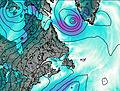
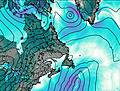
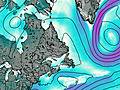
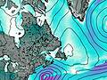
This table gives the weather forecast for Brave Mountain at the specific elevation of 500 m. Our advanced weather models allow us to provide distinct weather forecasts for several elevations of Brave Mountain. To see the weather forecasts for the other elevations, use the tab navigation above the table. For a wider overview of the weather, consult the Weather Map of Newfoundland.

