– Lat/Long: 57.12° N 3.60° W
 Bynack More
Weather Forecast, United KingdomIssued: 6 pm Thu 24 Apr Local TimeUpdates in: hr min sUpdate imminent
Bynack More Weather Forecast, United Kingdom
Issued: 6 pm Thu 24 Apr Local Time
Updates in:
Update imminent hr min s

Issued: 6 pm Thu 24 Apr Local Time
Updates in:
Update imminent hr min s
Days 1–4 Weather SummaryMostly dry. Mild temperatures (max 6°C on Sun morning, min 2°C on Thu night). Winds increasing (light winds from the S on Thu afternoon, near gales from the SW by Sat night). | Days 5–7 Weather SummarySome drizzle, heaviest during Sun afternoon. Very mild (max 11°C on Tue afternoon, min 5°C on Sun afternoon). Winds decreasing (strong winds from the WSW on Sun afternoon, calm by Wed morning). | ||||||||||||||||
Thu 24 | Friday 25 | Saturday 26 | Sunday 27 | Monday 28 | Tuesday 29 | ||||||||||||
PM | night | AM | PM | night | AM | PM | night | AM | PM | night | AM | PM | night | AM | PM | night | |
cloudy | some clouds | light rain | cloudy | cloudy | light rain | light rain | light rain | light rain | light rain | light rain | cloudy | some clouds | some clouds | some clouds | rain shwrs | rain shwrs | |
km/h | |||||||||||||||||
 |  |  |  |  |  | ||||||||||||
— | — | — | — | — | — | — | — | — | — | — | — | — | — | — | — | — | |
— | — | 0.1 | — | — | 0.3 | 0.2 | 0.1 | 0.2 | 0.9 | 0.1 | — | — | — | — | 0.1 | 0.2 | |
max°C | 3 | 3 | 3 | 4 | 4 | 4 | 4 | 5 | 6 | 6 | 7 | 9 | 9 | 9 | 10 | 11 | 8 |
min°C | 3 | 2 | 3 | 3 | 3 | 4 | 4 | 4 | 5 | 5 | 5 | 8 | 9 | 8 | 9 | 10 | 7 |
1 | -1 | -2 | -2 | -3 | -1 | -1 | -2 | -1 | -1 | -1 | 4 | 6 | 6 | 7 | 10 | 6 | |
1500 | 1450 | 1650 | 1500 | 1850 | 1800 | 1800 | 2000 | 2150 | 2050 | 2250 | 2350 | 2400 | 2600 | 2600 | 2650 | 2750 | |
Cloud base (m) | 800 | 750 | 550 | 600 | 550 | 500 | 500 | 500 | 500 | 500 | 650 | 800 | 1650 | 3100 | 5150 | 2300 | 2000 |
— | — | 5:41 | — | — | 5:39 | — | — | 5:35 | — | — | 5:33 | — | — | 5:31 | — | — | |
8:42 | — | — | 8:44 | — | — | 8:45 | — | — | 8:47 | — | — | 8:50 | — | — | 8:52 | — | |
Loading...
Bynack More Weather (Days 0-3):
The weather forecast for Bynack More is: Mostly dry. Mild temperatures (max 6°C on Sun morning, min 2°C on Thu night). Winds increasing (light winds from the S on Thu afternoon, near gales from the SW by Sat night).
Bynack More Weather (Days 3-6):
Some drizzle, heaviest during Sun afternoon. Very mild (max 11°C on Tue afternoon, min 5°C on Sun afternoon). Winds decreasing (strong winds from the WSW on Sun afternoon, calm by Wed morning).
This table gives the weather forecast for Bynack More at the specific elevation of 1090 m. Our advanced weather models allow us to provide distinct weather forecasts for several elevations of Bynack More. To see the weather forecasts for the other elevations, use the tab navigation above the table. For a wider overview of the weather, consult the Weather Map of United Kingdom.
* NOTE: not all weather observatories update at the same frequency which is the reason why some locations may show data from stations that are further away than known closer ones.
Bynack More Photos
View all
Grampians photos (156) |
Scottish Highlands photos (288) |
photos from mountains in United Kingdom (1957) |
all photos
 Upload new photo
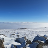
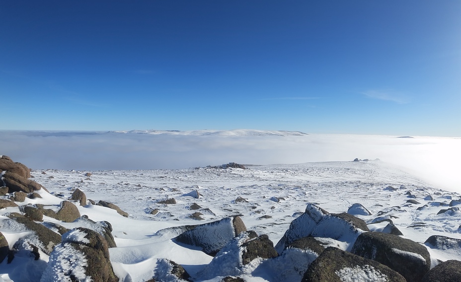
The view South from the Summit of Bynack More
Summit of Bynack with Ben Macdui & Cairngorm floating in the distant clouds.
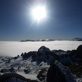
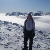
Bynack More
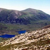
BuzyG Enjoying the view

